"Kemst þó hægt fari."
"You will reach your destination even though you travel slowly."
Old Icelandic Proverb
Iceland is a volcanic island in the North Atlantic, the largest in the world, between Greenland of North America and the British Isles of Europe. Its formation was destined some 70 million years ago when the final phase of fragmentation of the late Paleozoic supercontinent of Pangaea initiated between its northern components of Laurentia and Eurasia.
Emplacement of the North Atlantic Igneous Province - immense outpourings of lava that largely emplaced during the Paleocene - preceded Pangaea's break-up and persists today as vastly eroded remnants of continental flood basalts distributed on the margins of rifted continents of the North Atlantic Realm and across Iceland, the only remaining magmatically active portion.
 |
| Moss-Covered Eldhraun Lava Field and Fossil Sea Cliffs of the South Coast |
Young geologically, the island is elevated over 3,000 meters above the seafloor, while the nearly pole to pole, submarine mid-ocean plate boundary zigs and zags across Iceland on land in a shifting complex of interconnecting fracture zones, volcanic belts and faults.
 |
| Outlet Glaciers Skaftafellsjökull and Svínafellsjökull across Skeiðarársandur |
The fact that Iceland lies at the juncture of two large seafloor physiographic structures - the interplate spreading center of the Mid-Atlantic Ridge and the Greenland-Iceland-Faroe Ridge - has not gone unnoticed by genetic theorists.
The commonly held view is that asthenospheric flow in the upper mantle beneath the plate boundary interacts and mixes with a powerful, deep-seated mantle plume. Less differential density promoted buoyancy that led to dynamic uplift of the Iceland plateau and exceedingly high volcanic productivity. A second perspective, one that is rapidly gaining ground, is plumeless, relies on shallow mantle processes and is consistent with Plate Tectonic theory.
 |
| Outlet Glacier Skaftafellsjökull and Proglacial Lake |
Regardless of Iceland's genetic provenance, its unique landscape is a culmination of the opposing forces of construction via volcanism and sedimentation and destruction via wind, wave, water and glacial erosion. Working in concert, they have established Iceland as one of the most geologically active and dynamic places on Earth.
It's one of the few places where the intimate architecture of a mid-ocean ridge and its processes can be viewed on land. It serves as a modern analogue that demonstrates how the earliest landmasses on our planet likely formed. Whether they realize it or not, it's geology that brings everyone to this incredible place.
 |
| Hexagonal Columnar-Jointing in Basalt at Hálsanefshellir Sea Cave |
ABOUT THIS POST
It's a joyful collaboration with my daughter and travel companion Julia Share and follow-up to post Part I (here) entitled "Land of Hot Rocks and Water in All of Its Forms." This post documents our geological journey both on and off the Ring Road from the Reykjanes peninsula in the southwest across the South and Southeast Coasts. Part III, to follow, will take us from the East Fjords through the Northeast Highlands. Part IV, forthcoming, will geo-tour the Krafla Volcanic and Mývatn Lake District. Finally, Post V will take us all the way to Snæfellsnes peninsula in West Iceland.
Herein, relevant definitions are italicized and important names are in boldface, when first mentioned. Global coordinates of various locations are provided. Unless otherwise stated, all photos were taken by my daughter and me.
TOUCHDOWN ICELAND
Everyone's Icelandic geo-experience begins with their descent over the tip of Reykjanes, a peninsula that juts out to the southwest 50 to 60 km from the mainland. Peering out of the plane's tiny window or on the short drive to the capital at Reykjavik, the universal comment is that Iceland "looks like the moon" - drab, treeless, rough, monotonous and uninteresting. Of course, geologists know otherwise, and for them, it's when the excitement really begins.
It's there that the Reykjanes Ridge, the submarine extension of the Mid-Atlantic Ridge in the North Atlantic, comes ashore at Reykjanestá, the peninsula's southwest corner. On land, the ridge bends to the northeast and continues across the peninsula as the Reykjanes Volcanic Belt that separates the diverging North American and Eurasian plates.
The Reykjanes Volcanic Zone consists of four volcanic systems arranged en echelon (obliquely parallel) that endow the landscape with a myriad of tectonic and volcanic features. It's the reason Reykjanes is a geological paradise and world-class UNESCO Global GeoPark with 55 listed sites. Even the very tip of the peninsula at Reykjanestá is loaded with geologic features (below), all a consequence of the Reykjanes Ridge coming ashore.
It's a region of NE-trending fault zones, fissures and crater rows, Yngri Stampar lava flows, a main graben (open tensional fissure and on-land continuation of the Reykjanes Ridge), sea cliffs with pillow basalts and feeder dikes, lighthouse Reykjanesviti atop hyaloclastite mountain Bæjarfell (vertical white structure), a phreatomagmatic crater from the year 1226 (lower right), the Skálafell lava shield (center), the Gunnuhver geothermal (white plume) and adjacent Reykjanesvirkjun electrical power plant with its discharge reservoir (luminescent blue lake). Notice the sea stack of Karl off the coast. It's an eroded remnant of a crater cone related to the Stampar eruption.
TWO CURIOUSLY DISCONTINUOUS RIDGES
Similar to the Reykjanes Ridge at the southwest, Kolbeinsey Ridge on the North Coast is a seafloor extension of the Mid-Atlantic Ridge that approaches Iceland from the depths of the Arctic Ocean. It continues obliquely southeast on land as the Tjörnes Fracture Zone. During Iceland's inception some 24 million years ago, both the Reykjanes and Kolbeinsey Ridges are thought to have been continuous on land but not on the modern landscape.
Instead, the subaerial (on land) ridges veer to the east and connect with a parallelogram-shaped complex of shifting volcanic zones, faults and tectonic plate boundaries. The explanation for the evolution of this structural anomaly over time is the subject of intense debate among tectono-theorists that look to the Earth's mantle for a solution.
SOME IMPORTANT STUFF ABOUT THE MID-ATLANTIC RIDGE
It's a mid-ocean ridge system of quasi-linear, continuous volcanic mountains with an axial rift valley. It lies along the N-S axis of the Atlantic seafloor between the continents of the Atlantic realm and marks the boundary between the slowly-separating North American-Eurasian plates in the north and South American-African in the south. It spans the globe some 16,000 km, nearly pole to pole, and is part of the world's longest mountain range.
As the tectonic plates drift apart (at ~2.5 cm/yr or 25 km/myr), upwelling magma from the mantle (precisely from where, what depth and whether a mantle plume or shallow process is involved) reaches the seafloor and generates new crust of the widening ocean basin. The constructive process gave birth to the Atlantic Ocean and, on a vastly smaller scale, the elevated basalt plateau of Iceland, the largest volcanic island in the world.
SURFACE MANIFESTATIONS OF EXTENSION
Herein, relevant definitions are italicized and important names are in boldface, when first mentioned. Global coordinates of various locations are provided. Unless otherwise stated, all photos were taken by my daughter and me.
 |
| Julia at Skaftafellsarlon on the South Coast The proglacial lake is filled with glacial flour, a murky suspension of bedrock-eroded basalt. The streaks of gray are airborne-delivered, radiometric-datable volcanic ash that has been kneaded into the body of the glacier as it flowed and contorted downvalley. The color of the ice is the result of compressed, bubble-less ice that selectively absorbs colors from the red side of the visible spectrum, allowing luminous blues to reach the eye. |
TOUCHDOWN ICELAND
Everyone's Icelandic geo-experience begins with their descent over the tip of Reykjanes, a peninsula that juts out to the southwest 50 to 60 km from the mainland. Peering out of the plane's tiny window or on the short drive to the capital at Reykjavik, the universal comment is that Iceland "looks like the moon" - drab, treeless, rough, monotonous and uninteresting. Of course, geologists know otherwise, and for them, it's when the excitement really begins.
It's there that the Reykjanes Ridge, the submarine extension of the Mid-Atlantic Ridge in the North Atlantic, comes ashore at Reykjanestá, the peninsula's southwest corner. On land, the ridge bends to the northeast and continues across the peninsula as the Reykjanes Volcanic Belt that separates the diverging North American and Eurasian plates.
 |
| Reykjanes Peninsula and its Four Volcanic Systems The Reyjkjanes Volcanic Belt (dotted line) strikes NE through the peninsula toward the South Iceland Seismic Zone (not shown). Bending, once ashore, is due to the strong influence of the transform fault zone. Its four volcanic fracture systems are arranged obliquely parallel along the plate margin, while Hengill, the fourth to the east and first destination, forms part of the West Volcanic Zone (not shown). Modified from Gudmundsson |
The Reykjanes Volcanic Zone consists of four volcanic systems arranged en echelon (obliquely parallel) that endow the landscape with a myriad of tectonic and volcanic features. It's the reason Reykjanes is a geological paradise and world-class UNESCO Global GeoPark with 55 listed sites. Even the very tip of the peninsula at Reykjanestá is loaded with geologic features (below), all a consequence of the Reykjanes Ridge coming ashore.
It's a region of NE-trending fault zones, fissures and crater rows, Yngri Stampar lava flows, a main graben (open tensional fissure and on-land continuation of the Reykjanes Ridge), sea cliffs with pillow basalts and feeder dikes, lighthouse Reykjanesviti atop hyaloclastite mountain Bæjarfell (vertical white structure), a phreatomagmatic crater from the year 1226 (lower right), the Skálafell lava shield (center), the Gunnuhver geothermal (white plume) and adjacent Reykjanesvirkjun electrical power plant with its discharge reservoir (luminescent blue lake). Notice the sea stack of Karl off the coast. It's an eroded remnant of a crater cone related to the Stampar eruption.
 |
| Reykjanestá facing West Go there: 63°48'40.85"N, 22°41'50.34"W |
TWO CURIOUSLY DISCONTINUOUS RIDGES
Similar to the Reykjanes Ridge at the southwest, Kolbeinsey Ridge on the North Coast is a seafloor extension of the Mid-Atlantic Ridge that approaches Iceland from the depths of the Arctic Ocean. It continues obliquely southeast on land as the Tjörnes Fracture Zone. During Iceland's inception some 24 million years ago, both the Reykjanes and Kolbeinsey Ridges are thought to have been continuous on land but not on the modern landscape.
Instead, the subaerial (on land) ridges veer to the east and connect with a parallelogram-shaped complex of shifting volcanic zones, faults and tectonic plate boundaries. The explanation for the evolution of this structural anomaly over time is the subject of intense debate among tectono-theorists that look to the Earth's mantle for a solution.
 |
| Iceland in the North Atlantic Ocean The Iceland Basalt Plateau (dotted lines) lies at the junction of the Reykjanes and Kolbeinsey Ridges. The Iceland mantle plume lies beneath glacier Vatnajökull (red star), while previous locations (purple dots) are indicated during the creation of the North Atlantic Igneous Province. It developed during Pangaea fragmentation and separation of Greenland and Eurasia, as the plume progressively advanced toward Iceland from Greenland as the mid-ocean ridge migrated over it. Modified from Gudmundsson, 2008 |
SOME IMPORTANT STUFF ABOUT THE MID-ATLANTIC RIDGE
It's a mid-ocean ridge system of quasi-linear, continuous volcanic mountains with an axial rift valley. It lies along the N-S axis of the Atlantic seafloor between the continents of the Atlantic realm and marks the boundary between the slowly-separating North American-Eurasian plates in the north and South American-African in the south. It spans the globe some 16,000 km, nearly pole to pole, and is part of the world's longest mountain range.
As the tectonic plates drift apart (at ~2.5 cm/yr or 25 km/myr), upwelling magma from the mantle (precisely from where, what depth and whether a mantle plume or shallow process is involved) reaches the seafloor and generates new crust of the widening ocean basin. The constructive process gave birth to the Atlantic Ocean and, on a vastly smaller scale, the elevated basalt plateau of Iceland, the largest volcanic island in the world.
 |
| Cross-Section of the Mid-Atlantic Ridge A deeply buried magma body feeds vertical dikes (magma conduits) that reach the Atlantic seafloor and Iceland on land. Previous flows (transparent lines) lie at increasing distances on opposite sides of the MAR spreading center. Seamounts and flat-topped ridges build along the flanks of the ridge as older flows are preserved on-land across the Iceland, all as two new tectonic plates separate and a new ocean basin forms. From Woods Hole Oceanographic Institute. |
SURFACE MANIFESTATIONS OF EXTENSION
The precise location of the divergent plate boundary in Reykjanes should not be confused with the Bridge Between Continents. Located near the airport, the tourist attraction consists of a small footbridge spans a narrow sand-filled graben. German for 'grave', it's actually a narrow downdropped block of subsiding crust between a normal fault (a tension fracture between two parallel faults).
Rather than bridging two continents in a literal sense, it's a well-intended misnomer, a surface manifestation of the two massive plates diverging apart in Iceland. In reality, there are many swarms or zones of these faults on Reykjanes and elsewhere in Iceland, depending on where you look. At the Bridge, they're on-strike with the SW-NE trend of the Reykjanes Volcanic Belt, so that any one is good as another for "bridging continents", as least as far as the public is concerned.
(Two Tips: Don't expect any grocery stores or gas stations in the remote interior, so plan accordingly. Fast-moving, bedrock-filtered water that emerges from lava interfaces is generally potable. Glacially-derived water is generally high in clays and undrinkable.)
By our trip's end, our squeaky clean machine bore the battle scars of splashed river mud, wind-blown volcanic ash and four bent door hinges when gale-strength winds on our first day almost ripped them off the car when we stepped out downwind. This was most severe on the South Coast and was posted both online and the radio.
The climate of Iceland, although generally mild, is generally windy and wet. But in this region, faster warming of land than sea and nearby glacial influences can create extremely blustery days with broadcast warnings. (Tip: Open doors into the wind and check online)
TRAVERSING ICELAND
Fully-fueled, well-stocked and still-early, we headed east toward Reykjavik on Route 41, the only road to the capital from the airport along the north shore. It travels over terrane-spanning, gently undulating, layered flows of basalt lava. In this region of Reykjanes, it traverses one of its youngest flows of Holocene age, the Arnarseturshaun flow ('hraun' means lava in Icelandic). Closer to the capital, we passed over two more that are only about 2,000 and 1,000 years old, Afstapahraun and Kapelluhraun.
Almost all of Iceland's bedrock consists of one flow after another that vary in age and built this incredible landscape. Appearing motionless and serene, the dynamic aspects of their eruption and emplacement are frozen in lava's solidified flow features that are evident to the discerning eye.
In 1965 and 1967, NASA sent astronauts from the Apollo program to Iceland to train for their lunar landing mission. In fact, they just had a reunion on the island in 2015. NASA plans on landing on the Moon and Mars by 2030 and have chosen, once again, Iceland as their preparation site for their journey due to the similarities of terrain. It's not just the repetitive, motionless and volcanic topography that affords Iceland its lunar-look, but its color. The explanation involves some igneous rock geo-chemistry.
SOME IMPORTANT GEO-CHEMISTRY (JUST A LITTLE)
Basaltic lava's somber appearance is due to its ubiquitous nature but also its dark color. It's a mafic igneous rocks (encircled below) - high in Mg and Fe oxide-containing minerals of pyroxene, olivine and amphibole. Lava flows in Iceland are either composed of basalt or rhyolite, although the presence of the former vastly exceeds the latter.
The extrusive lava flows (magma reaching the surface) may form at opposite ends of the igneous rock compositional spectrum. High emplacement temperatures for basalt and rhyolite (1000-1250°C. and 700-900°C., respectively) facilitate fluidity, although basalt's reduced silica content (aka silicon dioxide) confers far lower viscosity, which makes it 'runny' and justifies its terminology as a flood basalt.
As a result of its geochemistry, physical properties and downslope topography, basaltic lavas are typically voluminous and, although slow-moving, can travel considerable distances across the landscape, many tens of kilometers, spurned by a high rate of effusion from a volcanic fissure (linear vent) or monogenetic (single-event) volcano.
ICELAND'S INFAMOUS LUNAR-LOOK
Iceland's lunaresque appearance is also related to the profound absence of tall vegetation, which is related more to human presence than the harsh climate conditions, which everyone assumes. The truth is that Iceland was once heavily forested with beech, spruce, pine and alder in the warmer late Pliocene, before the onset of Pleistocene glaciation. Fossil documentation exists in bedrock sedimentary rocks of the Tertiary Formation, the country's oldest succession in West and East Iceland at 16 to 3 myr ago.
With succeeding Pleistocene glaciations, boreal (northern) flora became increasing species-poor. Even so, at the time of human settlement when the first Vikings arrived almost 1,150 years ago, forests covered 25 to 40% of the island. Today, forests cover only a tiny percentage of the landscape, a condition that Icelanders are intent on reversing, although challenging considering the extent of the project.
A CASE STUDY IN DESERTIFICATION
As in all agrarian societies, Iceland's early Viking settlers slashed and burned trees to create fields for growing hay and barley and grazing land for livestock, especially sheep. Grazing prevented downy birch regeneration, the dominant tree in Iceland, which further enhanced its decline along with volcanic eruptions of ash and catastrophic flooding.
Volcanic ash is rich in nutrients but makes fragile, poor soils that don't hold water and readily succumbs to the wind. In addition, birchwood was also an important early source of fuel for cooking and heating, construction material, animal fodder and charcoal for smelting iron implements and weapons, it being an Iron Age culture.
NATURAL ENERGY GALORE
Just before reaching Reykjavik, everyone passes three curiously long buildings lying immediately next to the highway. Easily overlooked by weary travelers heading to their hotel rooms in the capital, the structures are a subtle commentary on Iceland's abundant, renewable and inexpensive natural resources that provide almost 100% of its electricity and heat.
Iceland is a world leader in harnessing power that has attracted the aluminum industry. Energy-intensive electric furnaces that drive electrolysis are housed in the 900 meter-long, metal-framed buildings. Their smelters convert bauxite ore, delivered by ship from as far as Australia, to aluminum and require the abundant and cheap power that Iceland can provide.
Rather than bridging two continents in a literal sense, it's a well-intended misnomer, a surface manifestation of the two massive plates diverging apart in Iceland. In reality, there are many swarms or zones of these faults on Reykjanes and elsewhere in Iceland, depending on where you look. At the Bridge, they're on-strike with the SW-NE trend of the Reykjanes Volcanic Belt, so that any one is good as another for "bridging continents", as least as far as the public is concerned.
 |
| "The Bridge Between Continents" The graben spans the Álfagjá rift. At 20 to 30 meters-wide and a few hundred meters deep, its walls expose layered pahoehoe lava flows of varying thickness that were derived from the nearby Langholl lava shield volcano. Primitive columnar jointing and tumuli are in the exposed walls. Go there: 63°52'5.55"N, 22°40'31.89"W |
The site is a cogent reminder of the extensional processes that dominate Iceland and on a grand scale, across the Atlantic realm both on land and on the seafloor. This is a common finding in geology - small-scale findings and events that reflect large-scale tectonic processes.
TOUCHDOWN ICELAND
"Velkomin á Ìslandi" the sign at Keflavik Airport proudly proclaimed on our drizzly, early morning walk across the tarmac. The terminal is an eclectic and hectic place with throngs of tours and tourists, students and earth scientists, Reykjavik nightlife seekers and all-night partygoers, and the trans-Atlantic stopover crowd coming and going.
In spite of the rain and dark sky, we were weather optimistic, since previous trips delivered abominable mixes of driving rain, wind, sleet and snow. Wisely, this time we chose summer. We didn't see the Aurora Borealis (aka Northern Lights), but we hiked at all hours of the evening in the midnight sun and felt no guilt about sleeping in (Tip: Bring a sleep mask).
With the exception of our first evening and following morning, our prayers to the Norse god Thor (the one with a hammer) were answered, when he bestowed upon us spectacular warm days and sunny blue skies. In fact, at trip's end (future post Part III), it was t-shirt weather just below the Arctic Circle. Good for us, not so much for Iceland's glaciers or the planet.
GO ICELAND!
For the backcountry, we rented a 4WD SUV with high-clearance (for steep inclines, travelling on rough gravel-surfaced, slippery F-roads and fording rivers, but not illegal off-road driving) and replete with an extra gas canister (just in case), a roof tent (camp on the go) and tailgate kitchenette (dine anywhere). Rental companies typically place stickers on the dashboards of 2WD cars that reminds everyone, "Do not drive on F-roads." But fear not lest you forget, there are warning signs even in the remotest of places.TOUCHDOWN ICELAND
"Velkomin á Ìslandi" the sign at Keflavik Airport proudly proclaimed on our drizzly, early morning walk across the tarmac. The terminal is an eclectic and hectic place with throngs of tours and tourists, students and earth scientists, Reykjavik nightlife seekers and all-night partygoers, and the trans-Atlantic stopover crowd coming and going.
In spite of the rain and dark sky, we were weather optimistic, since previous trips delivered abominable mixes of driving rain, wind, sleet and snow. Wisely, this time we chose summer. We didn't see the Aurora Borealis (aka Northern Lights), but we hiked at all hours of the evening in the midnight sun and felt no guilt about sleeping in (Tip: Bring a sleep mask).
 |
| Keflavik Airport at the Tip of the Reykjanes Peninsula Go there: 63°59'39.37"N, 22°37'25.13"W |
GO ICELAND!
(Two Tips: Don't expect any grocery stores or gas stations in the remote interior, so plan accordingly. Fast-moving, bedrock-filtered water that emerges from lava interfaces is generally potable. Glacially-derived water is generally high in clays and undrinkable.)
 |
| Backcountry Warning Sign in the Central Highlands Translation: Unbridged River Crossing (4x4 Only) |
By our trip's end, our squeaky clean machine bore the battle scars of splashed river mud, wind-blown volcanic ash and four bent door hinges when gale-strength winds on our first day almost ripped them off the car when we stepped out downwind. This was most severe on the South Coast and was posted both online and the radio.
The climate of Iceland, although generally mild, is generally windy and wet. But in this region, faster warming of land than sea and nearby glacial influences can create extremely blustery days with broadcast warnings. (Tip: Open doors into the wind and check online)
 |
| Julia in our Newly Rented, Clean Machine in a Hengill Geothermal Field |
TRAVERSING ICELAND
Fully-fueled, well-stocked and still-early, we headed east toward Reykjavik on Route 41, the only road to the capital from the airport along the north shore. It travels over terrane-spanning, gently undulating, layered flows of basalt lava. In this region of Reykjanes, it traverses one of its youngest flows of Holocene age, the Arnarseturshaun flow ('hraun' means lava in Icelandic). Closer to the capital, we passed over two more that are only about 2,000 and 1,000 years old, Afstapahraun and Kapelluhraun.
Almost all of Iceland's bedrock consists of one flow after another that vary in age and built this incredible landscape. Appearing motionless and serene, the dynamic aspects of their eruption and emplacement are frozen in lava's solidified flow features that are evident to the discerning eye.
 |
| Partially Vegetated Lava Flow near the Airport Solidified flow-features include joints (cooling cracks), hornitos (rootless pinnacles fed by lava rather than elongate vents), tumuli (domed hillocks of buckled pahoehoe), push-ups and pressure-ridges (from lateral pressure), spatter ramparts and spatter cones (elongate and discrete mounds of lava blobs over vents), channels (lava streams) and levees (lateral ramparts), lava tubes (rock-encased conduits) and accretionary balls (solidified lava rolling across an a'a surface). |
In 1965 and 1967, NASA sent astronauts from the Apollo program to Iceland to train for their lunar landing mission. In fact, they just had a reunion on the island in 2015. NASA plans on landing on the Moon and Mars by 2030 and have chosen, once again, Iceland as their preparation site for their journey due to the similarities of terrain. It's not just the repetitive, motionless and volcanic topography that affords Iceland its lunar-look, but its color. The explanation involves some igneous rock geo-chemistry.
SOME IMPORTANT GEO-CHEMISTRY (JUST A LITTLE)
Basaltic lava's somber appearance is due to its ubiquitous nature but also its dark color. It's a mafic igneous rocks (encircled below) - high in Mg and Fe oxide-containing minerals of pyroxene, olivine and amphibole. Lava flows in Iceland are either composed of basalt or rhyolite, although the presence of the former vastly exceeds the latter.
The extrusive lava flows (magma reaching the surface) may form at opposite ends of the igneous rock compositional spectrum. High emplacement temperatures for basalt and rhyolite (1000-1250°C. and 700-900°C., respectively) facilitate fluidity, although basalt's reduced silica content (aka silicon dioxide) confers far lower viscosity, which makes it 'runny' and justifies its terminology as a flood basalt.
 |
| Compositional Spectrum of Igneous Rocks The minerals that comprise igneous rocks form at a range of temperatures in aa orderly sequence known as the Bowen Reaction Series, a process that continues as the temperature of molten magma drops. Although it's contingent on the composition of the parent magma, a number of igneous rocks form, each with their own mineralogical chemical structure, appearance and physical properties (bottom arrows). Thus, runny basalt (encircled) can give rise to intermediate and viscous felsic rocks. Each rock type affects both the structure and behavior of volcanoes. When opposing rock types form in a volcanic system, it's a bimodal association. |
As a result of its geochemistry, physical properties and downslope topography, basaltic lavas are typically voluminous and, although slow-moving, can travel considerable distances across the landscape, many tens of kilometers, spurned by a high rate of effusion from a volcanic fissure (linear vent) or monogenetic (single-event) volcano.
ICELAND'S INFAMOUS LUNAR-LOOK
Iceland's lunaresque appearance is also related to the profound absence of tall vegetation, which is related more to human presence than the harsh climate conditions, which everyone assumes. The truth is that Iceland was once heavily forested with beech, spruce, pine and alder in the warmer late Pliocene, before the onset of Pleistocene glaciation. Fossil documentation exists in bedrock sedimentary rocks of the Tertiary Formation, the country's oldest succession in West and East Iceland at 16 to 3 myr ago.
With succeeding Pleistocene glaciations, boreal (northern) flora became increasing species-poor. Even so, at the time of human settlement when the first Vikings arrived almost 1,150 years ago, forests covered 25 to 40% of the island. Today, forests cover only a tiny percentage of the landscape, a condition that Icelanders are intent on reversing, although challenging considering the extent of the project.
 |
| A Small Developing Birch Forest on Skeiðarársandur of the South Coast This is likely the appearance of much of Iceland in the Pliocene. Unfortunately, the growing conditions are such that reforestation is a slow process. The same trees in Alaska could easily reach three times the height in the same time period. |
A CASE STUDY IN DESERTIFICATION
As in all agrarian societies, Iceland's early Viking settlers slashed and burned trees to create fields for growing hay and barley and grazing land for livestock, especially sheep. Grazing prevented downy birch regeneration, the dominant tree in Iceland, which further enhanced its decline along with volcanic eruptions of ash and catastrophic flooding.
Volcanic ash is rich in nutrients but makes fragile, poor soils that don't hold water and readily succumbs to the wind. In addition, birchwood was also an important early source of fuel for cooking and heating, construction material, animal fodder and charcoal for smelting iron implements and weapons, it being an Iron Age culture.
 |
| Viking Settlement Postage Stamp Our vision of the Vikings only as sword-wielding brutes that pillaged their way across the North Atlantic and northern Europe is an inaccurate generalization. When they weren't fighting, they were farming, growing crops and raising animals to feed their families and make a living. It took a difficult-to-reverse, arboreal toll on the landscape. This stamp is from the Faroe Islands in the North Atlantic to the east of Iceland. They were settled by Vikings a few hundred centuries before arriving in Iceland. |
NATURAL ENERGY GALORE
Just before reaching Reykjavik, everyone passes three curiously long buildings lying immediately next to the highway. Easily overlooked by weary travelers heading to their hotel rooms in the capital, the structures are a subtle commentary on Iceland's abundant, renewable and inexpensive natural resources that provide almost 100% of its electricity and heat.
Iceland is a world leader in harnessing power that has attracted the aluminum industry. Energy-intensive electric furnaces that drive electrolysis are housed in the 900 meter-long, metal-framed buildings. Their smelters convert bauxite ore, delivered by ship from as far as Australia, to aluminum and require the abundant and cheap power that Iceland can provide.
 |
| Rio Tinto Alcan's Smelter on Route 41 Its smelters were the first to arrive in Iceland in 1969 and currently are one of three aluminum manufacturing complexes in the country. Even companies like Cisco, Facebook, Google and Microsoft that run energy-guzzling server farms have been enticed by Iceland's low-cost electricity and natural air-conditioning. That may change with investors seeking higher returns and with more expensive power plants that come on-line. Go there: 64° 2'44.18"N, 22° 1'40.41"W |
THE (VERY) BLUE LAGOON
It's ironic that Iceland's most popular geological attraction is completely man-made! Only 20 minutes from the airport, Bláa lónið is another example of the island's abundant and renewable natural resources. On every tourist's must-see list, the hot soak (37-39°C) and health spa is rich in dissolved minerals, especially silica and sulfur, and a curious strain of harmless and possibly beneficial blue-green algae.
It's highly unlikely that bathers and spa-goers are thinking about climate change and energy during their visit, yet the Blue Lagoon symbolizes Iceland's remarkable journey from oil independence to world leader in renewable energy. Created by accident but ingeniously repurposed, it's a wastewater discharge reservoir, a by-product of operation for the nearby Svartsengi Power Plant built in 1971 with high-temperature geothermal resources related to the presence of the Reykjanes Ridge.
 |
| "Experience the Wonder. Explore the luxury. Unwind the clock. Book On-line" So urges the Blue Lagoon's website. It's Iceland's high-tech and touristy hot mineral soak and spa. Lava is porous and naturally filters water, so bedrock dissolution in the basin is prevented by a natural, precipitated silica-sludge that seals the floor of the basin. This is the region of Reykjanes's Illahraun lava flow, one of the youngest on the peninsula that emplaced about 800 years ago from a short crater row. Go there: 63°52'49.41"N, 22°26'58.23"W |
Why is the Blue Lagoon so blue? Molecules of silica in suspension absorb light from the red side of the visible spectrum and reflect blues.
(Two Tips: There are far less touristy, less expensive, geothermally-heated pools to be found in Iceland in the volcanic zones, even in Greater Reykjavik where there are four. Everyone that visits the Blue Lagoon and skips seeing the rest of Reykjanes is missing out on the peninsula's incredible geology.)
OUR GEO-JOURNEY
Our plan was to counterclockwise-circumnavigate the Ring Road or Þjóðvegur (vegur is 'road' in Icelandic) and a number of F-Roads ('F' for fjall or 'mountain'). The 1,332 km-long Ring Road (aka Route 1) is paved and well-maintained (only 33 km of it is gravel in the Golden Circle) and connects villages, towns and many attractions around the island.
F-Roads are gravel-surfaced and variably plowed or closed in winter. They lead to the desolate and glorious interior of the country. If remote canyons, glaciated volcanoes, moss-covered lava fields, stunning waterfalls, majestic rivers, blue mountain lakes, vast deserts of sand and virtually no crowds sound appealing, F-Roads are for you.
(Three Tips: Check websites for road closures and weathers conditions such as here. Many remote areas are out of cellular and GPS range. Fording rivers requires special skills and knowledge. Watch the tutorials on YouTube.)
ICELAND'S ECO-REGIONS
They were initially used for statistics, court jurisdictions (crime is nearly non-existent in this safest country in the world), and governmental and national insurance purposes but are now used for tourism and geology of course!
Most first-time visitors use Reykjavik (purple arrow) as their travel-base and for scheduled tours, especially those that visit the Golden Circle (not-to-be missed) and site-packed South Coast regions. But, having your own vehicle is enormously liberating, far less expensive than using a guide, prevents having to back-track to the capital for the evening and most importantly, allows far greater exposure to Iceland's incredible geological features.
ECO-REGIONS ARE ALSO GEO-REGIONS
The eco-regions actually possess profound relationships with the geologic framework of Iceland, its genesis and evolution. For example, the 80 km-long Snæfellsnes peninsula in the northwest (green circle) is an example of outlier volcanism, separate but genetically related to the mainland complex maze of boundaries. As such, it's a flank or volcanic zone, one of two, the other being the Öræfi Volcanic Belt in the southeast.
Snæfellsnes is an ancient rift zone that gave birth to the peninsula and was active some 6 myr ago and still active today within the Snæfellsnes volcanic complex at the end of the peninsula. Öræfi is considered to be a nascent rift. They both bear formative relationships to the position of a theorized mantle plume that lies deep beneath Iceland.
A BRIEF REVIEW OF WHAT'S DOWN THERE (MAYBE)
The commonly held view is that Iceland's formation, elevated topographic stature above the seafloor, high volcanic productivity and ongoing evolution are due to the presence of the Iceland mantle plume. Its presence is a consequence of planetary cooling and is considered to be part of the convection mantle mechanism that drives plate tectonics on the Earth's surface.
Although numerous modifications exist, it's envisioned as a mushroom-shaped diapir of slowly ascending, unusually hot rock from the deep mantle or mantle-core boundary. At shallow depths, it begins to melt and produce magma (a grossly oversimplified explanation), and on the surface, produces a hotspot that is manifested as intense, vigorous and effusive volcanic and seismic activity. In the North Atlantic, it built the elevated basalt plateau of Iceland above the surrounding North Atlantic seafloor and is thus, sea floor on land.
THE (POPULAR) PLUME MODEL
Although the plume is thought to be relatively stationary, the diverging MAR boundary of the North American and Eurasian plates migrates WNW relative to it, which makes the plume appear to move to the southeast. This activity may extend back some 130 myr, but in regard to seafloor spreading in the North Atlantic between Greenland and North Europe, it began ~55 or 60 myr ago, when the plume was somewhere beneath Greenland.
As spreading progressed, the Greenland-Iceland-Faroe Ridge formed as a volcanic land bridge between diverging Greenland and Eurasia, the fragmenting components of northern Pangaea. The GIFR is possibly part of the North Atlantic Large Igneous Province, a massive outpouring of igneous rock that preceded Pangaea's fragmentation and opening of the Atlantic Ocean. Volcanologically inactive, highly eroded remnants of the NAIP are distributed on the borders of the rifted continents of the Atlantic realm. The Palisades of the Hudson River in New Jersey and Giant's Causeway in Ireland are familiar examples.
Iceland remains as part of the GIFR and the only remaining, magmatically active portion of the NAIP formed of oceanic crust, while the rest forms a linear ridge on the seafloor. When the migrating plate boundary reached the plume some 24 myr ago, volcanic activity increased dramatically and formed elevated Iceland along the submerged GIFR, while its NW and SE regions became submerged. Thus, Iceland's oldest exposed rocks are only 14-16 myr.
GENETIC JUMPING RIFTS
As the spreading axis moves away from the plume, active new rifts form on land in an eastward direction to keep pace with it, that is, maintain relationships to the surface expression of the plume, while older rifts gradually become inactive. It explains why the Reykjanes and Kolbeinsey Ridges became discontinuous and reconnected to a central complex of shifting boundaries and rift zones in a gradual, transitional process called rift-jump.
SO, WHERE'S THE PLUME THESE DAYS?
Its head is thought to be located in the Earth's mantle below the northwestern part of ice cap Vatnajökull in southeast Iceland, while its tail, as mentioned, is somewhere beneath the Snæfellsnes Volcanic Belt of northwest Iceland. It's viewed as an extinct, rift-jumped precursor to the active West Volcanic Zone of the central complex. It helps to see all this on the "Principal Structural Elements of Iceland's Geology" diagram (down below).
A (PLUMELESS) PLATE MODEL
Don't buy the "Plume" model? Not everyone does. There's currently a potential paradigm shift in geology that's gaining ground (pun intended) that doesn't rely on "ad hoc assumptions", wrongly-interpreted data and exists "without first order observations" as does the Plume theory that is consistent with the theory of Plate Tectonics.
It expounds that Iceland's "anomalous volcanism" at its meltspot (and others globally) occurs "permissively" at areas of tectonic extension. At Iceland, it's where the Mid-Atlantic ridge crosses the Caledonian suture. The fault zone formed when Greenland, Scandinavia and Europe collided (tectonically unified) and the crust of the intervening Iapetus Ocean gradually closed and ultimately subducted into the mantle during the protracted formation of supercontinent Pangaea in the Paleozoic. See my Post I for more details.
As opposed to the Plumist model, the Platist model of Iceland's formation doesn't need a 'concocted' plume to explain its origin and is consistent with the almost universally accepted concept of Plate Tectonics. Take your pick.
ICELAND'S STRUCTURE (SIMPLIFIED)
Regardless of the theories, here's the structure of Iceland's plate boundary complex and what the components represent. Think of it this way. The submarine mid-ocean Atlantic Ridge is analogous to and roughly NS on-strike with Iceland's diverging volcanic belts on-land, while the EW on-land transform zones are comparable to seafloor fracture zones that are laterally offset to the MAR.
Transform fault zones are E-W trending plate boundaries with horizontal, strike-slip (side-to-side) motion that create high seismic (earthquake) and faulting activity. They're
conservative structures where lithosphere under shear is neither created nor destroyed. Most are concealed on the ocean floor, offset from mid-ocean ridges, but at Iceland they're on land and connect to spreading ridges where they accommodate eastward shift of the NVZ and EVZ:
• TFZ, Tjörnes Fracture Zone - the ocean-ridge discontinuity in North Iceland bridges the gap between the KR and NVZ and formed by shear stress between the NVZ and KR
• MIB, Mid-Icelandic Belt - bridges the gap between the WVZ and NVZ-EVZ triple junction
• SISZ, South Iceland Seismic Zone - earthquake region of strike-slip faults that bridges the gap between the WVZ and EVZ and takes up the transform motion (left lateral shear) between the Reykjanes Peninsula oblique rift and the EVZ
Divergent or spreading zones or belts are rift zones where lithosphere moves apart under tension. They're lineaments (large-scale linear features) that correspond to the submarine plate boundary across Iceland. The following segments comprise the Nevolcanic Zone, where most of the volcanic activity, magmatism and rifting occurs. It's also where, due to the elevation, most of the glaciation exists:
• RVB, Reykjanes Volcanic Belt - is the oblique on-land continuation of the Reykjanes Ridge through the Reykjanes Peninsula with left lateral shear motion and extension
• WVZ, West Volcanic Belt - is a continuation of the RVB with mostly extension and some volcanism (9%)
• EVZ, East Volcanic Belt - is a young "propagating" zone over the hotspot along with the NVZ. It appears to be taking over, a "rift in the making", from the receding WVZ, the main rift in South Iceland and where Iceland's four most (80%) active volcanic systems are located (Grımsvotn, Veidivotn, Hekla and Katla)
• NVZ, North Volcanic Zone - expression of the Mid-Atlantic Ridge in the north, see EVZ
The two flank or outlier volcanic belts of intraplate rifting, where younger rocks lie on older ones, indicating a significant time break are:
• SVB, Snæfellsnes Volcanic Belt - an ancient volcanic rift in the northwest that shifted to the WVZ thought to be related to the neck of the mantle plume and is superimposed on an extinct rift thought to be the precursor of the WZV.
• OVB, Öræfi Volcanic Belt - in the southeast on strike with the WVZ and EVZ and immediately to the east of the plume, which is thought to be beneath glacier Vatnajökull and possibly an embryonic rift and another future jump.
DESTINATION HENGILL AND HEKLA IN THE HIGHLANDS
Having left Reykjavik, we headed east on the Ring Road for our first two destinations - the volcanic systems of Hengill and Hekla in the southwestern highlands. They're located at opposite ends of the South Iceland Seismic Zone, where the transform zone contacts West and East Volcanic Zones, respectively.
On the west, the Hengill system formed at a triple plate junction. The ridge-ridge-transform (RRT) boundary is where the SISZ seismic boundary (dotted line) intersects two rift zones (black arrow) on the west - the West Volcanic Zone (WVZ) and the Reykjanes Volcanic Belt (RVB). The Hekla system is located at the intersection of the eastern end of the SISZ and EVZ, which forms a rift-transform (RT) plate junction.
The Hengill and Hekla systems are part of the Neovolcanic Zone of post-glacial Holocene-age (brown), where active volcanism is confined to about one-third of the island. It features nearly all known volcanic types: shield, stratovolcano, caldera, spatter, scoria and tuff cone, fissures, cone row, etc. They manifest most eruption types - Hawaiian, Strombolian, Vulcanian, Pelean and Plinian - but at Iceland, they're referred to as explosive, hydro-or phreatomagmatic, mixed, effusive, cataclysmic, etc.
HELLISHEIÐI IS HOT!
Upward wafting gases in the low hills around the Ring Road is the first indication of having entering the Hengill volcanic region. It's a 100 km-long, 3 to 16 km-wide, 100 sq km active system, having erupted in the last 2,000 years in the West Volcanic Zone. Hengill is the largest and furthest east of the previously mentioned four volcanic systems on the Reykjanes peninsula.
It's an area of significant tectonic, magmatic and high-temperature geothermal activity where two large geothermal power stations have been developed - Hellisheiði and Nesjavellir. Online at 2006, Hellisheiði is the largest of seven flash steam depressurization plants in Iceland (binary plants heat a secondary fluid that drives turbines) and second largest in the world. Heat sources are shallow magma intrusions fed by dike swarms, where erosion has exposed rocks formerly at a depth of 1-3 km.
Hellisheiði generates 303MW of electricity and 400MW of thermal energy via deep (~2.5 km) boreholes (over 30) that collects high-pressure hot water (>180°C) in proximity to a deeply buried magma chamber or associated reservoir. It's then directed to a low-pressure tank where it rapidly depressurizes and vaporizes and drives six steam turbines connected to a generator. Condensed water is returned to the subsurface via a well, while hot water is pipe-delivered above ground to Reykjavik for space heating.
GEOTHERMAL FIELDS
Across the Ring Road from the power station, telltale steam indicated another geothermal area of the Hengill system. Crossing over to investigate, we were the only ones there in contrast to Haukadalur Valley in the Golden Circle region, where caravans of buses vie for places to park and throngs of tourists shoot geyser selfies of Geysir and Strokkur and buy a few souvenirs (Tip: It's an important place to visit, but you'll have lots of company).
Although there were no geysers to be found, geothermal surface manifestations included ground that was warm to the touch with the smell of hydrogen sulfide gas in the air. Groundwater percolating through cracks and voids in the uppermost crust is heated (70 C. or more) and reaches the surface via vents in the form of fumeroles (venting gases of carbon and sulfur dioxide, hydrogen chloride and sulfide), steam vents (water vapor), hot springs and boiling mud pots.
The ground throughout the geothermal area has been thermally and chemically altered into hyaloclastites (volcaniclastic rocks formed by explosive water-magma fragmentation) and scoria (dark-red cindery basalt with acid-leached colors indicative of mineral content). Vegetation is limited to mosses and tolerant vascular plants due to severe chemical and physical factors.
Geothermal areas come in two flavors - high- and low-temperature. High's are located within or near active volcanic zones and indicate a shallow-crustal magma chamber. They're mostly on high ground with geologically young rocks that are permeable with a deep water table. Lows are found outside volcanic zones and are mainly hot or boiling springs. Their heat source is Iceland's abnormally hot crust related to tectonic activity and faults and fractures that are kept open and active for the flow of subterranean water.
HARNESSING GEOTHERMAL ENERGY
Adjacent to the geothermal hillside, a geodesic dome-like structure, one of scores that pepper the area, contains a wellhead. They contain a pressure regulator of a deep production well. On the top of the dome is a muffler that suppresses most of the deafening hiss of venting steam under extreme pressure. The flow of up to 300°C. water and steam is directed to an above-ground, zigzagging maze of elevated, insulated pipes.
Slightly warm to the touch, the insulated long-distance, aluminum transmission pipes carry pressurized steam and geothermally-heated water from the wellhead to Hellisheiði's Power Plant turbines and generators back across the Ring Road.

"GATEWAY TO HELL"
At 1,491 m-high, our second destination in the southwest highlands was volcano Hekla, some 50 km east of Hellisheiði. It's Iceland's most famous, most notorious and most active volcano with 23 historical eruptions since 1104. Having last erupted in 2000, its construction is the result of repeated eruptions over 6 to 7,000 years from a 5.5 km-long fissure. It's possible that the fissure is a strike-slip fault, a side-by-side sliding earthquake fault that extends into the volcanic zone and has been reactivated by plate tectonics.
When it comes to dread and destruction, Hekla is in a class by itself. Carried by the wind, ash intermittently blanketed some two-thirds of the landscape, repeatedly darkening the sky, devastating agriculture and killing livestock that ingested or inhaled toxic fluorides that coat ash, binds calcium and interferes with bone and teeth maturation. During one documented extreme eruption in 1300, the density of airborne ash was that "no-one...could tell whether it was night or day."
THE NATURE OF HEKLA
Uniquely elongate, Hekla is a central volcano. Volcanic systems are the principal geological structure in Iceland with some 30 of them in the Neovolcanic Zone. Each consists of a central volcano, a linear volcanic fissure or both. With a typical lifetime of 0.5 to 1.5 million years, the latter may evolve into the former. Both are surface manifestations of a buried magma-holding reservoir within the crust. Hekla demonstrates a common transition of a fissure to volcano but retains the architecture of both, which confers it with an inverted, boat hull shape.
Built by repeated eruptions of lava and ash into a tall composite cone, Hekla is a stratovolcano. The bimodal igneous rock composition, from felsic to mafic rocks with little or no intermediate rocks, is indicative of chemical stratification of a magma chamber. It's created as magma differentiates into various melts through processes such as magma mixing, crystal fractionation and crustal rock assimilation (See post Part I here for more details). Since the composition of Hekla's lavas are bimodal and intermediates, the greater viscosity diminishes flow distance, the greater threat being ash.
Hekla means 'short-hooded cloak' in Icelandic and refers to the cloud cover that often drapes over the summit. Its hellish moniker was acquired in the Middle Ages, when without warning in 1104, an intensely violent eruption (Plinian) sent columns of tephra and hot gases high into the atmosphere causing widespread destruction in Iceland and Europe. Foreboding and fiery Hekla appeared on an Icelandic map as early as 1585. The translation of the Latin in the map's text is "Hekla, perpetually condemned to storms and snow, (and) vomits stones under terrible noise."
EXPECT THE UNEXPECTED
Resisting a strong urge to continue driving further north into the remote Central Highlands, we reversed our direction and turned toward the South Lowlands and Coastal Plain, the destination of our first night's camp. Briefly, we decided to pull off the F-Road and get one last look at the sleeping giant of Hekla.
In so doing, we were immediately warned by two women in a jeep that we had less than two minutes to move over to the side of the road. What came was a thundering stampede of over 75 beautiful, long-maned Icelandic horses being rounded-up for a cross-country trail ride that operates in the region. With literally only seconds to spare, I took this lucky shot.
ICELANDIC HORSES AND LANGUAGE - ICELANDIC PURITY
By the way, they're not ponies but pure-bred, sure-footed horses with great stamina and endurance that are well-suited for Iceland's rough volcanic terrain. Besides traditional gaits of walk, trot, and canter-gallop, they possess a tölt, known for its explosive acceleration and speed, and a skeið, a fast and smooth "flying pace" for short distances.
They were brought over by Viking Age Scandinavians during the earliest settlement in 874. To prevent genetic dilution (they're the world's purest breed), Icelandic law disallows importation of foreign stock and return of exported animals. It's reminiscent of the protection afforded by the Icelandic government and various affiliated councils that preserve linguistic purity by overseeing the adoption of loanwords from other languages. Both are a vital connection to culture and heritage.
SUBGLACIAL VOLCANOES
Almost down to the South Coast, we got a great view of glacier Eyjafjallajökull to the east. It's the seventh largest glacier in Iceland with two large glacial tongues on its north slope. It includes a magnificent hiking region of lush, high mountains and glaciers called Þórsmörk (the "Þ" is pronounced "th") or the Valley of Thor. It can also be accessed via mountains pass Fimmvörðuháls from the South Coast.
Recent events have made glacier Eyjafjallajökull very famous for what lies beneath it. Penned E15 by news anchors that couldn't pronounce 'Ey-ya-fyad-la-ou-couth', it covers stratovolcano Eyjafjallajökull. With a summit of 1,651 meters, it has erupted infrequently since the last glacial period, but it's contemporary claim to fame is the massive societal disruption it caused when it did so with little warning in April 2010.
A fissure eruption beneath the glacier led to the development of a new vent on E15's caldera rim. Rapidly generated meltwater flowed in and immediately vaporized. A phreatomagmatic eruption (a magma-water interaction) ensued that elevated its explosive power as gases rapidly expanded and burst a column of volcanic ash (sintered silica-glass particles) high into the upper atmosphere.
This circumstance is by no means unique in Iceland. Countless volcanoes and fissures erupted beneath glacial ice during the Pleistocene that created distinctive volcaniforms and mountains that persist post-glacially on the landscape. In addition, phreatomagmatic eruptions beneath ice caps, in addition to the violent release of gases and ash, also produce sudden catastrophic floods called from the massive release of glacial meltwater.
In the jetstream, E15's tephra (explosively-ejected, pyroclastic volcanic rocks, particles and ash) was distributed across Europe especially Great Britain and Scandinavia. To protect the flying public and prevent aircraft engine damage, over 108,000 flights were cancelled stranding some 7,000,000 passengers over an eight-day period. It was the largest air traffic shutdown since WWII and could happen again at any time.
The event directed global attention to the remote North Atlantic island with everyone discussing hazard forecasting. It has become a sophisticated science involving landscape inflation and ground deformation, satellite imaging of magma, and seismic, GPS, camera and gas emission monitoring.
A GEO-GENETIC LINK TO THE SEA
Eyjafjallajökull means 'ice cap of the island-mountain', penned by early settlers. The name is assumed to refer to nearby Vestmannaeyjar, the Westman Islands archipelago off the South Coast in the East Volcanic Zone. Early Vikings couldn't have understood E15's former proximity to the sea when its south flank once formed a section of the southern coast from which the sea has retreated some 5 km since the end of the Ice Age. It's also true of volcano Katla's south flank some 25 km to the east.
Indeed, the former coastline of both volcanoes is preserved as a long line of tall, ancient eroded sea cliffs that are some 5 to 20 km in-land from the modern South Coast. Driving along the Ring Road, the cliffs are a major attraction for the countless waterfalls that plummet over them, notably Seljalandsfoss and Skógafoss. On a clear day from the coast, you get a great view of the two towering glaciers atop the volcanoes above the cliffs.
FOSSIL SEA CLIFFS OF THE SOUTH COAST
On close inspection, the walls of the sea cliff are constructed of layered flows of lava, tephra and hyaloclastite breccia that formed when lava contacted ice during the Pleistocene or even marine water and then instantly cooled and shattered.
Telltale wave cut notches, sea caves in lowermost sections, pillow basalts (from rapid cooling during subglacial and submarine submersion) and marine terraces substantiate former sea proximity and submersion at or near the end of the last Ice Age some 13,000 years ago, when sea level was perhaps 100 to 150 meters higher than today.
Spherical and tubular-shaped magma forms distinctive pillows about one meter in diameter when extruded under water or ice in a pressurized environment. They are characteristically found under volcanoes as an initial, densely packed deposit in table mountains.
The rim or rind of pillows, which cools more quickly, has a glassy black surface called tachylite. Radial fractures may occur within the mass as the pillow cools and the magma changes volumetrically, reminiscent of columnar jointing. Vesicles may form within the pillow as gas escapes that may subsequently contain minerals such as quartz, calcite or chlorite related to secondary deposition during fluid transport. The in-filled holes may be almond-shaped called amygdules. Combined external pressure and internal gas escape may rupture the pillow into a pillow-breccia mix that leads to pure breccia.
The force of the sea attacked the cliff in the Holocene, as glacially-derived rivers and streams spilled over the brink that eroded back the knickpoints (sharp change in channel slope) through Recent times. The cliff's resistant volcanic structure has served to maintain its verticality as it gradually retreated inland.
THE SOUTH COAST
The drive down to the central South Coast from Hekla in the highlands is a dramatic experience of contrasting topography and geology. Bound by the NS-trending West and East Volcanic Zones that are linked by the E-W South Iceland Seismic Zone, the central South Coast transects the lowlands from the base of the Reykjanes peninsula on the west to Hekla (encircled below) on the east.
The South Coast region is the source of some of Iceland's largest earthquakes that occur every hundred years or so. Faulting occurs mainly in the two parallel seismic zones - the SISZ and TFZ - and volcanic eruptions are generally preceded by seismic activity.
ERUPTIONS INVOLVING WATER AND ICE
The changing climate, as far back as the Tertiary, has had a profound influence on Iceland's landscape, especially that of the South Coast. As glaciers grew in size during the Pleistocene, subglacial and submarine eruptions became more frequent. Similar to basaltic eruptions, they can occur from a circular vent or linear fissure and form a móberg cone or móberg ridge, respectively.
Water or ice contact produces an eruption that enters a hydromagmatic phase with the generation of profuse tephra. If it continues, the volcano grows large enough to prevent water from entering the vents, the eruption becomes purely effusive with subaerial lava flows over the edifice. The resulting volcaniform is a flat-topped, steep-sided table mountain or tuya ('stapi' in Icelandic). Many were glacially carved into spectacular jagged peaks and deep, broad valleys seen during deglaciated, post-glacial Holocene time.
POST-GLACIAL EMERGENCE
During the Pleistocene, the Iceland Ice Sheet - part of the Eurasian Ice Sheet, the massive continental glacier system that blanketed northern North America and Eurasia - carved deep troughs into the periphery of Iceland. The weight of glacial ice depressed the landscape, driving its volcanic margins beneath the sea. At the Last Glacial Maximum some 18 to 20,000 years ago, Iceland was completely covered more than double its area in spite of a lower glacioeustatic state with global water bound as ice.
When the Weichselian-age glacier (the final glaciation episode that occurred 120,000 to 10,000 years ago) retreated from South Iceland, the lowlands and coast, both regionally and globally, were inundated by rising seas in the early Holocene, perhaps 100 to 150 meters higher than today. Free from the burden of glacial ice, the depressed Icelandic lithosphere of the coast, lagging behind, began to isostatically rebound in order to maintain equilibrium called glacioisostasy.
Rivers and streams from melting glaciers in the highlands began to emerge and merge and, gathering strength, deliver relentless amounts of volcaniclastic debris of all sizes onto vast sandur plains that developed along the South Coast. Aggradation was assisted in great part by intermittent jökulhlaups (meaning 'running glacier' in Icelandic), massive catastrophic glacial outburst floods from the glaciovolcanic volcanic zones to the north.
The surface of many of the flows have weathered into andisols (fertile volcaniclastic ash soils) that support birch woodlands, shrub heaths and mires and fell. Despite the cool climate and restricted growing season, the water table in the lowlands is high and the site of fairly heavy and frequent precipitation. They support grasses and mosses, hay fields and a variety of food crops of potatoes, turnips, carrots, rhubarb, cabbage, kale, and cauliflower.
WHY ARE ICELAND'S GLACIERS WHERE THEY ARE?
The regional distribution of Iceland's glaciers is an indication of how precipitation arrives with prevailing southerly winds, where the elevated topography exists in the Neovolcanic Zone and where temperatures (below or close to freezing most of the year) sustain glacial snow (where accumulation exceeds ablation and winter precipitation exceeds summer melt).
As the island-blanketing Iceland Ice Sheet progressively diminished in size at the end of the Pleistocene, it formed a number of glaciers in the Holocene identified by ice caps (thick ice mass under 50,000 sq km), ice sheets (over 50,000), outlet glaciers (sub-glacial valleys and channels), piedmont glaciers (outlet glaciers on open lowlands), surge glaciers (short-lived fast-flow) and snow patches (persistent areas of perennial snow and uncompressed granular firn).
BETWEEN THE SEA CLIFFS AND THE COASTLINE
On the afternoon of our first day, having traveled over 180 kilometers from Reykjavik, we reached the lowlands of the South Coast. Continuing our trek on the Ring Road, we began to cross outwash plains Skógasandur and then Sólheimasandur. The latter is southwest of Sólheimajökull, the long-and-slender outwash glacier of parent lacier Eyjafjallajökull.
It has long been studied by glaciologists for its response to changes in climate, both ongoing and in the past. Of interest are its multitude of moraines that confirm repeated advances and retreats as recent as the 19th century as much as two km.
The sandurs are post-glacial features commonly seen in Iceland both within the interior and along the coast. Here, they lie between former sea cliffs and the modern coastline. Subject to the ever-changing volume of glacial meltwater and catastrophic floods induced geothermally and volcanically and from ice-dam and moraine-dam failure, the sandur is a vast expanse of unconsolidated volcanclastic debris and braided rivers and streams on an ever-changing course to the sea - a glacial outwash plain.
KATLA GEO-PARK
InlcudTravelling over a number of bridges that span rivers and streams laden with sediment, we heading for the Katla GeoPark. The UNESCO "unified geographical area" was created for "the protection of the region's natural environment, promotion of local sustainable development and introduction of local culture with a strong emphasis on nature tourism." It covers 9,542 sq km, about 8% of Iceland.
About 2,700 people live within the park and almost two million people visit it annually. It's in the most volcanically active region of Iceland and includes almost every form of volcaniform in addition to immense sandurs, three of Iceland's largest glacial systems, the island's oldest bedrock, tallest mountain and an immense line of fossil sea cliffs with countless waterfalls that spill over them. One corner of the park includes the Iceland mantle plume centered beneath Vatnajökull ice cap.
(Tip: Challenging to pronounce, the suffix of proper names designates a particular landform. Common examples include: -ey for island, -foss for waterfall, -dranger for rock pillar, -fjara for beach, -fjall for mountain, -jökull is glacier, -hellir is cave, -höfði for promontory and -sandur meaning outwash plain.) Here's a complete list.
THE ARCHED-ISLAND WITH A DOOR-HOLE
Having descended to the South Coastal lowlands, the waterfalls and sandurs we visited were in the western portion of the geo-park. Along the coastline, Dyrhólaey is one of Iceland's most photographed landmarks. It's a volcano that erupted from a submarine fissure within the East Volcanic Belt in the late Pleistocene, that contributed the elongate morphology and secondarily erupted after the vent became isolated from the sea. Evidence are sea-quenched hyaloclastites at the base and subaerial caps of lava.
As indicated by the suffix -ey, Dyrhólaey was originally an island before becoming a promontory attached to the mainland in the Holocene by the developing sandur that eventually incorporated it. Of course early Viking settlers could hardly have known that when they titled it, suggesting that the narrow headland was named because it was island-like. Intense erosion and weathering did the rest - glacial and marine - including the semi-circular, 'door-hole' openings at sea level.
Dyrhólaey is the southernmost point in mainland Iceland but briefly lost that distinction to a 1918 Katla eruption-induced jökulhlaup that extended the shoreline about three km to the south. Such is Iceland, dynamic and ever-changing, often catastrophically so. The power of erosion will eventually convert the headland to sea stacks off the coast.
EVOLUTION OF THE SOUTHERN LOWLANDS AND COAST
The views to the west and east from Dyrhólaey reveal much about the geo-evolution of the South Coast and Lowlands. The coastline evolved dramatically during the Holocene via a combination of fluvial, glacial, volcanic and marine processes often working in concert or succession. For example, flat-topped, hyaloclastite mountain Pétursey (center distance) formed in a submarine locale.
It too was likely an island, when it was named by Viking settlers about 1,100 years ago as suggested by its suffix -sey, which means 'island' in Icelandic. Yet today, it's on dry land within sandur Sólheimasandur. The conclusion to be drawn is that once insular and, in the Holocene (most likely), the sandur extended seaward at the rate of ~3 mm per year on average (a simple time-distance calculation).
The view to the east of Dyrhólaey is equally impressive and revealing. Barren, basaltic black sand and pebble beach Reynisfjara borders a large lagoon. It's touted as one of the most beautiful beaches in the world and dangerous due to rogue waves (Tip: Don't turn your back on the ocean near the water).
The coastline forms the strandline (high-water level above shore) at the terminus of Mýrdalssandur. The outwash plain's development and rapid progradation (sedimentary growth) occurred mostly from Katla-originating jökulhlaups and is about 2.2 to 2.5 km south of its year 1660 location. Numerous lava flows are likely buried beneath the coastal sandurs. One example is the Hólmsá lava that is ~7700 years old. Both jökulhlaups and lava flows have significantly and catastrophically changed the topography and hydrology of the outwash plains.
At 66 m-high, the three rock pillars or sea stacks, Reynisdrangar, off the coast are a famous landmark in Iceland. They persist by virtue of their resistant extrusive and intrusive igneous rocks, although erosion has isolated at sea them from parent mountain Reynisfjall. They are composed of a mix of extrusive and intrusive rocks. Most stacks such as this are feeder-conduits of magma.
Reynisfjall is genetically similar to Pétursey and Dyrhólaey that emplaced in a submarine locale and were incorporated into the mainland by processes of post-glacial sandur aggradation and isostatic rebound. It's a remarkably flat-topped, steep-sided hyaloclastite mountain (composed of basaltic breccias and tuff) that was constructed of a variety of extrusive and intrusive igneous rock units that indicate it formed in several eruptive phases. It's cap of pahoehoe lava was acquired subaerially from a feeder-dike.
Most of Iceland's table mountains formed under glacial ice during the Pleistocene, although some form under the sea or in deep lakes. And, of course they are still forming today, both on land subglacially and sea. The Surtsey island eruption is a recent example of the latter.
On close inspection of Reynisfjall's exposed south face, an inclined feeder-dike (lower left to upper right) has intruded the contact between contorted columnar basalts of the sill and hyaloclastites that form the mass of the mountain. Above the section (beyond the photo), the dike verticalizes and narrows as it delivered magma to the mountain's pahoehoe cap of lava.

The ever-popular sea cave Hálsanefshellir opens onto beach Reynisfjara at the base of mountain Reynisfjall. It was formed by sea waves crashing into its base. It's most striking feature are the uniform columnar-jointed pillars of basalt that formed as a sill (horizontal intrusion). Emplaced en masse, it gradually cools down to about 800°C from 1200-1300°C. During the process of solidification, it volumetrically contracts into polygonals, typically of five or six sides with columns that many exceed 10 meters in length.
When I first visited the sea cave some 15 years ago, there was only a small dirt parking. Today, there's a large paved lot, visitor center, gift shop, cafeteria and restrooms. It's indicative of the extent tourism is promoted and has grown, now one-third of the island's economy. It helped save Iceland from financial crisis, but airlines are overburdened and prices for goods and serves are rising, not that they were low to begin with. The challenge is how to promote growth and not irreversibly compromise the environment and ecology in the process.
THE HIDDEN FOLK
A widely-held interpretation for the formation of the Reynisdrangar sea stacks, one that is grounded in Icelandic folklore, involves trolls and elves. Social among themselves but unhelpful to humans, they're ugly supernatural beings that live among nature in caves, rocky outcrops and mountain settings in a dark parallel world.
Just off the black sand beach of Reynisfjara, three Huldufólk were caught in morning sunlight, while attempting to drag a ship ashore. Death was certain until the light of dawn struck the creatures and turned them to stone.
BELIEVE IT OR NOT
If you don't think Icelanders take trolls seriously, think again. There are hidden people experts that were consulted before a road was to be excavated through a suspicious lava field and, in one region, before drilling for water. Because many Icelanders believe the human-like elves with pointy ears are everywhere, tiny wooden houses called álfhól are placed in gardens and rocky outcrops for them to live in.
In a land where villages, farms and entire landscapes vanish in the blink of an eye, where massive glacial floods catastrophically pour down from the highlands, where the smell of sulfur from rivers indicates that cauldrons of magma smolder underfoot, where the Northern Lights light up the winter sky and the Midnight Sun illuminates the summer sky, where hot springs and mudpots roil and bubble from the earth, and where glaciers spout skyward on schedule, anything is possible.
OTHERWORLDLY ÞAKGIL
With sunset approaching and only twilight for darkness given Iceland's high summer latitude, we headed to camp at Þakgil for our first night. It's remotely located in the southern Central Highlands some 20 km north of the small South Coast village of Vík í Mýrdal. It's an incredible place, but getting there is half the fun.
The "canyon with a roof" is one of Iceland's "best-kept secrets", of which there are many. It's off the radar on most guide books because of its remoteness and challenge to get to. Having formed as part of a subglacial tuff ridge at the end of the Pleistocene, it was subsequently carved by glacial meltwater at the end of the period. Not to be confused with tufa, a limestone precipitated from groundwater, tuffa is consolidated volcanic ash.
The trek to Pakgill crosses the upper reaches of vast sandur Mýrdalssandur and river Múlakvísl. They're a product of ice cap Mýrdalsjökull, Iceland's fourth largest glacier, and Kötlujökull, its curved outlet to the southeast. The river reaches the North Atlantic east of Vik through the coastal plains of Mýrdalssandur.
Standing on one of countless flood terraces of fluvially-delivered volcaniclastic debris, it's a majestic site in the highlands with only the sound of wind and water and no one in sight as far as the eye can see.
A Pakgill Haiku
Our first Icelandic night.
Cold. Windy. Drenched.
Elated. But praying for sun.
RETURN TO THE SOUTH COAST
Thor be praised. Our prayers were granted in the morning, when as we broke camp and headed back to the South Coast, the rain abated and the sun miraculously appeared. In fact, we had perfect weather for the remainder of our trip.
Retracing our steps on road Kerlingardalsvegur heading south, we recrossed upper Mýrdalssandur before reaching Höfðabrekkuheiðar. It's part of the same tuff ridge that formed Þakgil subglacially and post-glacially but eroded into a windswept landscape covered by moss and lichen. There's no question that trolls live among the intricate and tortured forms.
Just before hitting the coast, we descended into a serene, glacially-carved valley with a small mountain stream wending its way across the flat, sediment-filled floor. The fertile volcanic soil and coast's high precipitation are perfect for growing hay for animal fodder.
With intermittent sunshine and plentiful rain, the plastic bales of hay seal out oxygen and enhance grass fermentation silage-style. They're color-coded blue to indicate the farmer's contributions to prostate cancer. Yellow bales are also used for various children's cancers and pink for breast cancer.
A VOLCANIC MOUNTAIN IN A SEA OF LUPINE
Having reached the lowlands of the coast, east of Vik is Hjörleifshöfði. The table mountains has an interesting historical and geological past. It's named after the brother-in-law of Viking Ingólfur Arnarson, Iceland's first official settler in 874. Hjörleifur met his fate here when he was slain by his slaves and is buried on the summit marked with a stone mound.
The mountain is an inselberg, a stand-alone landform constructed of palagonite, an alteration product from the interaction of water or ice and volcanic glass. It appears as if stranded in the middle of glacial floodplain Mýrdalssandur. How did it get there?
Following deglaciation in the early Holocene, when the low-lying coastal plain was fully emerged, rivers transported volcaniclastic debris on the developing sandur that extended the shoreline to the south and isolated the island-mountain from the sea. The mountain was originally a promontory of the mainland, as indicated by höfði meaning cape.
RUGGED AND ENDURING BUT HIGHLY VULNERABLE
Hjörleifshöfði is surrounded by another sea, one of purple lupine. It's a visually striking and politically controversial plant in the legume family of peanuts, beans and lentils that's germinating seemingly everywhere in Iceland.
Propelled by climate change, the invasive and tenacious plant out-competes indigenous plants for sunlight. Attempts to plow it under only releases more nitrogen that enriches developing root nodules. It's an example of rugged Iceland's vulnerability in regards to the warming climate. Fortunately, the plant doesn't grow on glaciers, that is until they too succumb to the inevitable.
The circumstance that led to its take-over began a thousand years ago, well before lupine arrived on the island, when the first Vikings cut native birch and other trees for their agrarian and pastoral lifestyles. Over the millennium that followed, severe and widespread wind erosion and soil loss devastated much of the lowlands. In 1954, the solution for soil stabilization and reforestation was to import Alaskan lupine and saplings of birch, pine, spruce and larch from Alaska that thrive in acidic, sandy soil.
It was a challenging undertaking considering the magnitude of Iceland's vast treeless landscape and slow-growth conditions. A seed dispersal program in the seventies to ensure widespread distribution of lupine made things better or worse, depending on your perspective. Lupine remains central to the controversy of making Iceland green or allowing it to become purple.
LAVA FLOWS FROM KATLA AND LAKI FISSURES
Further east, we crossed outwash plain Mýrdalssandur, built by countless jökulhlaups from glacier Mýrdalsjökull. Large portions of it were blanketed by lava flows, two in particular since settlement-times with an incredible history of regional and global devastation. The lavas originated from some of the most volcanically active areas of Iceland from fissure systems in the highlands of the East Volcanic Zone to the northeast of glacier Mýrdalsjökulll towards Vatnajökull.
The first was around 934, shortly after the settlement of Iceland, that possibly lasted nine years. Eldgjá fissures" likely from Katla produced Eldgjárhraun that flowed down glacially-cut valleys to the lowlands and covered a portion of the outwash plain (purple below). The "Fire Lava" was one Iceland's largest post-glacial flows. Had it been 5x10 meters in size, it would have spanned the circumference of the Earth nine times!
The second infamous flow (pink) came with Skaftá Fires (or Skaftáreldar) that erupted from Laki fissures and crater rows (aka Lakagígar) of the Grímsvötn volcanic system, close to glacier Vatnajökull. The violent phreatomagmatic eruption lasted eight months from 1783 to 1784 and produced the Eldhraun flow, the largest since the end of the Ice Age. Reaching the sea, it consisted of 42 billion tons of lava (10X the area of Manhattan) and emitted poisonous clouds of hydrofluoric acid and sulfur dioxide.
The volcanic haze produced Móðuharðindin or "Dusty Hard Times." The "poison from the sky" destroyed ten farms locally and killed over a quarter of the island's population (~9,000) and well over half of the livestock from dental and skeletal fluorosis due to inhalation and ingestion. Crops failed in Europe, droughts occurred in North Africa and India, and one of the longest and coldest winter was recorded in North America. The impact on European climate contributed to an increase in poverty, famine, food prices and bread riots that may have helped trigger the French Revolution in 1789.
In this eastern region of the South Coast, the Ring Road closely parallels the cliffs, indulating in and out. At their lower portions, hyaloclastites document marine weathering along with wave-cut sea caves and beach terraces as compound lava flows cap the summits. Rivers reach the lowlands from a number of south-flowing, 'warm' outlet glaciers that emanate from parent ice cap Vatnajökull.
Even further east on the Ring Road, countless post-Pleistocene age waterfalls cascade from fossil cliffs below Vatnajökull. At intervals, glacially-carved gorges were once filled by outlet glaciers that have either retreated into the highlands. Meltwater in streams from streams and lakes above the cliffs seek the spillways that were created.
It's a spectacular landscape and genetic scenario that's the similar to what we've seen beneath Eyjajallajökull and Mýrdalsjökull to the west. Only here, waters run clear, not sediment-laden with a milky rock flour suspension since Vatnajökull is some distance to the north.
A number of lava flows such as Eldhraun that originated from fissures in the highlands reached the lowlands and coastal sandurs via glacial valleys and notched spillways in the cliff rim. Further east of Dverghamrar (below), one such persistent stream tumbles over steps worn into the lava flow. Joining other tributaries, it will converge into river Skaftá that courses through Brunasandur.
POST-GLACIAL PROCESSES
The loose material that exists on sandurs both in the highlands and along the coast is the product of Ice Age glaciers. At the base of the base cliffs, a dramatic vegetated apron of talus ends where the expanse of a flat sandur begins that stretches to the sea. Active destructive geological processes are hard at work throughout Iceland.
Notice the solifluction terraces of subtle, parallel steps in the soils and rocks of the unconsolidated slope. Frost-heaving (swelling of soil during freezing caused by an increasing presence of ice as it grows surfaceward) that causes expansive volume changes in uppermost soils and gravity-induced downhill movement regardless of vegetation result in a gradual movement downslope. On a grander scale, the same process produces cirques, an amphitheater or massive bowl-shaped depression on steep glaciated mountain slopes in association with winter-compacted ice, glacial carving and mass wasting.
Wetland vegetation thrives in the damp and water-saturated soils around the streams that course from the base of the cliffs. It includes reeds, rushes, sedges, horsetails, mosses and cottongrass. There are over 606 different species of moss in Iceland.
Iceland currently has six wetlands designated of international importance. Many are located inland and cover almost 10% of the vegetated surfaces of the island. They consist of both andisol (formed from volcanic ash) and histosol (organic peaty) soils, which are uncommon together elsewhere on Earth. Many larger wetlands in Iceland have been drained for cultivational and pastoral purposes, a trend that conservationists and preservationists are worked to cease.
SKEIÐARÁRSANDUR
Leaving the cliffs and lowlands of the central-South Coast, we continued our trek northeast to Skaftafell Wilderness, our destination for the second night. But, first we had to cross Skeiðarársandur, the largest outwash plain in the world and actively growing.
With 56 km of coastline and area of 1,300 sq km, Holocene-age Skeiðarársandur formed from the transport of volcaniclastic debris by five or so rivers such as Skeiðará that originates in the highlands. The majority of its meltwater originates from glacier Skeiðarárjökull, one of many south-flowing tongues of Vatnajökull. Countless jökulhlaups have contributed volcaniclastic debris and blocks of ice to the sandur that have been geothermally-spurned by the volcanic systems of Grímsvötn and Öræfajökull that lie beneath Vatnajökull.
REMNANTS OF THE ICELAND ICE SHEET


At the crest, a glorious view unfolds of the characteristic geomorphic features at the glacier's terminus: a proglacial lake filled with a milky suspension of fine-grained glacial flour and a number of calved icebergs afloat, an ice blue glacial toe filled with kneaded horizons of datable volcanic ash, a steep lateral moraine and a proglacial river heading toward its sandur at the distal end of the foreland. Speculator!
A ~700 k-old sediment sequence in the root of Öræfajökull volcano contains fossils primarily of leaves that record climate change on Iceland through the Pleistocene. It's from a deciduous broad-leaf forest that characterized long-gone Tertiary flora. Iceland is composed largely of igneous rocks (25 types) of various types (both volcanic and plutonic), whereas, sedimentary rocks account for about 10% of Iceland's volume. There is no true metamorphic rock, only those altered by geothermal and hydrothermal contact.
SVÍNAFELLSJÖKULL
After visiting Skaftafellsjökull, we broke camp and headed to Svínafellsjökull, the next outlet glacier in succession to the east. Also south-flowing and part of the Skaftafell Reserve, it formed from the merging of two steep, alpine glaciers and has the appearance of a valley glacier as it flows to its terminus.
Svínafellsjökull is a popular site for guided glacier walks and hiking the lateral moraine on its western flank. Many films and commercials have been filmed there most notably Game of Thrones season 2, where Jon Snow and the Night Watch captured Ygritte.
The Skaftafell region is also the site of a long-gone historic farm that played a role in the thirteenth-century Njáls Saga, said to be the most impressive of the medieval Icelandic sagas, prose narratives based on historical events in the 9th through 11th centuries that deal with struggles and conflicts within the early settlers. Basically, it deals with a 50-year blood feud and the consequences of retaliatory vengeance.

EAST ICELAND
After Jökulsárlón, we headed northeast on the Ring Road to our campground destination for the third night. We're now southeast of Vatnajökull with more outlets and their sandurs, but the scenery has begun to undergo a striking change. It's not only the region of the older Tertiary Basalt Formation that formed some 3.3 to 16 my in the Pliocene but the region of dramatic glacial valleys that end in immense fjords that extend below the level of the sea.
The landscape formed before the onset of Pleistocene glaciation but has since succumbed to it with fluvial ravines that were carved into beautifully proportioned U-shaped valleys and alpine-like summits that were intricately sculpted by the movement of glacial ice. Many of the glacial valleys extend below sea level and formed fjords, the most distinctive feature of East Iceland.
OUR THIRD NIGHT
Our camp was located on the shores of fjord Hornafjörður literally in the village of Höfn in southeast Iceland (pronounced 'hup'). The fjord is an estuary (a tidal river mouth), the only navigable one in the country. This is also the region of the Hornafjörður central volcanoes that formed within a Tertiary-age volcanic zone that currently stretches along the southeastern margin of Vatnajökull and northwards, across the eastern fjords.
Many of the volcanoes have been severely eroded by Pliocene and Pleistocene glaciers, and some are still partly covered by Vatnajökull outlets. The eastern landscape includes magnificent outlet glaciers, glacial-carved valleys, moraines and fjords that mark the maximum glacial extent during this time. Here's a sample of what we'll see just north of Höfn tomorrow morning in Post III.
DINNER FROM THE NORWEGIAN SEA
Höfn means 'harbor' in Icelandic, but it might as well be 'Lobster Capital of Iceland.' The coastal village's livelihood centers on fishing and tourism, but hands down, the specialty of the region is lobster or langustines to be more precise. A European term, they look like crayfish with small claws and a large tail (Tip: It's where all the meat is).
Nephrops norvegicus (aka Norway lobster, Scampi or Dublin Bay prawn) thrives on the icy cold seafloor of the Northeast Atlantic and is the most important commercial crustacean not only in Iceland but in Europe. We heard they're more tender and delicious than their larger arthropodal New England relative. So, putting geo-tourism briefly aside, we turned down a tailgate feast of freeze-dried Mountain House lasagna for some of Höfn's finest with ice cold champagne. It didn't disappoint.
TENT TIME
Following dinner, we turned in with the midnight sun still lighting the evening sky, albeit dimly. Here's our north view of fjord Hornafjörður at high tide and the Tertiary volcanoes along the East Coast from our roof tent at sunset. What a place!

(Two Tips: There are far less touristy, less expensive, geothermally-heated pools to be found in Iceland in the volcanic zones, even in Greater Reykjavik where there are four. Everyone that visits the Blue Lagoon and skips seeing the rest of Reykjanes is missing out on the peninsula's incredible geology.)
OUR GEO-JOURNEY
Our plan was to counterclockwise-circumnavigate the Ring Road or Þjóðvegur (vegur is 'road' in Icelandic) and a number of F-Roads ('F' for fjall or 'mountain'). The 1,332 km-long Ring Road (aka Route 1) is paved and well-maintained (only 33 km of it is gravel in the Golden Circle) and connects villages, towns and many attractions around the island.
F-Roads are gravel-surfaced and variably plowed or closed in winter. They lead to the desolate and glorious interior of the country. If remote canyons, glaciated volcanoes, moss-covered lava fields, stunning waterfalls, majestic rivers, blue mountain lakes, vast deserts of sand and virtually no crowds sound appealing, F-Roads are for you.
(Three Tips: Check websites for road closures and weathers conditions such as here. Many remote areas are out of cellular and GPS range. Fording rivers requires special skills and knowledge. Watch the tutorials on YouTube.)
 |
| F-Road 586 Bridgeless Rivercrossing in the Northwest Highlands Icelandic rivers are typically classified in three groups: direct runoff-rivers from precipitation gathered by coalescing streams and lakes; frequently turbulent and rapidly flowing glacial rivers (75%) and spring-fed rivers that carry groundwater. |
ICELAND'S ECO-REGIONS
They were initially used for statistics, court jurisdictions (crime is nearly non-existent in this safest country in the world), and governmental and national insurance purposes but are now used for tourism and geology of course!
Most first-time visitors use Reykjavik (purple arrow) as their travel-base and for scheduled tours, especially those that visit the Golden Circle (not-to-be missed) and site-packed South Coast regions. But, having your own vehicle is enormously liberating, far less expensive than using a guide, prevents having to back-track to the capital for the evening and most importantly, allows far greater exposure to Iceland's incredible geological features.
 |
| Iceland's Eight Touring Regions and the Ring Road |
ECO-REGIONS ARE ALSO GEO-REGIONS
The eco-regions actually possess profound relationships with the geologic framework of Iceland, its genesis and evolution. For example, the 80 km-long Snæfellsnes peninsula in the northwest (green circle) is an example of outlier volcanism, separate but genetically related to the mainland complex maze of boundaries. As such, it's a flank or volcanic zone, one of two, the other being the Öræfi Volcanic Belt in the southeast.
Snæfellsnes is an ancient rift zone that gave birth to the peninsula and was active some 6 myr ago and still active today within the Snæfellsnes volcanic complex at the end of the peninsula. Öræfi is considered to be a nascent rift. They both bear formative relationships to the position of a theorized mantle plume that lies deep beneath Iceland.
 |
| Stratovolcano Snæfellsjökull from the West On the western tip of the Snæfellsnes Peninsula, the volcano has a bimodal composition with felsic and mafic igneous rocks. Note the flank's erosive rugations and pyroclastic cones and unconsolidated, unsorted glacial till in the foreground. The summit crater is the entry point from which science fiction author Jules Verne's Professor Lidenbrock and his entourage initiated their "Journey to the Centre of the Earth." The volcano is the centerpiece of Snaefellsjokull National Park, which is visible from Reykjavik some 120 km to the south. |
The commonly held view is that Iceland's formation, elevated topographic stature above the seafloor, high volcanic productivity and ongoing evolution are due to the presence of the Iceland mantle plume. Its presence is a consequence of planetary cooling and is considered to be part of the convection mantle mechanism that drives plate tectonics on the Earth's surface.
Although numerous modifications exist, it's envisioned as a mushroom-shaped diapir of slowly ascending, unusually hot rock from the deep mantle or mantle-core boundary. At shallow depths, it begins to melt and produce magma (a grossly oversimplified explanation), and on the surface, produces a hotspot that is manifested as intense, vigorous and effusive volcanic and seismic activity. In the North Atlantic, it built the elevated basalt plateau of Iceland above the surrounding North Atlantic seafloor and is thus, sea floor on land.
 |
| Schematic Impression of the Iceland Mantle Plume From the cover of Nature Magazine 1977 |
THE (POPULAR) PLUME MODEL
Although the plume is thought to be relatively stationary, the diverging MAR boundary of the North American and Eurasian plates migrates WNW relative to it, which makes the plume appear to move to the southeast. This activity may extend back some 130 myr, but in regard to seafloor spreading in the North Atlantic between Greenland and North Europe, it began ~55 or 60 myr ago, when the plume was somewhere beneath Greenland.
As spreading progressed, the Greenland-Iceland-Faroe Ridge formed as a volcanic land bridge between diverging Greenland and Eurasia, the fragmenting components of northern Pangaea. The GIFR is possibly part of the North Atlantic Large Igneous Province, a massive outpouring of igneous rock that preceded Pangaea's fragmentation and opening of the Atlantic Ocean. Volcanologically inactive, highly eroded remnants of the NAIP are distributed on the borders of the rifted continents of the Atlantic realm. The Palisades of the Hudson River in New Jersey and Giant's Causeway in Ireland are familiar examples.
 |
| North Atlantic Bathymetry Map Iceland's hotspot (red dot) lies beneath Vatnajökull and over the Mid-Atlantic ridge. At 40 Ma, it was positioned beneath East Greenland (grey dot). The aseismic GIFR between Greenland, Iceland and the Faroe Islands is the plume's hotspot track (red lines). Absolute plate motions of the North American and Eurasian plates are shown (arrows) with velocities 26 mm/yr and 15 mm/yr, respectively. Inactive remnants of the NAIP are located in West and East Greenland, the Faroe Islands and northern Great Britain, while Iceland remains as the only volcanologically and seismically active remnant. Modified from Bjarnason, 2008. |
Iceland remains as part of the GIFR and the only remaining, magmatically active portion of the NAIP formed of oceanic crust, while the rest forms a linear ridge on the seafloor. When the migrating plate boundary reached the plume some 24 myr ago, volcanic activity increased dramatically and formed elevated Iceland along the submerged GIFR, while its NW and SE regions became submerged. Thus, Iceland's oldest exposed rocks are only 14-16 myr.
GENETIC JUMPING RIFTS
As the spreading axis moves away from the plume, active new rifts form on land in an eastward direction to keep pace with it, that is, maintain relationships to the surface expression of the plume, while older rifts gradually become inactive. It explains why the Reykjanes and Kolbeinsey Ridges became discontinuous and reconnected to a central complex of shifting boundaries and rift zones in a gradual, transitional process called rift-jump.
 |
| Tectonic Evolution of Iceland's Plate Boundaries and Rift Zones The eastward migration of spreading in Iceland is one evidence among advocates of an eastward-migrating plume. The northwesterly drift of the North America-Eurasia plate boundary relative to the fixed Iceland mantle plume is thought to be the driving force behind rift jumps. It's what's currently happening with the active WVZ and NVZ, as the former "jumps" to the EVZ (see below). From Foulger, mantleplumes.org. |
SO, WHERE'S THE PLUME THESE DAYS?
Its head is thought to be located in the Earth's mantle below the northwestern part of ice cap Vatnajökull in southeast Iceland, while its tail, as mentioned, is somewhere beneath the Snæfellsnes Volcanic Belt of northwest Iceland. It's viewed as an extinct, rift-jumped precursor to the active West Volcanic Zone of the central complex. It helps to see all this on the "Principal Structural Elements of Iceland's Geology" diagram (down below).
 |
| Subglacial Grímsvötn One of the most active volcanoes in Iceland, it's thought to lie at the junction of the East and West Volcanic Zones beneath ice cap Vatnajökull and above the core of the Iceland mantle plume. Actually, a cluster of subglacial volcanoes that also includes Bárðarbunga mark its presumed center. Wikimedia. |
A (PLUMELESS) PLATE MODEL
Don't buy the "Plume" model? Not everyone does. There's currently a potential paradigm shift in geology that's gaining ground (pun intended) that doesn't rely on "ad hoc assumptions", wrongly-interpreted data and exists "without first order observations" as does the Plume theory that is consistent with the theory of Plate Tectonics.
It expounds that Iceland's "anomalous volcanism" at its meltspot (and others globally) occurs "permissively" at areas of tectonic extension. At Iceland, it's where the Mid-Atlantic ridge crosses the Caledonian suture. The fault zone formed when Greenland, Scandinavia and Europe collided (tectonically unified) and the crust of the intervening Iapetus Ocean gradually closed and ultimately subducted into the mantle during the protracted formation of supercontinent Pangaea in the Paleozoic. See my Post I for more details.
 |
| Caledonian Suture in the North Atlantic Iceland lies where the Mid-Atlantic Ridge crosses the Caledonian suture (dotted line), the site of a ~400 myr-old subduction zone. The large melt production may be explained by enhanced fertility inherited from ancient subducted slabs that still remain in the shallow mantle. Thus, Iceland and the associated NAIP are explained as natural consequences of relatively shallow (rather than deep) processes associated with plate tectonics. Modified from Foulger, mantleplumes.org |
As opposed to the Plumist model, the Platist model of Iceland's formation doesn't need a 'concocted' plume to explain its origin and is consistent with the almost universally accepted concept of Plate Tectonics. Take your pick.
ICELAND'S STRUCTURE (SIMPLIFIED)
Regardless of the theories, here's the structure of Iceland's plate boundary complex and what the components represent. Think of it this way. The submarine mid-ocean Atlantic Ridge is analogous to and roughly NS on-strike with Iceland's diverging volcanic belts on-land, while the EW on-land transform zones are comparable to seafloor fracture zones that are laterally offset to the MAR.
Transform fault zones are E-W trending plate boundaries with horizontal, strike-slip (side-to-side) motion that create high seismic (earthquake) and faulting activity. They're
conservative structures where lithosphere under shear is neither created nor destroyed. Most are concealed on the ocean floor, offset from mid-ocean ridges, but at Iceland they're on land and connect to spreading ridges where they accommodate eastward shift of the NVZ and EVZ:
• TFZ, Tjörnes Fracture Zone - the ocean-ridge discontinuity in North Iceland bridges the gap between the KR and NVZ and formed by shear stress between the NVZ and KR
• MIB, Mid-Icelandic Belt - bridges the gap between the WVZ and NVZ-EVZ triple junction
• SISZ, South Iceland Seismic Zone - earthquake region of strike-slip faults that bridges the gap between the WVZ and EVZ and takes up the transform motion (left lateral shear) between the Reykjanes Peninsula oblique rift and the EVZ
 |
| Three Principle Types of Plate Boundaries Geological deformation in Iceland is produced mainly by rifting (spreading) of the mid-ocean ridge on land, while extensional cracks and transform faults are found perpendicular to the spreading direction. Convergent zones are where plates are compressed and form a reverse fault. Divergent zones (rift zones) are where they're under tension and move apart forming a normal fault. Transform zones (fracture zones) are where they slide past one another and produce a strike-slip fault. |
Divergent or spreading zones or belts are rift zones where lithosphere moves apart under tension. They're lineaments (large-scale linear features) that correspond to the submarine plate boundary across Iceland. The following segments comprise the Nevolcanic Zone, where most of the volcanic activity, magmatism and rifting occurs. It's also where, due to the elevation, most of the glaciation exists:
• RVB, Reykjanes Volcanic Belt - is the oblique on-land continuation of the Reykjanes Ridge through the Reykjanes Peninsula with left lateral shear motion and extension
• WVZ, West Volcanic Belt - is a continuation of the RVB with mostly extension and some volcanism (9%)
• EVZ, East Volcanic Belt - is a young "propagating" zone over the hotspot along with the NVZ. It appears to be taking over, a "rift in the making", from the receding WVZ, the main rift in South Iceland and where Iceland's four most (80%) active volcanic systems are located (Grımsvotn, Veidivotn, Hekla and Katla)
• NVZ, North Volcanic Zone - expression of the Mid-Atlantic Ridge in the north, see EVZ
 |
| Principal Structural Elements of Iceland's Geology Main fault-seismic structures and volcanic zones and belts are delineated (solid and dotted red lines). Glaciers are on the zones' highest summits (white) in the interior and above the South Coast. From the Miocene through Pleistocene, basaltic bedrock ages are colored chronologically and lie on opposite sides of the main spreading axes that traveled outward on diverging crust. Iceland is mainly formed by basalt flows younger than 17 Ma grouped into four stratigraphic successions: Tertiary Basalt, Plio-Pleistocene, Upper Pleistocene and Holocene lavas and sandurs. Modified from Thordarson, 2012 |
The two flank or outlier volcanic belts of intraplate rifting, where younger rocks lie on older ones, indicating a significant time break are:
• SVB, Snæfellsnes Volcanic Belt - an ancient volcanic rift in the northwest that shifted to the WVZ thought to be related to the neck of the mantle plume and is superimposed on an extinct rift thought to be the precursor of the WZV.
• OVB, Öræfi Volcanic Belt - in the southeast on strike with the WVZ and EVZ and immediately to the east of the plume, which is thought to be beneath glacier Vatnajökull and possibly an embryonic rift and another future jump.
DESTINATION HENGILL AND HEKLA IN THE HIGHLANDS
Having left Reykjavik, we headed east on the Ring Road for our first two destinations - the volcanic systems of Hengill and Hekla in the southwestern highlands. They're located at opposite ends of the South Iceland Seismic Zone, where the transform zone contacts West and East Volcanic Zones, respectively.
On the west, the Hengill system formed at a triple plate junction. The ridge-ridge-transform (RRT) boundary is where the SISZ seismic boundary (dotted line) intersects two rift zones (black arrow) on the west - the West Volcanic Zone (WVZ) and the Reykjanes Volcanic Belt (RVB). The Hekla system is located at the intersection of the eastern end of the SISZ and EVZ, which forms a rift-transform (RT) plate junction.
 |
| Geothermal Fields and Associated Bedrock and Boundary Zones Used largely for heat-exchange, there are about 30 high-temperature (red dots) geothermal areas (in excess of 200°C with 386° highest) in Iceland. They're mostly in volcanic zones (black lines) in the youngest bedrock (brown) and connected to active central volcanoes. Hellisheiði (black arrow) is near Reykjavik (green arrow). Some 250 low-temperature fields (from over 100°C down to a few degrees) are in (black dots) older bedrock (green and tan) outside of the volcanic zones. Modified from Hallgrímsdóttir, 2012. |
The Hengill and Hekla systems are part of the Neovolcanic Zone of post-glacial Holocene-age (brown), where active volcanism is confined to about one-third of the island. It features nearly all known volcanic types: shield, stratovolcano, caldera, spatter, scoria and tuff cone, fissures, cone row, etc. They manifest most eruption types - Hawaiian, Strombolian, Vulcanian, Pelean and Plinian - but at Iceland, they're referred to as explosive, hydro-or phreatomagmatic, mixed, effusive, cataclysmic, etc.
HELLISHEIÐI IS HOT!
Upward wafting gases in the low hills around the Ring Road is the first indication of having entering the Hengill volcanic region. It's a 100 km-long, 3 to 16 km-wide, 100 sq km active system, having erupted in the last 2,000 years in the West Volcanic Zone. Hengill is the largest and furthest east of the previously mentioned four volcanic systems on the Reykjanes peninsula.
It's an area of significant tectonic, magmatic and high-temperature geothermal activity where two large geothermal power stations have been developed - Hellisheiði and Nesjavellir. Online at 2006, Hellisheiði is the largest of seven flash steam depressurization plants in Iceland (binary plants heat a secondary fluid that drives turbines) and second largest in the world. Heat sources are shallow magma intrusions fed by dike swarms, where erosion has exposed rocks formerly at a depth of 1-3 km.
 |
| Hellisheiði Geothermal Power Station The air temperature in the region is on average 2.6°C lower than in the Reykjavik capital area. With higher humidity and rainfall that is three times higher, the young lava flows are green with vascular plants, lichens and mosses. Go there: 64° 2'15.26"N, 21°24'1.92"W |
Hellisheiði generates 303MW of electricity and 400MW of thermal energy via deep (~2.5 km) boreholes (over 30) that collects high-pressure hot water (>180°C) in proximity to a deeply buried magma chamber or associated reservoir. It's then directed to a low-pressure tank where it rapidly depressurizes and vaporizes and drives six steam turbines connected to a generator. Condensed water is returned to the subsurface via a well, while hot water is pipe-delivered above ground to Reykjavik for space heating.
 |
| Hellisheiði's Maze of Transmission Pipes The largest geothermal power station in Iceland and the third largest in the world. About a third of electricity produced in Iceland is produced from geothermal power. The Ring Road is in the distance. |
GEOTHERMAL FIELDS
Across the Ring Road from the power station, telltale steam indicated another geothermal area of the Hengill system. Crossing over to investigate, we were the only ones there in contrast to Haukadalur Valley in the Golden Circle region, where caravans of buses vie for places to park and throngs of tourists shoot geyser selfies of Geysir and Strokkur and buy a few souvenirs (Tip: It's an important place to visit, but you'll have lots of company).
Although there were no geysers to be found, geothermal surface manifestations included ground that was warm to the touch with the smell of hydrogen sulfide gas in the air. Groundwater percolating through cracks and voids in the uppermost crust is heated (70 C. or more) and reaches the surface via vents in the form of fumeroles (venting gases of carbon and sulfur dioxide, hydrogen chloride and sulfide), steam vents (water vapor), hot springs and boiling mud pots.
 |
| Satellite Geothermal Area near Hellisheiði When high temperature water reaches the surface, it depressurizes and boils, releasing gases of carbon dioxide, hydrogen sulfide and hydrogen. They mix with surface water and formed acids such as sulfuric that macerates the country rock. The hydrothermal fluids transform it by removing minerals, altering existing ones and adding new ones in fractures and pores. It accounts for white, brown and green oxides of iron, white calcium and gray pyrites and clays. When the surface water cools, the minerals precipitate out of solution such as highly recognizable yellow native sulfur. Go there: 64° 1'18.12"N, 21°25'0.87"W |
The ground throughout the geothermal area has been thermally and chemically altered into hyaloclastites (volcaniclastic rocks formed by explosive water-magma fragmentation) and scoria (dark-red cindery basalt with acid-leached colors indicative of mineral content). Vegetation is limited to mosses and tolerant vascular plants due to severe chemical and physical factors.
Geothermal areas come in two flavors - high- and low-temperature. High's are located within or near active volcanic zones and indicate a shallow-crustal magma chamber. They're mostly on high ground with geologically young rocks that are permeable with a deep water table. Lows are found outside volcanic zones and are mainly hot or boiling springs. Their heat source is Iceland's abnormally hot crust related to tectonic activity and faults and fractures that are kept open and active for the flow of subterranean water.
HARNESSING GEOTHERMAL ENERGY
Adjacent to the geothermal hillside, a geodesic dome-like structure, one of scores that pepper the area, contains a wellhead. They contain a pressure regulator of a deep production well. On the top of the dome is a muffler that suppresses most of the deafening hiss of venting steam under extreme pressure. The flow of up to 300°C. water and steam is directed to an above-ground, zigzagging maze of elevated, insulated pipes.
 |
| One of 30 Geodesic Domes and Production Geothermal Wells at Hellisheiði |
Slightly warm to the touch, the insulated long-distance, aluminum transmission pipes carry pressurized steam and geothermally-heated water from the wellhead to Hellisheiði's Power Plant turbines and generators back across the Ring Road.

"GATEWAY TO HELL"
At 1,491 m-high, our second destination in the southwest highlands was volcano Hekla, some 50 km east of Hellisheiði. It's Iceland's most famous, most notorious and most active volcano with 23 historical eruptions since 1104. Having last erupted in 2000, its construction is the result of repeated eruptions over 6 to 7,000 years from a 5.5 km-long fissure. It's possible that the fissure is a strike-slip fault, a side-by-side sliding earthquake fault that extends into the volcanic zone and has been reactivated by plate tectonics.
When it comes to dread and destruction, Hekla is in a class by itself. Carried by the wind, ash intermittently blanketed some two-thirds of the landscape, repeatedly darkening the sky, devastating agriculture and killing livestock that ingested or inhaled toxic fluorides that coat ash, binds calcium and interferes with bone and teeth maturation. During one documented extreme eruption in 1300, the density of airborne ash was that "no-one...could tell whether it was night or day."
 |
| Sleeping Giant Hekla Looking majestic and serene, ominous cloud-cloaked Hekla has a ferocious and destructive reputation, having erupted some 18 times since Iceland's first settlement. Carried by the wind, datable tephra layers are buried in Holocene soils and glaciers throughout Iceland. By the way, the area around Hekla was once forested with birch and willow and grasses, both resilient to ash and pumice fall than low vegetation. Volcanic activity and human habitation combined have left an unstable surface subject to erosion. A reforestation project is currently underway, the largest in Europe. Go there: 63.98°N 19.70°W |
THE NATURE OF HEKLA
Uniquely elongate, Hekla is a central volcano. Volcanic systems are the principal geological structure in Iceland with some 30 of them in the Neovolcanic Zone. Each consists of a central volcano, a linear volcanic fissure or both. With a typical lifetime of 0.5 to 1.5 million years, the latter may evolve into the former. Both are surface manifestations of a buried magma-holding reservoir within the crust. Hekla demonstrates a common transition of a fissure to volcano but retains the architecture of both, which confers it with an inverted, boat hull shape.
Built by repeated eruptions of lava and ash into a tall composite cone, Hekla is a stratovolcano. The bimodal igneous rock composition, from felsic to mafic rocks with little or no intermediate rocks, is indicative of chemical stratification of a magma chamber. It's created as magma differentiates into various melts through processes such as magma mixing, crystal fractionation and crustal rock assimilation (See post Part I here for more details). Since the composition of Hekla's lavas are bimodal and intermediates, the greater viscosity diminishes flow distance, the greater threat being ash.
 |
| Main Structural Elements of an Idealized Volcanic and Dike Feeder System Top, When present, the central volcano (CV), often caldera-capped, is the surface expression of a 2-6 km-deep magma chamber (C) and focal point of eruptive activity related to plate movements. Earthquake swarms, eruptions of the volcano and fissure swarms (fs/fe) characterize episodes of rifting. Bottom, the injection and growth of dikes feeds eruptions at the surface during a rifting episode. The numbers indicate growth progression. Modified from Thordarson, 2012. |
Hekla means 'short-hooded cloak' in Icelandic and refers to the cloud cover that often drapes over the summit. Its hellish moniker was acquired in the Middle Ages, when without warning in 1104, an intensely violent eruption (Plinian) sent columns of tephra and hot gases high into the atmosphere causing widespread destruction in Iceland and Europe. Foreboding and fiery Hekla appeared on an Icelandic map as early as 1585. The translation of the Latin in the map's text is "Hekla, perpetually condemned to storms and snow, (and) vomits stones under terrible noise."
 |
| Olaus Ortelius' 1585 Map of Iceland and Hekla |
EXPECT THE UNEXPECTED
Resisting a strong urge to continue driving further north into the remote Central Highlands, we reversed our direction and turned toward the South Lowlands and Coastal Plain, the destination of our first night's camp. Briefly, we decided to pull off the F-Road and get one last look at the sleeping giant of Hekla.
In so doing, we were immediately warned by two women in a jeep that we had less than two minutes to move over to the side of the road. What came was a thundering stampede of over 75 beautiful, long-maned Icelandic horses being rounded-up for a cross-country trail ride that operates in the region. With literally only seconds to spare, I took this lucky shot.
 |
| Icelandic Horses in Hekla Country Long-lived, muscular and hardy Icelandic horses aren't ponies, just smaller than the common horse. They're used for sheep herding, racing, showing and trail rides. |
ICELANDIC HORSES AND LANGUAGE - ICELANDIC PURITY
By the way, they're not ponies but pure-bred, sure-footed horses with great stamina and endurance that are well-suited for Iceland's rough volcanic terrain. Besides traditional gaits of walk, trot, and canter-gallop, they possess a tölt, known for its explosive acceleration and speed, and a skeið, a fast and smooth "flying pace" for short distances.
They were brought over by Viking Age Scandinavians during the earliest settlement in 874. To prevent genetic dilution (they're the world's purest breed), Icelandic law disallows importation of foreign stock and return of exported animals. It's reminiscent of the protection afforded by the Icelandic government and various affiliated councils that preserve linguistic purity by overseeing the adoption of loanwords from other languages. Both are a vital connection to culture and heritage.
 |
| Quiet and Friendly Majestic Horses of Hekla |
SUBGLACIAL VOLCANOES
Almost down to the South Coast, we got a great view of glacier Eyjafjallajökull to the east. It's the seventh largest glacier in Iceland with two large glacial tongues on its north slope. It includes a magnificent hiking region of lush, high mountains and glaciers called Þórsmörk (the "Þ" is pronounced "th") or the Valley of Thor. It can also be accessed via mountains pass Fimmvörðuháls from the South Coast.
Recent events have made glacier Eyjafjallajökull very famous for what lies beneath it. Penned E15 by news anchors that couldn't pronounce 'Ey-ya-fyad-la-ou-couth', it covers stratovolcano Eyjafjallajökull. With a summit of 1,651 meters, it has erupted infrequently since the last glacial period, but it's contemporary claim to fame is the massive societal disruption it caused when it did so with little warning in April 2010.
 |
| Ice Cap and Volcano Eyjafjallajökull from the Southwest The faint outline of the subglacial volcano's caldera can be seen at the summit. We are in a very green part of Iceland. The fertility of the soil has been greatly, while tall volcanoes generate clouds and precipitation along with that of the South Coast. As a result, the region experiences Iceland's highest rainfall seen in verdant pastures and talus slopes as far as the nearby sea to the south. Go there: 63.63°N 19.62°W |
A fissure eruption beneath the glacier led to the development of a new vent on E15's caldera rim. Rapidly generated meltwater flowed in and immediately vaporized. A phreatomagmatic eruption (a magma-water interaction) ensued that elevated its explosive power as gases rapidly expanded and burst a column of volcanic ash (sintered silica-glass particles) high into the upper atmosphere.
This circumstance is by no means unique in Iceland. Countless volcanoes and fissures erupted beneath glacial ice during the Pleistocene that created distinctive volcaniforms and mountains that persist post-glacially on the landscape. In addition, phreatomagmatic eruptions beneath ice caps, in addition to the violent release of gases and ash, also produce sudden catastrophic floods called from the massive release of glacial meltwater.
 |
| Volcanic Lightning and Volcano Eyjafjallajökull in 2010 Before the 2010 eruption, the previous was in 1821-1823. Making its own weather, the summit caldera of E15 is clearly evident. Go there: 63°37′12″N, 19°36′48″W. Used with permission by photographer Sigurður Stefnisson (siggi@stefnisson.com) |
In the jetstream, E15's tephra (explosively-ejected, pyroclastic volcanic rocks, particles and ash) was distributed across Europe especially Great Britain and Scandinavia. To protect the flying public and prevent aircraft engine damage, over 108,000 flights were cancelled stranding some 7,000,000 passengers over an eight-day period. It was the largest air traffic shutdown since WWII and could happen again at any time.
The event directed global attention to the remote North Atlantic island with everyone discussing hazard forecasting. It has become a sophisticated science involving landscape inflation and ground deformation, satellite imaging of magma, and seismic, GPS, camera and gas emission monitoring.
 |
| Eyjafjallajokull Volcano's Ash Plume on May 10, 2010 NASA Image courtesy of Jeff Schmaltz, MODIS Rapid Response Team |
A GEO-GENETIC LINK TO THE SEA
Eyjafjallajökull means 'ice cap of the island-mountain', penned by early settlers. The name is assumed to refer to nearby Vestmannaeyjar, the Westman Islands archipelago off the South Coast in the East Volcanic Zone. Early Vikings couldn't have understood E15's former proximity to the sea when its south flank once formed a section of the southern coast from which the sea has retreated some 5 km since the end of the Ice Age. It's also true of volcano Katla's south flank some 25 km to the east.
Indeed, the former coastline of both volcanoes is preserved as a long line of tall, ancient eroded sea cliffs that are some 5 to 20 km in-land from the modern South Coast. Driving along the Ring Road, the cliffs are a major attraction for the countless waterfalls that plummet over them, notably Seljalandsfoss and Skógafoss. On a clear day from the coast, you get a great view of the two towering glaciers atop the volcanoes above the cliffs.
 |
| Seljalandsfoss Just off the Ring Road and fed by meltwater from Eyjafjallajökull, the waterfall spills off a 60 meter-high escarpment below the southwest flank of the volcano. Narrow river Seljalandsa drains its plunge pool and crosses a sandur that lead to the once-close sea to the south. You can literally walk behind the waterfall on a footpath, if you don't mind getting soaked. Go there" 63°36′57″N, 19°59′34″W |
FOSSIL SEA CLIFFS OF THE SOUTH COAST
On close inspection, the walls of the sea cliff are constructed of layered flows of lava, tephra and hyaloclastite breccia that formed when lava contacted ice during the Pleistocene or even marine water and then instantly cooled and shattered.
Telltale wave cut notches, sea caves in lowermost sections, pillow basalts (from rapid cooling during subglacial and submarine submersion) and marine terraces substantiate former sea proximity and submersion at or near the end of the last Ice Age some 13,000 years ago, when sea level was perhaps 100 to 150 meters higher than today.
 |
| Skógafoss Plunges over the Ancient Shoreline With the highlands above and coastal lowlands below, the 60 meter-high and 15 meter-wide, symmetrical waterfall spills off the cliffs of the former ancient coastline. Its meltwaters are derived from the combined watershed that drains both ice caps Eyjafjallajökull and Mýrdalsjökull. Notice the typical layer cake volcanic stratigraphy of the Upper Pleistocene cliff face that alternates between hyaloclastites and lava flows. There are also intrusions of dikes and sills that fed the fury. This part of Iceland receives much precipitation and is extremely verdant with mosses and vascular plants. |
Spherical and tubular-shaped magma forms distinctive pillows about one meter in diameter when extruded under water or ice in a pressurized environment. They are characteristically found under volcanoes as an initial, densely packed deposit in table mountains.
The rim or rind of pillows, which cools more quickly, has a glassy black surface called tachylite. Radial fractures may occur within the mass as the pillow cools and the magma changes volumetrically, reminiscent of columnar jointing. Vesicles may form within the pillow as gas escapes that may subsequently contain minerals such as quartz, calcite or chlorite related to secondary deposition during fluid transport. The in-filled holes may be almond-shaped called amygdules. Combined external pressure and internal gas escape may rupture the pillow into a pillow-breccia mix that leads to pure breccia.
 |
| Cross-Section of Pillows at the Base of Sea Cliff |
The force of the sea attacked the cliff in the Holocene, as glacially-derived rivers and streams spilled over the brink that eroded back the knickpoints (sharp change in channel slope) through Recent times. The cliff's resistant volcanic structure has served to maintain its verticality as it gradually retreated inland.
 |
| Julia hikes to Waterfall Kevernufoss An easy-to-reach "hidden gem" is only 1.5 km east of Skógafoss, a short hike past the Skogar Museum. The waterfall is at the end of a wind-tunnel that exits the gorge that embraces river Kverna, whose meltwaters are derived both from glaciers Eyjafjallajökull and Mýrdalsjökull to the north. |
THE SOUTH COAST
The drive down to the central South Coast from Hekla in the highlands is a dramatic experience of contrasting topography and geology. Bound by the NS-trending West and East Volcanic Zones that are linked by the E-W South Iceland Seismic Zone, the central South Coast transects the lowlands from the base of the Reykjanes peninsula on the west to Hekla (encircled below) on the east.
 |
| West View of South Coast from Dyrhólaey Everything in view, the coastline, black sand beach, the sandur and sea cliffs in the distance were shaped and transformed by Pleistocene glacial and Holocene post-glacial processes. |
The South Coast region is the source of some of Iceland's largest earthquakes that occur every hundred years or so. Faulting occurs mainly in the two parallel seismic zones - the SISZ and TFZ - and volcanic eruptions are generally preceded by seismic activity.
 | ||
| Seismic Map of Iceland from 1994-2007 Over 250,000 earthquakes and icequakes (below glaciers in the highlands) in Iceland and the offshore shelf appear on a map superimposed on volcanic and fault zones (dotted lines). Within the South Iceland Seismic Zone of the Lowlands (encircled) and the Tjörnes Fracture Zone that connects the North Volcanic Zone to the Kolbeinsey Ridge is where the largest earthquakes occur. Modified from Jakobsdóttir 2008. |
ERUPTIONS INVOLVING WATER AND ICE
The changing climate, as far back as the Tertiary, has had a profound influence on Iceland's landscape, especially that of the South Coast. As glaciers grew in size during the Pleistocene, subglacial and submarine eruptions became more frequent. Similar to basaltic eruptions, they can occur from a circular vent or linear fissure and form a móberg cone or móberg ridge, respectively.
Water or ice contact produces an eruption that enters a hydromagmatic phase with the generation of profuse tephra. If it continues, the volcano grows large enough to prevent water from entering the vents, the eruption becomes purely effusive with subaerial lava flows over the edifice. The resulting volcaniform is a flat-topped, steep-sided table mountain or tuya ('stapi' in Icelandic). Many were glacially carved into spectacular jagged peaks and deep, broad valleys seen during deglaciated, post-glacial Holocene time.
 |
| Growth Stages of a Table Mountain A, Eruptions begin beneath ice and generates pillow basalts as surface subsidence initiates. If eruption ceases, a pillow-lava ridge forms. B, Eruption changes to pillow breccia (angular, broken volcaniclastic rock) and then hyaloclastites (an aggregate of glassy fragments from water contact) as melting develops a subglacial lake. If it ceases, a móberg ridge forms. C, Subaerial eruption of pahoehoe lavas on the hyaloclastites and pillows. D, Lava shield develops on the surface. Modified from Thordarson, 2015. |
 |
| Post-Glacial Melting Reveals a Flat-Topped, Steep-Sided Table Mountain Left in isolation as an inselberg (island mountain), its foundation is largely pillow lavas followed by pillow breccias and finally hyaloclastites at higher elevations. A small pahoehoe lava shield is at the summit. The hyaloclastite-lava cap contact indicates the approximate level of the sea or glacial thickness, when the table mountain first formed. The morphology of the volcaniform, whether moberg cone, ridge or table mountain forms, is determined by the type of eruption and shape of the confining ice. Modified from Thordarson, 2015. |
POST-GLACIAL EMERGENCE
During the Pleistocene, the Iceland Ice Sheet - part of the Eurasian Ice Sheet, the massive continental glacier system that blanketed northern North America and Eurasia - carved deep troughs into the periphery of Iceland. The weight of glacial ice depressed the landscape, driving its volcanic margins beneath the sea. At the Last Glacial Maximum some 18 to 20,000 years ago, Iceland was completely covered more than double its area in spite of a lower glacioeustatic state with global water bound as ice.
When the Weichselian-age glacier (the final glaciation episode that occurred 120,000 to 10,000 years ago) retreated from South Iceland, the lowlands and coast, both regionally and globally, were inundated by rising seas in the early Holocene, perhaps 100 to 150 meters higher than today. Free from the burden of glacial ice, the depressed Icelandic lithosphere of the coast, lagging behind, began to isostatically rebound in order to maintain equilibrium called glacioisostasy.
 |
| Iceland Ice Sheet at Last Glacial Maximum Rapid deglaciation initiated ~18.6 and 15k years ago, although it temporarily reversed during climatic deterioration of the Younger Dryas 13.8 and 12 with glacial readvance as shorelines formed at lower altitudes. The first deglaciation resulted in collapse of the marine based portion of the ice sheet as glaciers retreated within the confines of the present coastline as shorelines at high altitude were formed. Isostatic recovery from glacial unloading was rapid. The process repeated a third time at 11.2 with even lower shorelines. After that ~10.0k, the ice sheet retreated rapidly as sea level fell below present levels. At 8.7, it disintegrated into solitary sheet and glaciers seen nowadays. From Halldór G. Pétursson et al, 2015 |
Rivers and streams from melting glaciers in the highlands began to emerge and merge and, gathering strength, deliver relentless amounts of volcaniclastic debris of all sizes onto vast sandur plains that developed along the South Coast. Aggradation was assisted in great part by intermittent jökulhlaups (meaning 'running glacier' in Icelandic), massive catastrophic glacial outburst floods from the glaciovolcanic volcanic zones to the north.
The surface of many of the flows have weathered into andisols (fertile volcaniclastic ash soils) that support birch woodlands, shrub heaths and mires and fell. Despite the cool climate and restricted growing season, the water table in the lowlands is high and the site of fairly heavy and frequent precipitation. They support grasses and mosses, hay fields and a variety of food crops of potatoes, turnips, carrots, rhubarb, cabbage, kale, and cauliflower.
 |
| Former Coastal Sea Cliff below Glacier Eyjafjallajökull Skógá river from waterfall Skógafoss (off to the right) travels about 5 km southward to the sea through a cultivated and finally unvegetated sandur. The hanging valley above the cliff face is a remnant of the former landscape when sea level was higher, while wave-action eroded the cliff base and, as sea level fluctuated, formed a number of strandlines (former shorelines) in the form of beaches and shoreface terraces. Fossil bivalves document varying glacioeustasy (global glaciation-related sea level change). |
WHY ARE ICELAND'S GLACIERS WHERE THEY ARE?
The regional distribution of Iceland's glaciers is an indication of how precipitation arrives with prevailing southerly winds, where the elevated topography exists in the Neovolcanic Zone and where temperatures (below or close to freezing most of the year) sustain glacial snow (where accumulation exceeds ablation and winter precipitation exceeds summer melt).
As the island-blanketing Iceland Ice Sheet progressively diminished in size at the end of the Pleistocene, it formed a number of glaciers in the Holocene identified by ice caps (thick ice mass under 50,000 sq km), ice sheets (over 50,000), outlet glaciers (sub-glacial valleys and channels), piedmont glaciers (outlet glaciers on open lowlands), surge glaciers (short-lived fast-flow) and snow patches (persistent areas of perennial snow and uncompressed granular firn).
 |
| Eight Regional Glacier Groups in Iceland There are some eight regional groups of glaciers that are melting remnants of the Iceland Ice Sheet that once covered the entirety of the island and the currently submerged shelves. The groups are a collection of larger and smaller contiguous glaciers. Modified from Sigurðsson et al |
BETWEEN THE SEA CLIFFS AND THE COASTLINE
On the afternoon of our first day, having traveled over 180 kilometers from Reykjavik, we reached the lowlands of the South Coast. Continuing our trek on the Ring Road, we began to cross outwash plains Skógasandur and then Sólheimasandur. The latter is southwest of Sólheimajökull, the long-and-slender outwash glacier of parent lacier Eyjafjallajökull.
It has long been studied by glaciologists for its response to changes in climate, both ongoing and in the past. Of interest are its multitude of moraines that confirm repeated advances and retreats as recent as the 19th century as much as two km.
 |
| Sólheimajökull Within easy reach from the Ring Road, it's a highly visited site. Owing to rapid retreat in the last 100 years, an increasingly longer hike has been necessary to reach the outlet glacier's snout. From atop its lateral moraine, one is afforded an excellent view of the glacier's crevasse-scarred and ash-stained terminus, its calved, iceberg-choked proglacial lake and proglacial braided-stream wending its way across the black sand and cobble-encrusted foreland that leads to its sandur. Inverted mounds of ice punctuate the surface where accumulated ash insulates underlying ice from the sun and retards its melting. |
The sandurs are post-glacial features commonly seen in Iceland both within the interior and along the coast. Here, they lie between former sea cliffs and the modern coastline. Subject to the ever-changing volume of glacial meltwater and catastrophic floods induced geothermally and volcanically and from ice-dam and moraine-dam failure, the sandur is a vast expanse of unconsolidated volcanclastic debris and braided rivers and streams on an ever-changing course to the sea - a glacial outwash plain.
 |
| River Jökulsá á Sólheimasandi and Outwash Plain Sólheimasandur Flowing across an ever-changing sandur, its river originates from Sólheimajökull, one of many radiating tongues of parent ice cap Mýrdalsjökull. It's a treacherous river that has claimed many lives. Katla activity may infuse its waters with hydrogen sulfide from leaking geothermal fluids and indicate invigoration of the subglacial convective hydrothermal circulation, seismic disturbances of groundwater flow and other hydrovolcanic interactions. Gas monitoring and hydrochemistry assays help to forecast jökulhlaups. |
KATLA GEO-PARK
InlcudTravelling over a number of bridges that span rivers and streams laden with sediment, we heading for the Katla GeoPark. The UNESCO "unified geographical area" was created for "the protection of the region's natural environment, promotion of local sustainable development and introduction of local culture with a strong emphasis on nature tourism." It covers 9,542 sq km, about 8% of Iceland.
About 2,700 people live within the park and almost two million people visit it annually. It's in the most volcanically active region of Iceland and includes almost every form of volcaniform in addition to immense sandurs, three of Iceland's largest glacial systems, the island's oldest bedrock, tallest mountain and an immense line of fossil sea cliffs with countless waterfalls that spill over them. One corner of the park includes the Iceland mantle plume centered beneath Vatnajökull ice cap.
 |
| Katla Ge-Park Click for a larger view. |
(Tip: Challenging to pronounce, the suffix of proper names designates a particular landform. Common examples include: -ey for island, -foss for waterfall, -dranger for rock pillar, -fjara for beach, -fjall for mountain, -jökull is glacier, -hellir is cave, -höfði for promontory and -sandur meaning outwash plain.) Here's a complete list.
THE ARCHED-ISLAND WITH A DOOR-HOLE
Having descended to the South Coastal lowlands, the waterfalls and sandurs we visited were in the western portion of the geo-park. Along the coastline, Dyrhólaey is one of Iceland's most photographed landmarks. It's a volcano that erupted from a submarine fissure within the East Volcanic Belt in the late Pleistocene, that contributed the elongate morphology and secondarily erupted after the vent became isolated from the sea. Evidence are sea-quenched hyaloclastites at the base and subaerial caps of lava.
As indicated by the suffix -ey, Dyrhólaey was originally an island before becoming a promontory attached to the mainland in the Holocene by the developing sandur that eventually incorporated it. Of course early Viking settlers could hardly have known that when they titled it, suggesting that the narrow headland was named because it was island-like. Intense erosion and weathering did the rest - glacial and marine - including the semi-circular, 'door-hole' openings at sea level.
 |
| Dyrhólaey The arches formed from conjoined sea caves by erosive wave action. Originally joined to the headland before it retreated, the sea stacks have succumbed to erosive marine action that will eventually claim Dyrhólaey. If weather permits, which it didn't on our blustery first day, the island type-volcano of Surtsey can be seen about 75 km off the coast to the southwest in the West Volcanic Zone. If visiting, check ahead, since access is restricted during breeding season in this protected reserve for puffins, eiders, terns, kittiwakes and plovers. |
Dyrhólaey is the southernmost point in mainland Iceland but briefly lost that distinction to a 1918 Katla eruption-induced jökulhlaup that extended the shoreline about three km to the south. Such is Iceland, dynamic and ever-changing, often catastrophically so. The power of erosion will eventually convert the headland to sea stacks off the coast.
EVOLUTION OF THE SOUTHERN LOWLANDS AND COAST
The views to the west and east from Dyrhólaey reveal much about the geo-evolution of the South Coast and Lowlands. The coastline evolved dramatically during the Holocene via a combination of fluvial, glacial, volcanic and marine processes often working in concert or succession. For example, flat-topped, hyaloclastite mountain Pétursey (center distance) formed in a submarine locale.
It too was likely an island, when it was named by Viking settlers about 1,100 years ago as suggested by its suffix -sey, which means 'island' in Icelandic. Yet today, it's on dry land within sandur Sólheimasandur. The conclusion to be drawn is that once insular and, in the Holocene (most likely), the sandur extended seaward at the rate of ~3 mm per year on average (a simple time-distance calculation).
 |
| West View of Vegetated Lowlands and Black Sand Beach of Sólheimasandur Many lowland areas, bolstered by high precipitation, have been cultivated for crops. The lakes that dot the landscape are man-made and serve as protective agricultural buffers for frequent flooding. Mist-enveloped fossil sea cliffs on the horizon are on the south flank of volcano Eyjafjallajökull. |
The view to the east of Dyrhólaey is equally impressive and revealing. Barren, basaltic black sand and pebble beach Reynisfjara borders a large lagoon. It's touted as one of the most beautiful beaches in the world and dangerous due to rogue waves (Tip: Don't turn your back on the ocean near the water).
The coastline forms the strandline (high-water level above shore) at the terminus of Mýrdalssandur. The outwash plain's development and rapid progradation (sedimentary growth) occurred mostly from Katla-originating jökulhlaups and is about 2.2 to 2.5 km south of its year 1660 location. Numerous lava flows are likely buried beneath the coastal sandurs. One example is the Hólmsá lava that is ~7700 years old. Both jökulhlaups and lava flows have significantly and catastrophically changed the topography and hydrology of the outwash plains.
 |
| East View of Mountain Reynisfjall, Sea Stacks Reynisdrangar and Black Sand Beach Reynisfjara from Dyrhólaey |
At 66 m-high, the three rock pillars or sea stacks, Reynisdrangar, off the coast are a famous landmark in Iceland. They persist by virtue of their resistant extrusive and intrusive igneous rocks, although erosion has isolated at sea them from parent mountain Reynisfjall. They are composed of a mix of extrusive and intrusive rocks. Most stacks such as this are feeder-conduits of magma.
 |
| Mountain Reynisfjall and Ever-Popular Sea Cave Hálsanefshellir With a blanket of lava, note the extreme flatness of the mountain's topography. |
Reynisfjall is genetically similar to Pétursey and Dyrhólaey that emplaced in a submarine locale and were incorporated into the mainland by processes of post-glacial sandur aggradation and isostatic rebound. It's a remarkably flat-topped, steep-sided hyaloclastite mountain (composed of basaltic breccias and tuff) that was constructed of a variety of extrusive and intrusive igneous rock units that indicate it formed in several eruptive phases. It's cap of pahoehoe lava was acquired subaerially from a feeder-dike.
Most of Iceland's table mountains formed under glacial ice during the Pleistocene, although some form under the sea or in deep lakes. And, of course they are still forming today, both on land subglacially and sea. The Surtsey island eruption is a recent example of the latter.
 |
| South-Facing Cliff-Face of Reynisfjall The volcanic processes that built the subglacial mountain are evident in its eroded southern cliff-face. The columnar basalt-roofed sea cave Hálsanefshellir lies at the base of the cliff. In places, basalts display columnar-jointed indicative of slow-cooling within the magmatic mass and water-quenched pillow basalts and entablature forms, cube-jointed lobes indicative of water-accelerated cooling. An exposed feeder dike off to the north (left) fed the effusion of lavas that blanketed the mountain's summit. |
On close inspection of Reynisfjall's exposed south face, an inclined feeder-dike (lower left to upper right) has intruded the contact between contorted columnar basalts of the sill and hyaloclastites that form the mass of the mountain. Above the section (beyond the photo), the dike verticalizes and narrows as it delivered magma to the mountain's pahoehoe cap of lava.

The ever-popular sea cave Hálsanefshellir opens onto beach Reynisfjara at the base of mountain Reynisfjall. It was formed by sea waves crashing into its base. It's most striking feature are the uniform columnar-jointed pillars of basalt that formed as a sill (horizontal intrusion). Emplaced en masse, it gradually cools down to about 800°C from 1200-1300°C. During the process of solidification, it volumetrically contracts into polygonals, typically of five or six sides with columns that many exceed 10 meters in length.
When I first visited the sea cave some 15 years ago, there was only a small dirt parking. Today, there's a large paved lot, visitor center, gift shop, cafeteria and restrooms. It's indicative of the extent tourism is promoted and has grown, now one-third of the island's economy. It helped save Iceland from financial crisis, but airlines are overburdened and prices for goods and serves are rising, not that they were low to begin with. The challenge is how to promote growth and not irreversibly compromise the environment and ecology in the process.
 |
| Sea Cave Hálsanefshellir By entering the cave, a unique view of the columns from the underside can be had. |
THE HIDDEN FOLK
A widely-held interpretation for the formation of the Reynisdrangar sea stacks, one that is grounded in Icelandic folklore, involves trolls and elves. Social among themselves but unhelpful to humans, they're ugly supernatural beings that live among nature in caves, rocky outcrops and mountain settings in a dark parallel world.
Just off the black sand beach of Reynisfjara, three Huldufólk were caught in morning sunlight, while attempting to drag a ship ashore. Death was certain until the light of dawn struck the creatures and turned them to stone.
 |
| Three Stacks, One Hidden |
BELIEVE IT OR NOT
If you don't think Icelanders take trolls seriously, think again. There are hidden people experts that were consulted before a road was to be excavated through a suspicious lava field and, in one region, before drilling for water. Because many Icelanders believe the human-like elves with pointy ears are everywhere, tiny wooden houses called álfhól are placed in gardens and rocky outcrops for them to live in.
In a land where villages, farms and entire landscapes vanish in the blink of an eye, where massive glacial floods catastrophically pour down from the highlands, where the smell of sulfur from rivers indicates that cauldrons of magma smolder underfoot, where the Northern Lights light up the winter sky and the Midnight Sun illuminates the summer sky, where hot springs and mudpots roil and bubble from the earth, and where glaciers spout skyward on schedule, anything is possible.
 |
| Julia Befriends a Troll (or Vice-Versa) Grýla is described as a parasitic beggar who walks around asking parents to give up their disobedient children. I wish I knew about that years ago. |
OTHERWORLDLY ÞAKGIL
With sunset approaching and only twilight for darkness given Iceland's high summer latitude, we headed to camp at Þakgil for our first night. It's remotely located in the southern Central Highlands some 20 km north of the small South Coast village of Vík í Mýrdal. It's an incredible place, but getting there is half the fun.
The "canyon with a roof" is one of Iceland's "best-kept secrets", of which there are many. It's off the radar on most guide books because of its remoteness and challenge to get to. Having formed as part of a subglacial tuff ridge at the end of the Pleistocene, it was subsequently carved by glacial meltwater at the end of the period. Not to be confused with tufa, a limestone precipitated from groundwater, tuffa is consolidated volcanic ash.
 |
| Þakgil's Ravine It's also a campground with cabins for rent and a dining hall with long tables built into a deep cave on the canyon floor, where herders used to stay during autumn sheep herding. At the end of the ravine is a small waterfall that's been harnessed for hydroelectric power. We were certain their were trolls living up there. Go there: 63.530185°N, 18.887883°W |
The trek to Pakgill crosses the upper reaches of vast sandur Mýrdalssandur and river Múlakvísl. They're a product of ice cap Mýrdalsjökull, Iceland's fourth largest glacier, and Kötlujökull, its curved outlet to the southeast. The river reaches the North Atlantic east of Vik through the coastal plains of Mýrdalssandur.
 |
| Very Green Section of Upper Mýrdalssandur and Braided-River Múlakvísl |
Standing on one of countless flood terraces of fluvially-delivered volcaniclastic debris, it's a majestic site in the highlands with only the sound of wind and water and no one in sight as far as the eye can see.
 |
| Upper Mýrdalssandur and Múlakvísl at Low Flow With more than 10 meters of precipitation annually and glacial melt occurring both naturally and induced by subglacial volcano Katla (overdue to erupt), voluminous sediments of black basaltic sand, gravel and tephra are carried downglacier across the sandur to the sea. Vast, barren and strikingly beautiful, the region floods repeatedly, washing out bridges and closing roads (right of center). Note the tall flood-built terraces, size of transported boulders in the bed and unsorted till in the foreground. |
A Pakgill Haiku
Our first Icelandic night.
Cold. Windy. Drenched.
Elated. But praying for sun.
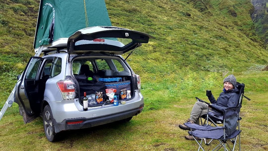 |
| This says it all. |
RETURN TO THE SOUTH COAST
Thor be praised. Our prayers were granted in the morning, when as we broke camp and headed back to the South Coast, the rain abated and the sun miraculously appeared. In fact, we had perfect weather for the remainder of our trip.
Retracing our steps on road Kerlingardalsvegur heading south, we recrossed upper Mýrdalssandur before reaching Höfðabrekkuheiðar. It's part of the same tuff ridge that formed Þakgil subglacially and post-glacially but eroded into a windswept landscape covered by moss and lichen. There's no question that trolls live among the intricate and tortured forms.
 |
| Eroded Tuff Ridge Höfðabrekkuheiðar Lumps and clumps of angular volcanic ejecta and co-mingled sedimentary rocks were incorporated within the subglacially-erupted, post-glacially eroded tuffaceous mass. The region has provided the background to many well-known films and television shows including Game of Thrones. |
With intermittent sunshine and plentiful rain, the plastic bales of hay seal out oxygen and enhance grass fermentation silage-style. They're color-coded blue to indicate the farmer's contributions to prostate cancer. Yellow bales are also used for various children's cancers and pink for breast cancer.
 |
| Glacial Valley on Road Kerlingardalsvegur just above Vik on the South Coast |
A VOLCANIC MOUNTAIN IN A SEA OF LUPINE
Having reached the lowlands of the coast, east of Vik is Hjörleifshöfði. The table mountains has an interesting historical and geological past. It's named after the brother-in-law of Viking Ingólfur Arnarson, Iceland's first official settler in 874. Hjörleifur met his fate here when he was slain by his slaves and is buried on the summit marked with a stone mound.
The mountain is an inselberg, a stand-alone landform constructed of palagonite, an alteration product from the interaction of water or ice and volcanic glass. It appears as if stranded in the middle of glacial floodplain Mýrdalssandur. How did it get there?
Following deglaciation in the early Holocene, when the low-lying coastal plain was fully emerged, rivers transported volcaniclastic debris on the developing sandur that extended the shoreline to the south and isolated the island-mountain from the sea. The mountain was originally a promontory of the mainland, as indicated by höfði meaning cape.
 |
| A Virtual Sea of Lupine on Mýrdalssandur The outwash plain was built via deposition from rivers and streams and countless jökulhlaups generated from ice cap Mýrdalsjökull by glacially-covered volcano Katla. Go there: 63°25'20.85"N, 18°45'14.75"W |
RUGGED AND ENDURING BUT HIGHLY VULNERABLE
Hjörleifshöfði is surrounded by another sea, one of purple lupine. It's a visually striking and politically controversial plant in the legume family of peanuts, beans and lentils that's germinating seemingly everywhere in Iceland.
Propelled by climate change, the invasive and tenacious plant out-competes indigenous plants for sunlight. Attempts to plow it under only releases more nitrogen that enriches developing root nodules. It's an example of rugged Iceland's vulnerability in regards to the warming climate. Fortunately, the plant doesn't grow on glaciers, that is until they too succumb to the inevitable.
 |
| Alaskan lupine (Lupinus nootkatensis) |
The circumstance that led to its take-over began a thousand years ago, well before lupine arrived on the island, when the first Vikings cut native birch and other trees for their agrarian and pastoral lifestyles. Over the millennium that followed, severe and widespread wind erosion and soil loss devastated much of the lowlands. In 1954, the solution for soil stabilization and reforestation was to import Alaskan lupine and saplings of birch, pine, spruce and larch from Alaska that thrive in acidic, sandy soil.
It was a challenging undertaking considering the magnitude of Iceland's vast treeless landscape and slow-growth conditions. A seed dispersal program in the seventies to ensure widespread distribution of lupine made things better or worse, depending on your perspective. Lupine remains central to the controversy of making Iceland green or allowing it to become purple.
LAVA FLOWS FROM KATLA AND LAKI FISSURES
Further east, we crossed outwash plain Mýrdalssandur, built by countless jökulhlaups from glacier Mýrdalsjökull. Large portions of it were blanketed by lava flows, two in particular since settlement-times with an incredible history of regional and global devastation. The lavas originated from some of the most volcanically active areas of Iceland from fissure systems in the highlands of the East Volcanic Zone to the northeast of glacier Mýrdalsjökulll towards Vatnajökull.
The first was around 934, shortly after the settlement of Iceland, that possibly lasted nine years. Eldgjá fissures" likely from Katla produced Eldgjárhraun that flowed down glacially-cut valleys to the lowlands and covered a portion of the outwash plain (purple below). The "Fire Lava" was one Iceland's largest post-glacial flows. Had it been 5x10 meters in size, it would have spanned the circumference of the Earth nine times!
 |
| The Eldgjá and Laki Lava Flows Eldgjá is a 75 km long discontinuous eruptive fissure in the Katla volcanic system. The flow (purple) blanketed the western portion of outwash plain Mýrdalssandur called Álftaver (see map). The Laki flow (pink) originated from fissures and crater rows of the Grímsvötn system. Modified from Sigurðardóttir et al, 2015 |
The second infamous flow (pink) came with Skaftá Fires (or Skaftáreldar) that erupted from Laki fissures and crater rows (aka Lakagígar) of the Grímsvötn volcanic system, close to glacier Vatnajökull. The violent phreatomagmatic eruption lasted eight months from 1783 to 1784 and produced the Eldhraun flow, the largest since the end of the Ice Age. Reaching the sea, it consisted of 42 billion tons of lava (10X the area of Manhattan) and emitted poisonous clouds of hydrofluoric acid and sulfur dioxide.
The volcanic haze produced Móðuharðindin or "Dusty Hard Times." The "poison from the sky" destroyed ten farms locally and killed over a quarter of the island's population (~9,000) and well over half of the livestock from dental and skeletal fluorosis due to inhalation and ingestion. Crops failed in Europe, droughts occurred in North Africa and India, and one of the longest and coldest winter was recorded in North America. The impact on European climate contributed to an increase in poverty, famine, food prices and bread riots that may have helped trigger the French Revolution in 1789.
 |
| Post-Glacial Lava Flow Eldhraun The serene lava field has a history of widespread devastation. Some 12 meters-thick and composed of pahoehoe lava of the Altaver field of western Eldhraun, it's covered with a thick, continuous, lobular mat of fragile, slow-growing and resilient (but sensitive to trampling) Woolly Fringe moss (Racomitrium lanuginosum) that's gray when dry and bright green when wet. Notice the vegetated clifface and talus slope that forms the southernmost flank of the Katla system and former sea cliff. Go there: 63°44’47.8”N, 18°09’39.0”W |
In this eastern region of the South Coast, the Ring Road closely parallels the cliffs, indulating in and out. At their lower portions, hyaloclastites document marine weathering along with wave-cut sea caves and beach terraces as compound lava flows cap the summits. Rivers reach the lowlands from a number of south-flowing, 'warm' outlet glaciers that emanate from parent ice cap Vatnajökull.
 |
| Fossil Sea Cliff near Village Dverghamrar on the Ring Road Fossil sea cliffs record a history of marine invasion with marine platforms and terraces (smooth seafloor area below the cliff), sea caves, marine bivalve fossils and pillow basalts. The parallel steps in the slope are related to frost-shattering that induces volumetric changes in the soil and promotes downslope movement. This is a large farming and animal husbandry district with open pastures for free-roaming sheep. |
Even further east on the Ring Road, countless post-Pleistocene age waterfalls cascade from fossil cliffs below Vatnajökull. At intervals, glacially-carved gorges were once filled by outlet glaciers that have either retreated into the highlands. Meltwater in streams from streams and lakes above the cliffs seek the spillways that were created.
It's a spectacular landscape and genetic scenario that's the similar to what we've seen beneath Eyjajallajökull and Mýrdalsjökull to the west. Only here, waters run clear, not sediment-laden with a milky rock flour suspension since Vatnajökull is some distance to the north.
 |
| Foss á Síðu In the hamlet of Dverghamrar, a sea cliff hosts a 30 m-high waterfall named for the farm in front of the falls. River Fossá's source is post-glacial lake Þórutjörn above the palagonite cliff. Flowering plant Garden Angelica decorates the foreground and is a member of the carrot family. Also called 'Wild Celery', it has a sweet-scented stem if eaten or boiled with skim milk, but an ID must be made since related species are poisonous. |
A number of lava flows such as Eldhraun that originated from fissures in the highlands reached the lowlands and coastal sandurs via glacial valleys and notched spillways in the cliff rim. Further east of Dverghamrar (below), one such persistent stream tumbles over steps worn into the lava flow. Joining other tributaries, it will converge into river Skaftá that courses through Brunasandur.
 |
| Glacial River and Terraces along the Ring Road |
POST-GLACIAL PROCESSES
The loose material that exists on sandurs both in the highlands and along the coast is the product of Ice Age glaciers. At the base of the base cliffs, a dramatic vegetated apron of talus ends where the expanse of a flat sandur begins that stretches to the sea. Active destructive geological processes are hard at work throughout Iceland.
Notice the solifluction terraces of subtle, parallel steps in the soils and rocks of the unconsolidated slope. Frost-heaving (swelling of soil during freezing caused by an increasing presence of ice as it grows surfaceward) that causes expansive volume changes in uppermost soils and gravity-induced downhill movement regardless of vegetation result in a gradual movement downslope. On a grander scale, the same process produces cirques, an amphitheater or massive bowl-shaped depression on steep glaciated mountain slopes in association with winter-compacted ice, glacial carving and mass wasting.
 |
| Vegetated Talus Slope below Former Sea Cliff meets the Sandur Generated by mass wasting under the influence of gravity, talus cover the base of most mountains slopes in Iceland. They're formed by the accumulation of eroded angular stones over time that have loosened by weathering from vertical rock faces. As it develops, it can creep downslope en masse and can form icy rock glaciers over time typically in glacial valleys at higher elevations. |
Wetland vegetation thrives in the damp and water-saturated soils around the streams that course from the base of the cliffs. It includes reeds, rushes, sedges, horsetails, mosses and cottongrass. There are over 606 different species of moss in Iceland.
Iceland currently has six wetlands designated of international importance. Many are located inland and cover almost 10% of the vegetated surfaces of the island. They consist of both andisol (formed from volcanic ash) and histosol (organic peaty) soils, which are uncommon together elsewhere on Earth. Many larger wetlands in Iceland have been drained for cultivational and pastoral purposes, a trend that conservationists and preservationists are worked to cease.
 |
| Common Cottongrass Growing in Ditch Wetland It's a flowering plant in the sedge family (grasslike plants with triangular stems) that's restricted to wetland habitats such as bogs, marshes, stream edges and even ditches. With its distinctive cottony head, early Icelandic settlers used it for wicks in fish oil lamps and stuffing in pillows and bedding. |
SKEIÐARÁRSANDUR
Leaving the cliffs and lowlands of the central-South Coast, we continued our trek northeast to Skaftafell Wilderness, our destination for the second night. But, first we had to cross Skeiðarársandur, the largest outwash plain in the world and actively growing.
With 56 km of coastline and area of 1,300 sq km, Holocene-age Skeiðarársandur formed from the transport of volcaniclastic debris by five or so rivers such as Skeiðará that originates in the highlands. The majority of its meltwater originates from glacier Skeiðarárjökull, one of many south-flowing tongues of Vatnajökull. Countless jökulhlaups have contributed volcaniclastic debris and blocks of ice to the sandur that have been geothermally-spurned by the volcanic systems of Grímsvötn and Öræfajökull that lie beneath Vatnajökull.
 |
| Skeiðarársandur facing West Reworked by the wind and nearly devoid of vegetation, black sandy soil and unsorted volcaniclastic clasts on the sandur are delivered by rivers from the highlands to the north and from countless jökulhlaups triggered geothermally and volcanically and from ice-dam failure of impounded water. Moving seaward from the source, clast size progressively diminishes until it consists of black gravelly-sand at the coast. To the west, a string of jutting sea cliffs extends below Mýrdalsjökull. |
Sandurs such as Skeiðarársandur typically form in association with an active volcanic boundary, the East Volcanic Zone in this case, where eruptions frequently occur in concert with glacial retreat that delivers sediment to the aggrading plain. It's crossed by a braided maze of rivers and streams that flow south 20 or 30 km to the sea. In places, deltas have extended the sandur even further out to sea. Jökulhlaup historical lithofacies can be seen in Ring Road-cuts and channel-cuts that cut through the sandur.
 |
| Skeiðarársandur facing South from the Trail to Svartifoss From the highlands of the Skaftafell Wilderness, the expanse and immensity of the sandur is evident, even though the photo takes it a small angle of view. |
HYDROLOGIC REGIME OF A DEGLACIATING PLANET
Skeiðarársjokull is essentially an alluvial plain of Vatnajökull's outlet glaciers, as rivers and streams shifted their course and flooded the landscape. In affect, it's the consequence of combined volcanism and climate change. What we see on it are modern Holcene-age sediments, yet what lies beneath is multi-layered volcanic bedrock that built Iceland beginning in the Miocene-Pliocene and were modified by glaciers during the Pleistocene.
 |
| The Skeiðará Bridge Monument Twisted steel is all that remains of a 880 m-long Ring Road bridge that spanned river Skeiðará, the only means of transport across Skeiðarársandur, the longest span in Iceland. In 1996, it succumbed to house-size icebergs delivered during a massive jökulhlaup. The girders are an artistic monument to the event against a spectacular backdrop of southern outlet glaciers Skeiðarárjökull, Skaftafellsjökull and Svínafellsjökull. |
This southeast region of Iceland is known as Öræfi, which originally meant "area without a harbor" or "land between the sands" from vast Skeiðarársandur on the west and
Breiðamerkursandur to the east. But, as a result of the landscape that has been created during its destructive volcanological and glacial outburst past, it has assumed the meaning of "desert" or "wasteland."
It's difficult to imagine this region was, according to the ancient Icelandic Book of Settlements, once covered by a vast forest when Iceland was first settled some 1,100 years ago. It was one of the most isolated parts of Iceland until the Ring Road and its many bridges, the one crossing river Skeiðará in particular, connected it to civilization.
GLORIOUS SKAFTAFELL
Established in 1967, Skaftafell Wilderness is the most visited of Iceland's parks. It was shaped by glacial action and water erosion and located where flat Skeiðarársandur meets the south flank of mountain Skaftafellsheiði in the shadow of glacier Vatnajökull.
 |
| All the Comforts of Home at Skaftafell Campground The campground is a 400 tent site, one of the largest in Iceland, replete with hot showers, washer-dryers, a cafeteria and visitor center. In 2008, it was incorporated into immense Vatnajökull National Park, the largest park in Europe at ~13,952 sq km and covers about 14% of the surface area of Iceland. About two-thirds of Vatnajökull ice cap are located within the park. |
VATNAJÖKULL
The glacial system is an enormous instrument of change across Iceland's landscape. The ice cap is the centerpiece of the eponymous national park that includes a large variety of volcanic, glacial, fluvial and lowland-alluvial and outwash plain landscapes. What's more, seven volcanic systems lurk beneath Vatnajökull's ice, including Grímsvötn, Iceland's most active volcano that erupts roughly every ten years.
Some 40 individual outlet glaciers, each with their own name, radiate outward in every direction from the ice cap's body. From west to east on its southern to eastern margin, the largest tongues include the pronunciation twisters Skaftárjökull, Síðujökull, Skeiðarárjökull, Skaftafellsjökull, Svínafellsjökull, Öræfajökull and Breiðamerkurjökull.
 |
| Ice Cap Vatnajökull and Major Southern Outlet Glaciers It's some 30 outlet glaciers and their forelands radiate outward from the parent ice cap in every direction. Two major rivers to the north carry meltwater from a number of collective outlets. The southern region includes coastal lowlands, U-shaped valleys and barren sandur plains. Modified from Landsat NASA, 2017 |
Outlet glaciers along the South Coast typically possess a proglacial lake and proglacial river that reaches the North Atlantic across an expansive sandur. In contrast, Iceland's second longest river, 206 km-long Jökulsá á Fjöllum (River in the Mountains) emanates from the ice cap's north side and empties into the Arctic Ocean. We'll cross the river and visit its famous gorges and waterfalls in post Part III.
 |
| Mighty Vatnajökull in Southeast Iceland In reality, seen from the lagoon of Jökulsárlón, this is the glacial tongue Breiðamerkurjökull of parent ice cap Vatnajökull, whose body-proper looms in the distance some 20 km at the head of the outlet glacier. |
REMNANTS OF THE ICELAND ICE SHEET
Like all glaciers at all elevations in Iceland, Vatnajökull is the largest remnant of the Iceland Ice Sheet that blanketed the entire island in the Pleistocene. In a country where 11.1% of the land area is covered by glaciers, it occupies over 8%, making it the largest and most voluminous in Iceland and second largest in Europe. In fact, it's the largest ice cap outside of the poles at ~8,300 sq km (twice the size of Rhode Island) and larger than all of Europe's continental glaciers combined.
Its 3,000 million tons depress the Earth's crust ~100 m below the middle of the ice cap. It's mean thickness is ~400 m and maximum nearly one km. The mean altitude is ~1,300 m with a maximum more than 2,100 m. Its lowest point is an astounding 300 m below sea level in a trough carved into the bedrock at the terminus. West to east, it measures 143 km (88.8 miles) and north to south, 98 km (60.9 miles).
 |
| Ominous Clouds over Vatnajökull From the southwest, outlets Skaftafellsjökull and Svínafellsjökull are separated by mountain ridge Skaftafellsheiði. We're looking across a small section of massive outwash plain Skeiðarársandur from the Ring Road. Unseen (off to the left) is outlet glacier Skeiðarárjökull, and off to the right lies Öræfajökull. |
The topographic map (below) is centered over the Skaftafell Wilderness of Vatnajökull National Park, where three south-flowing outlet glaciers (blue arrows) and their proglacial rivers converge on sandur Skeiðarársandur (encircled) - Skeiðarárjökull, Skaftafellsjökull and Svínafellsjökull. A fourth, Öræfajökull, at Vatnajökull's southernmost extremity, lies to the east (unseen). It blankets the largest volcano in the country of the same name with Iceland's tallest peak at its western rim, Hvannadalshnúkur at 2,110 meters (6,921 feet).
Icelandic glaciers, like their high latitudinal counterparts on other continents, have been waning following the Last Glacial Maximum some 20,000 years ago, for the most part, the outlets reached their Little Ice Age Maximum extent near the end of the nineteenth century and have been in a recession much of the time since. Consistent warming since the mid-1980s has led to retreat of almost all of the outlets over the last two decades, leaving proglacial lakes, rivers and assorted ice-depositional features in their wakes.
 |
| Skeiðarársandur and the Skaftafell Wilderness The campground is at the foot of Skaftafellsheiði mountain (green tent icon) off the Ring Road and smaller ones (red). Three south-flowing outlet glaciers emanate from parent ice cap Vatnajökull (top right). The source of the black sand plain Skeiðarársandur (encircled) is primarily from three outlet glaciers delivered by their respective proglacial rivers Skeiðará, Morsá and Skaftafellsá and countless jökulhlaups. This map is available on-line and at the Skaftafell Visitor Center. Click for a larger view. |
A BALANCING ACT OF ICE AND MELTWATER
Vatnajökull is a temperate glacier, as are all Icelandic glaciers, that's essentially at the melting point (versus a polar glacier that is below freezing throughout its mass for the entire year). As a result, a small temperature change can have a major impact on melting and volume. It's liquid water co-exists with glacier ice and is nowhere frozen to the underlying bedrock as is the polar ice cap. Its vast quantity of contained water both within and below in subglacial lakes have earned the name "Water Glacier" in Icelandic.
 |
| Outlet Glacier Öræfajökull Facing east from waterfall Svartifoss, stratovolcano Öræfajökull lurks beneath the eponymous outlet glacier. Pyramidal peak Hvannadalshnúkur, Iceland's highest post-glacial volcano at 2,110 meters, rises from its summit crater. The view is across two outlet glaciers unseen, Skaftafellsjökull and Svínafellsjökull. When travelling the Ring Road, fog and mist frequently obscures one's view of the lofty parent ice cap but not of its many outlets that flow to lower elevations. |
THE GLACIAL POWER OF WEATHER CHANGE
Glaciers not only alter the landscape, but when as massive as Vatnajökull, they create their own microclimate. It includes strong katabatic winds in which high density cold air blasts downslope to the lowlands, which in turn enhances the melting rate in the lower ablation areas. Violent hurricane-strength wind gusts as high as 35 m/s (78 mph) and sand storms may occur on the Ring Road both south and southeast of Vatnajökull.
 |
| Katabatic Wind Simulation From slideplayer.com |
SVARTIFOSS
After dinner in the subdued light of the midnight sun, we hiked up the southern flank of mountain Skaftafellsheiði to Svartifoss. The 'Black Waterfall, so named for the color of its iron oxide-stained amphitheater, is one of Iceland's most photographed icons and signature attraction of the Skaftafell Wilderness. Its multiple lava flows are from the Upper Pleistocene, younger than 0.8 myr, that have been eroded to reveal an impressive, eight-tiered colonnade of columnar-jointed basalt.
Many of the columns have become undermined at the base and fractured off leaving the remnants appearing suspended in space. Columnar basalt is certainly not unique to Iceland and found on all continents. Familiar North American examples include the Devil's Postpile in California Devil's Tower in Wyoming and the Columbia River Basalts in the Northwest.
 |
| Svartifoss from the Banks of River Bæjargil |
Columnar jointing occurs at or near the Earth's surface due to a volumetric change in thick basalt lava flows, although rhyolitic ones do exist. As the mass cools, a temperature gradient develops from the top down that results in contraction and fracture and resulting in hexagonal patterns, common in nature, from equally-spaced cooling centers. If uneven, 5 and 7-sided polygonal structures form. In reality, the formative process is far more complex and poorly understood and involves the crystalline structure of basalt.
 |
| Diagram of Tensile Stress and Temperature Gradients in a Mass of Cooling Basalt Joints in igneous rocks are often associated with the tensile stresses generated by shrinkage as the rock cools. The joints form normal (at right angles) to the cooling surface. The margins of lava flows, sills, dikes and plutons commonly form the cooling surfaces. In bodies of uniform thickness, perfect hexagonal, columnar joints may form. Polygonal joints of this kind are very common. From usask.ca |
Water - glacial or marine - can play a role in the morphology of solidified basalt.
 |
| South View of Svartifoss Stream Bæjargil created a V-shaped notch at the knickpoint as the falls advance upslope by headward erosion. Judging from the breadth of the amphitheater, at one time, likely early Holocene, significant volumes of meltwater cascaded over the falls. Undercutting of the cliff has left many of the colonnades in multiple tiers without basal support that have subsequently fractured and fallen into the plungepool. |
Svartifoss's uppermost colonnade exhibits appears in entablature form, an irregular bent presentation also formed during cooling but in an aqueous environment. Its presence at the top implies flooding. An alternative interpretation is that entablature represents the region where the two opposing joint sets meet, resulting in a complicated distribution of stress resulting in irregular and curved columns.
 |
| Junction of Entablature and Upper Colonnade The sides of the columns (left margin center) exhibit uniform corrugated banding around the perimeter but aren't necessarily aligned with adjacent columns. The surfaces possess fine laminations and a crescent-shaped, hackly fracture pattern within the horizontal striations. In cross-section, parting surfaces expose a faint concentric circle in positive or negative relief and radiating hackles that extend to the surrounding rim. |
Micromorphologically, linked and aligned plagioclase laths (basalt mineral along with pyroxene but with or without olivine). The consensus is that the features formed during top-down thermal contraction coupled with pressure and crystallization-induced melt migration. The dissimilar horizontal banding in adjacent columns may be related to an asymmetric isotherm between adjacent columns.
 |
| Julia Affectionately Embraces a Downed Hexagonal Column of Basalt |
THE SKAFTAFELLSJÖKULL TRAIL
There are no roads in Skaftafell Park, only networks of well-marked trails. Under a sunny blue sky in the morning, we hiked some two km to Skaftafellsjökull. The trail follows a fossil sea cliff below mountain Skaftafellsheiði. It's similar to those we saw to the west only more diminutive in height. It too emplaced in the Pliocene, was glacially carved in the Pleistocene, and marine eroded and retreated from the sea in the Holocene.
Its cliff face is constructed of compound lava and ash flows with intermittent redbeds between flows of the Upper Tertiary Formation, the oldest in Iceland (over 3.3 myr) found in the southeast and across the island in the northwest. Having formed in the central rift zone, it was delivered to Iceland's opposing sides via the diverging conveyor-belt action of plate extension across the landscape. The redbeds, being less resistant to erosion, have created a series of steps in between the erosion resistant flows.
 |
| Freshwater Spring with Floral Micro-Habitat Springs to form in association with dikes and faults by following a path of least resistance. |
Facilitated by joints (fracture without displacement) and faults in the cliff face, water from runoff or emanating between lava flows and redbeds undergoes repeated freeze-thaw cycles over time. Upon freezing, water expands 9% of its volume and exerts considerable pressure on the rock, weakening and mechanically breaking it apart, as seen by the scree piles of shattered rock at the base of the cliff.
Frost weathering is an extremely powerful destructive force, albeit slow, in Iceland owing to its subarctic climate, amount of precipitation and susceptible basalt rock. Weathering and erosion go hand-in-hand, as water, wind and gravity transport away pulverized rock.
 |
| Frost-Weathering of the Cliff Face |
From the base of the fossil sea cliff at trail's end, a portion of the vegetated foreland of outlet glacier Skaftafellsjökull, our immediate destination, is visible, while unseen to the north (left) is the glacier's terminus and proglacial lake (below). The foreland is the area between the glacier's leading edge and the moraines of the last maximum.
Barely visible in the distance is the terminus of outlet Svínafellsjökull. In the foreground, an exquisite spring that emanates between two flows supports a sumptuous micro-habitat of mosses, sedge and flowering angelica.
 |
| East View of Skaftafellsjökull's Foreland |
TERTIARY-PERIOD VOLCANIC PLUMBING
Erosion has exposed a number of features in the cliff face that record the history of its Pliocene genesis, Pleistocene glaciation and Holocene exposure. Feeder dikes, acting as conduits, injected (vertically deliver) molten magma from a source such as a laccolithic reservoir or magma chamber to the surface through subvertical joints and paths of least resistance, cross-cutting layered volcanic strata of the host rock.
Rarely observed unless exposed by erosion, most (98 to 99%) basaltic magma solidified in situ as an arrested or non-feeder dike, as exposed in the cliff face, having never reached the surface. Magma that reaches the surface typically fuels eruptions from fissures and adds to the growing pile of the Tertiary Basalt Formation. Sustained flows through a single vent may lead to spatter cone or plug formation or even a central volcano.
 |
| Outcropping Dikes in the Fossil Cliff Face They vertically transect a number of compound lava flows and hyaloclastite breccias on their way toward the surface. They may never have reached the surface, unknown since the overburden has been removed by glaciation. The cliff section formed in a number of eruptions, and given the age of the Tertiary strata, it's likely that it formed in the sea rather than subglacially. However, it was glaciated during the Pleistocene as evidenced by the cut-off of the feeder-dike (far right). Increased thickness and vesicle formation in feeder dikes occurs as the magma intrusion nears the surface due to gas depressurization. |
In Iceland, normal faulting, fracturing and magmatic activity are largely limited to axial rift zones that trend N-S to NE-SW across the island. Within the zone, magmatic activity is associated with volcanic systems and their associated plumbing systems (dikes, sills, inclined sheets and laccoliths) along with transform and tensile fracturing.
 |
| Tectonically-Controlled Magmatism and Faulting in the Rift Zone This is one of many scenarios that might exist. Seen here, a feeder dikes dissects to the surface following a path of least resistance through the host rock. Magmatic extension induces the formation of subsidence faults, lateral fault migration and spreading. On the surface, magmatic inflation and surface flexure, deflation and subsidence, and fissure and volcano formation can occur. Modified from Tentler et al, 2007. |
Dikes in rift zones coexist with other extensional structures such as tension fractures, normal faults and grabens, which generally trend parallel with axis of the rift zone. A normal fault may be re-activated as a reverse fault by dike intrusion under extreme injection pressure. Local stress fields develop in the host rock and may manifest in the smallest of features, even those seen at the microscopic level in thin sections.
 |
| Small-Scale Jointing in the Cliff Face In the cliff face, immediately adjacent to an area of normal faulting, joint sets have developed in symmetric fracture planes, indicative of complex stress fields. Shear joints are often grooved, striated, polished or slickensided by even small amounts of shear displacement. |
SKAFTAFELLSJÖKULL FORELAND
Our walk to the glacial foreland revealed a number of depositional and excavational-erosional features. It's the ice-free region between the glacier's terminus (its leading edge) and terminal moraines (bulldozed end-point formed during the glacier's latest maximum extent).
As the terminus of a glacier fluctuates with advances and retreats, glacial features within the foreland constantly change as they are reworked, over-ridden, over-printed or even completely altered with new ones. As a result, what we see on the landscape of the deglaciated foreland is a summation of glacial history that has occurred over time.
A deglaciated foreland typically includes:
• till - unsorted sediment from erosion, entrainment and transport;
• kame and kettle topography - deposits and depressions from meltwater ice;
• esker - serpentine deposit by subglacial streams;
• lateral moraine (formed by erosion of valley walls);
• medial moraine (joining of two laterals);
• recessional (intermediary transverse) and terminal (final advance) moraines and associated crevasse squeeze ridges;
• relict stream channels and new ones;
• fluting - subglacially deformed, elongated till;
• drumlins - elongate mounds of unconsolidated debris on-strike with glacial direction.

Standing on the topographic crest of Skaftafellsjökull's broad terminal moraine, it has gained some elevation from isostatic rebound. The hummocky surface of the elongate ridge of unconsolidated volcaniclastic debris was bulldozed into an ice-marginal heap and displays in cross-section, folding and thrusting related to glaciotectonics.
 |
| North Facing View of a Portion of the Skaftafell Wilderness The aforementioned glacial system features can be seen on Google Earth. Oultet glaciers Skaftafellsjökull is on the left (west) and Svínafellsjökull on the right, all radiating from parent ice sheet Vatnajökull. |
A SOUTHERN FORELAND ECOSYSTEM
The plant community is in the midst of a succession (a directional, non-seasonal change in the type of plants though time) from a mixed low-shrub-moss heath (open, uncultivated area of small plants) with with abundant forbs (herbaceous flowering plants) to a moss-dominated heath habitat.
"Iceland moss" is among the most common plant, plus it's usually the first to pioneer (hardy species first to colonize) not only lava fields but regions such the foreland where growing conditions are harsh and unfavorable. There's minimal wind-eroded soil, and yet the moraine is covered with a continuous mat of largely low profile vegetation.
The plants have evolved to withstand and thrive in harsh subarctic conditions of growth, acidic free-draining soil, short growing season and cold but not frigid arctic temperatures. In spite of the plant's rugged constitution, repeated soil compaction and trampling quickly destroys the slow-growing, vulnerable plants, and warning signs caution everyone to remain on the trail.
 |
| Skaftafellsjökull Trail across the Terminal Moraine The moraine was blanketed with woolly moss (Racomitrium lanuginosum) that accounts for more than half of Icelandic vegetation, edible crowberry (Empetrum nigrum), purple saxifrage (Saxifraga oppositifolia), bearberry (Arctostaphylus uva-ursi), Scotch heather (Calluna vulgaris), harebell (Campanula rotundifolia), wild thyme (Thymus praecox), and native Northern Birch (Betula pubescens), here more bushy than tree-like. |
Iceland's locale in the North Atlantic gives rise to a humid and cool temperate climate characterized by cool summers and mild winters. Yet, the climate of the Skaftafell region is generally warmer than neighboring districts due to sheltering from outlet Öræfajökull to the east. Temperatures near the glacier are significantly cooler and subject to glacial winds, the mean annual temp here is s 4°C to 6°C, with a January winter mean near 0°C and a July summer mean of 10°C.
Vegetation is varied with birch and rowan mountain-ash shrubs on mountain slopes, as seen on the hike to Svartifoss. On the other hand, here in the region of the foreland, the sandy and gravelly, flatish surface with its acidic, low-nutrient volcanic soils favors a hardy tundral ecosystem (largely treeless regions that are cold, snow-covered windy and with scant precipitation) of largely bryophytes (non-vascular plants such as mosses) and herbaceous forbs (low shrubs).

Rapid glacial retreat in the glacier's foreland (distal to the terminus and proximal to the outwash plain) exposed rock surfaces of varying topography support dense and diverse, tundral plant colonization. Actually, a number of nested moraines formed between 1890 and 1934 with flat, intra-moraine areas that represent alluvial outwash terraces and incised channels. The different surfaces exhibit ecological chronosequences as successions of plant-types take over.
 |
| Downy Milk Cap Fungus Lactarius pubescens is a species of fungus that grows in sandy soils often under or near birch (Betula nana) and thrives under the same growth conditions. The gilled mushroom is surrounded by a thick carpet of clubmoss and crowberry. |
SKAFTAFELLSJÖKULL
Our short hike to the terminus of the outlet glacier across the foreland, the area between the glacier's leading edge and the moraines of the last maximum, the temperature suddenly dropped some 10 degrees F. as a cold steady wind that streamed downglacier. Parent ice cap Vatnajökull is some 10 km upglacier obstructed beneath by the clouds.
At the head of Skaftafellsjökull, two flow units have merged below a nunatuk (pyramidal mid-glacier ridge or mountain) that produced the distinctive medial moraine of debris that runs down the center of the glacier. Mountain Skaftafellsheiði borders the glacier on the east (right) and separates it from outlet Svínafellsjökull, our next stop. Immediately over the crest of the terminal moraine on which we stand is a deep proglacial lake.
 |
| Skaftafellsjökull from the South Flank of the Terminal Moraine At 100 meters, it's the highest terminal moraine in Iceland. |
At the crest, a glorious view unfolds of the characteristic geomorphic features at the glacier's terminus: a proglacial lake filled with a milky suspension of fine-grained glacial flour and a number of calved icebergs afloat, an ice blue glacial toe filled with kneaded horizons of datable volcanic ash, a steep lateral moraine and a proglacial river heading toward its sandur at the distal end of the foreland. Speculator!
 |
| Glacial Features at the Terminus of Skaftafellsjökull Panorama taken from lateral Moraine |
The narrow ridge of Skaftafellsheiði (below) separates outlet glaciers Skaftafellsjökull and Svínafellsjökull. Its glacially carved flank reveals an eroded, glacially-plucked layer-cake lava flow stratigraphy that was fed by numerous feeder-dikes that stand out in relief. Julia shines on a transported erratic of hyaloclastite breccia, scattered among a carpet of unsorted and unconsolidated glacial till.
 |
| Julia at Skaftafellsandur Among the unsorted, unconsolidated glacial till of the outwash plain, Julia delicately balances on a glacially-transported erratic of brecciated hyaloclastite. Note its angular, fragmented clasts of basalt. |
A ~700 k-old sediment sequence in the root of Öræfajökull volcano contains fossils primarily of leaves that record climate change on Iceland through the Pleistocene. It's from a deciduous broad-leaf forest that characterized long-gone Tertiary flora. Iceland is composed largely of igneous rocks (25 types) of various types (both volcanic and plutonic), whereas, sedimentary rocks account for about 10% of Iceland's volume. There is no true metamorphic rock, only those altered by geothermal and hydrothermal contact.
 | |||
| Western Flank of Mountain Skaftafellsheiði The glacier-scarred cliff face exposes stacked flows of the Tertiary Basalt Formation and dike in swarms and inclined sheets. The 5 to 12,000 year interval between flows are thin horizons of iron-oxidized redbed volcanic soils. Being more susceptible to erosion, it weathers in horizontal steps that stand out in cross-section. The 5 to 10° dip of the entire succession is toward the crust-depressed spreading axis that forms two massive synclines that extend outward from it. Note the terminal moraine in the foreground. |
SVÍNAFELLSJÖKULL
After visiting Skaftafellsjökull, we broke camp and headed to Svínafellsjökull, the next outlet glacier in succession to the east. Also south-flowing and part of the Skaftafell Reserve, it formed from the merging of two steep, alpine glaciers and has the appearance of a valley glacier as it flows to its terminus.
 |
| Svínafellsjökull and its Foreland |
Svínafellsjökull is a popular site for guided glacier walks and hiking the lateral moraine on its western flank. Many films and commercials have been filmed there most notably Game of Thrones season 2, where Jon Snow and the Night Watch captured Ygritte.
 |
| Game of Thrones from HBO |
The Skaftafell region is also the site of a long-gone historic farm that played a role in the thirteenth-century Njáls Saga, said to be the most impressive of the medieval Icelandic sagas, prose narratives based on historical events in the 9th through 11th centuries that deal with struggles and conflicts within the early settlers. Basically, it deals with a 50-year blood feud and the consequences of retaliatory vengeance.

"WHAT'S PAST IS PROLOGUE" OR "NOT IF, BUT WHEN"
Extravasated by erupting volcanoes and fissures and distributed hither and yon by the wind, ash settles on land, sea, seafloor and glacier far from the site of origin. Where found, undisturbed fallout serves as highly specific, identifiable marker horizons that are a well-defined datable record and valuable tephrochronological record of past eruptions, environmental conditions, climate change and assist in archaeological correlations.
If the historic record of the devastation and destruction wielded by Iceland's volcanoes is any indication, Iceland is in for a lot more fireworks as the Mid-Ocean Ridge continues to
 |
| Soil Profile of Marker Horizons and Temporal Relationships The cross-sectional soil sample is from a valley north of glacier Eyjafjallajökull. A number of dated tephra isochron layers (series of points in time versus absolute dating) from volcanoes Katla, Hekla and Eyjafjallajökull have been identified. Iceland's first human settlement is at the Settlement Layer marked at 871 AD. Modified from Dugmore, 2012. |
THE TERMINUS
Also referred to as the snout, toe or ice front, the end of the glacier appears stationary, even though it's in constant motion either retreating or advancing. Above the equilibrium line in the accumulation zone, the glacier is acquiring ice mass from precipitation, but below it in the ablation zone, there is a net loss due to melting, sublimation (solid directly to gas), evaporation, calving, eolian processes and avalanche.
It's riddled with crevasses (brittle fractures at right angles to stress) as it contorts its way downslope and ogives (arcuate bands of alternating winter and summer snow and ice). Blanketing ash fallout, even from far-removed volcanic sources, becomes folded and kneaded into the body. It's a primary isochron for tephrochronological dating that provides marker horizons for climatic change and environmental purposes. Similarly, terrestrial surfaces possess a secondary isochron that formed after the glacier melted and redeposited the ash.
 |
| The Snout of SvínafellsjökullI Notice the lateral moraine (left) of deposited, unconsolidated bedrock debris. |
As glaciers flow downslope from the highlands, they carry vast quantities of eroded and weathered bedrock. In addition to subglacial erosion of the bedrock by rock-laden ice, glaciers scrape, gouge, grind, abrade and polish volcanic bedrock of the valley's walls.
 |
| Glacial Striations and Polish in the Walls of Svínafellsjökull Glaciers contribute to the denudation of the landscape by using the frozen rocky debris that they carry as an erosional tool. Bedrock walls, rocky outcrops and exposed boulders become carved, scoured, scratched and polished, all in the direction of glacial movement. The trough that glaciers gouge into the landscape is typically U-shaped, whereas rivers, also utilizing carried glacially eroded debris, widen their channels by abrasion and create V-shaped valleys and gorges surrounded by arêtes (serrated ridges) and hanging valleys. |
While standing on the rocky debris pile of Svínafellsjökull's lateral moraine, one can really appreciate its height and steepness above the proglacial lake, some 150 meters below. Photos don't do it justice.
In the middle distance is the glacier's terminal moraine (note man on the crest for scale) and beyond begins vast sandur Skeiðarársandur and the North Atlantic coast 25 km away (note Ring Road bridge for scale upper left). Barely visible, the misty slope and cliffline of glacier Mýrdalsjökull lies some 125 km to the southwest (upper right).
 |
| View South of Svínafellsjökull's Foreland facing South The view is incredibly serene with a glacially cooled breeze at our backs, but to the discerning eye, the landscape has undergone enormous change at the whim of the glacier due to climate change and even global environmental feedbacks. At the terminal extent of the lake, the lateral and terminal moraines almost grade together with one flank breached by the proglacial river as it heads across the sandur to the sea. |
THE ROAD TO JÖKULSÁRLÓN
Leaving the Svínafellsjökull's foreland, we continued across Skeiðarársandur and began to round the terminus of outlet Öræfajökull on parent Vatnajökull's southernmost extremity. Its eponymous subglacial stratovolcano contains the highest peak in Iceland and its largest and possibly most active volcano.
In 1362, an explosive eruption drowned farmlands in the region and showered them with ash that traveled as far as Western Europe. Distant ships could hardly sail through the pumice that blanketed the sea. Over 40 years passed before resettlement could occur. Today, smaller eruptions and earthquakes continue to plague the region that's on high watch for anticipated reawakening of the subglacial volcano.
 |
| Sedge and Cottongrass-Vegetated Skeiðarársandur Destroyed by glacial floods and raining ash, farmsteads in the lowlands once stood here. Harsh volcanic conditions have taken their toll on any possible remains. Julia captured this dramatic photo. |
BREIÐAMERKURJÖKULL AND JÖKULSÁRLÓN
Past Skeiðarársandur and around Öræfajökull, we entered sandur Breiðamerkursandur situated between rivers Kvíá and Fellsá and beneath outlet Breiðamerkurjökull. Our immediate destination was Jökulsárlón. It's the largest, deepest, fastest growing, newest and most visited proglacial lake in Iceland.
The Ring Road crosses Jökulsárlón suspension Bridge that spans short proglacial river and estuary Jokulsá that connects the lagoon with the North Atlantic. Special care was taken during its construction to build a coffer dam to protect the abutments from potential iceberg and flood damage, a frequent occurrence on the South Coast.
 |
| South View of the North Atlantic Coast from the Shore of River Jokulsá The Diamond Beach (and massive parking lot) is off to the right. This is a very busy place. |
Breiðamerkurjökull is a southeast-flowing, surge-type (cyclically advancing and retreating over short periods not under climate control) outlet glacier of Vatnajökull, and lake is actually a lagoon, since it communicates with the sea and brackish at high tide. The outlet is also a piedmont glacier in that, having flowed onto the flat coastal lowlands without lateral bedrock confinement, it fanned out in a lobular shape.
The two are big-time worldwide attractions. Tourists arrive by the bus and carload to admire the beauty, snowmobile on the glacier, traverse the lagoon on Zodiacs, walk along the ice-strewn black sand shore, gaze at shore birds and hungry seals, and photograph blue icebergs sparkling in the sun. It's a site to behold but far from a solitary experience (Tips: Stay nearby, so you can arrive early. Book a Zodiac boat tour well in advance. Or, go to far less visited Fjallsárlón lagoon about 10 km to the southwest).
 |
| Calving Icebergs The icebergs that float in the lagoon are milky white and luminous blue, dependent on the amount of air trapped within the ice. Many are streaked with gray volcanic ash that was kneaded into the glacier as it flowed and deformed during the journey downslope. Once small enough, prevailing winds and the tide facilitate their journey to the sea, a very slow process. |
ANATOMY OF JÖKULSÁRLÓN
It's interesting that although subglacial lakes are common features of Holocene ice masses, they're rarely identified in the geologic record due to the difficulty in discriminating between subglacial and proglacial lake sediments. A similar situation exists for glacial depositional landforms such as moraines that form and reform as the termini of glaciers repeatedly advance and retreat and alter what has formed before.
Typical of Iceland's South Coast melting valley glaciers, Breiðamerkurjökull excavated an exceptionally deep trough in bedrock that served as an ice-marginal lake basin following its retreat. A millennium ago when the first settlers arrived (~874 to 930 AD), the terminus was ~20 km to the north. During the Little Ice Age (1600 to 1900), a brief period of Neoglaciation, it advanced to 256 m from the coast. Since then, the glacier retreated 5.6 km. Today, it's one of two Icelandic glaciers that extends closest to the sea.
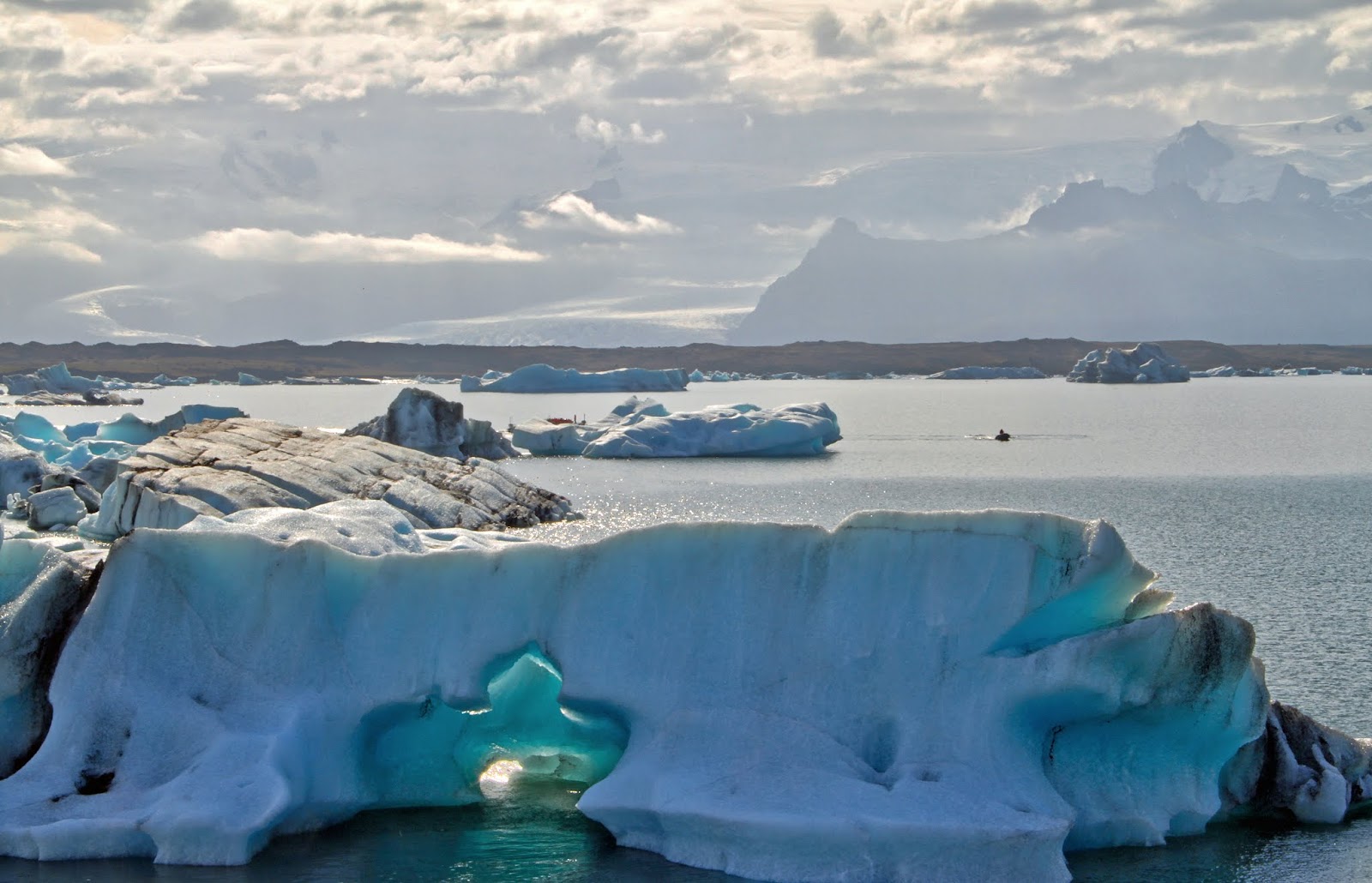 |
| West View of Subglacial Stratovolcano Öræfajökull from Jökulsárlón In the distance, a tongue of Vatnajökull spills into less tourist-crowded, iceberg-filled proglacial lake Fjallsárlón. The volcano is the largest in the country with the tallest peak. The sea level enters with the tide at Jökulsárlón, increasing its temperature. Entering salmon, capelin and herring entice Common and Gray seals to follow the food, all as Eider ducks, Arctic terns, Great Skua and Snow Buntings fill the sky. |
Jökulsárlón is a recent addition to the landscape in geological terms. It was first described in 1932, although it certainly predated that. Regional maps from the 1700s, indicate that Breiðamerkurjökull drained directly into the sea and that the lake has grown in size in concert with the glacier's retreat.
With an area of 8 sq km in 1975, it occupied 18 sq km. Although less than a century old, the lagoon-proglacial lake is over 258 m (814 ft) deep and occupies the deep, below sea level-trough gouged by the glacier that actually extends some 20 km beneath it upvalley.
 |
| The Famous Icebergs of Jökulsárlón Only 10-20% of each iceberg lies above the surface of the lagoon. The lake is never completely frozen due to its tidal infusion of saltwater from its communication with the sea. Although the surface may freeze, since denser saltwater sinks to the bottom of the lake. Bet you can't take only one photo! |
Breiðamerkurjökull's snout floats over the edge of the lake, which is above freezing at the surface. Icebergs that calve from it break-up and drift tidally to the sea on barely 0.5 km-long river Jokulsá, a buoyant journey of perhaps five years. The river is getting shorter at the expense of ongoing ocean-side beach erosion, which will eventually destroy the bridge and convert the proglacial lake-lagoon into a deep bay or broad coastal fjord in the near geological future.
 |
| Terminus of Breiðamerkurjökull The glacier possesses two medial moraines that are the result of being fed eroded volcanic material from the lateral aspects of nunataks Esjufjöll and Mávabyggðir, the small ranges in the distance. Breiðamerkurjökull is formed by four converging glacier streams, three of which are named: Esjufjallajökull, Mávabyggðajökull and Norðlingalæðarjökull. Beyond them lie the immense body of parent glacier Vatnajökull. |
ICEBERG DESTINY
The icebergs that calve from the floating toe of the glacier, eventually wash up on the ocean-facing, black sand Diamond Beach. It's a major tourist photo-op, and many have been stranded on icebergs that have begun to drift out to sea from the beach.
When you think about it, the icebergs are the final stage of the water cycle from the ocean to the atmosphere, precipitating down to glaciers, and finally to the sea, to happen once again and again. As for the lagoon, if the current trend of climate change continues, the river will be consumed as the sea rises and the lagoon directly communicates with it. At that point, it will become a fjord. Iceland ever-changing.
 |
| Stranded Iceberg on Diamond Beach |
EAST ICELAND
After Jökulsárlón, we headed northeast on the Ring Road to our campground destination for the third night. We're now southeast of Vatnajökull with more outlets and their sandurs, but the scenery has begun to undergo a striking change. It's not only the region of the older Tertiary Basalt Formation that formed some 3.3 to 16 my in the Pliocene but the region of dramatic glacial valleys that end in immense fjords that extend below the level of the sea.
The landscape formed before the onset of Pleistocene glaciation but has since succumbed to it with fluvial ravines that were carved into beautifully proportioned U-shaped valleys and alpine-like summits that were intricately sculpted by the movement of glacial ice. Many of the glacial valleys extend below sea level and formed fjords, the most distinctive feature of East Iceland.
 |
| Eroded Peaks of Tertiary Basalt Between Lake Jökulsárlón and village Höfn in Southeast Iceland, erosion and time have revealed the regularly stacked and thin "layer-cake" morphology of the Tertiary Basalt Formation. Then as now, the lenticular stratigraphic successions built the island of Iceland into an elevated volcanic plateau. I used to think that Arizona and Utah had the best clouds, but after visiting Iceland a number of times, I'm not so sure. |
OUR THIRD NIGHT
Our camp was located on the shores of fjord Hornafjörður literally in the village of Höfn in southeast Iceland (pronounced 'hup'). The fjord is an estuary (a tidal river mouth), the only navigable one in the country. This is also the region of the Hornafjörður central volcanoes that formed within a Tertiary-age volcanic zone that currently stretches along the southeastern margin of Vatnajökull and northwards, across the eastern fjords.
Many of the volcanoes have been severely eroded by Pliocene and Pleistocene glaciers, and some are still partly covered by Vatnajökull outlets. The eastern landscape includes magnificent outlet glaciers, glacial-carved valleys, moraines and fjords that mark the maximum glacial extent during this time. Here's a sample of what we'll see just north of Höfn tomorrow morning in Post III.
 |
| Scree-Covered Slope and Black Sand Beach below Mountain Krossanesfjall It's part of the Austurhorn silicic volcano, which is an exhumed Tertiary intrusive complex that solidified underground in the Pliocene. After Pleistocene exhumation, it acquired a glacially-jagged summit. This is the region of the Tertiary Basalt Formation, Iceland's oldest stratigraphic succession in the Pliocene. It's a dangerous section of the Ring Road plagued by rockfall closures. Go there: 64°25'3.96"N, 14°31'31.70"W |
DINNER FROM THE NORWEGIAN SEA
Höfn means 'harbor' in Icelandic, but it might as well be 'Lobster Capital of Iceland.' The coastal village's livelihood centers on fishing and tourism, but hands down, the specialty of the region is lobster or langustines to be more precise. A European term, they look like crayfish with small claws and a large tail (Tip: It's where all the meat is).
Nephrops norvegicus (aka Norway lobster, Scampi or Dublin Bay prawn) thrives on the icy cold seafloor of the Northeast Atlantic and is the most important commercial crustacean not only in Iceland but in Europe. We heard they're more tender and delicious than their larger arthropodal New England relative. So, putting geo-tourism briefly aside, we turned down a tailgate feast of freeze-dried Mountain House lasagna for some of Höfn's finest with ice cold champagne. It didn't disappoint.
 |
| "Now this is roughing it!" There was little doubt of the freshness of our sumptuous repast with the fishing vessel that brought in the catch that morning docked literally outside the restaurant. |
TENT TIME
Following dinner, we turned in with the midnight sun still lighting the evening sky, albeit dimly. Here's our north view of fjord Hornafjörður at high tide and the Tertiary volcanoes along the East Coast from our roof tent at sunset. What a place!

ICELAND POST PART III
Please join Julia and I for Part III, forthcoming, when we explore the geology of the glaciated fjords of East Iceland, the barren lava fields and sandurs of the Central Highlands, the geothermally and volcanically active Myvatn lakes district, the arctic North Coast and the remote Snæfellsnes peninsula in the northwest.
Here's a small sample of what's to be seen.
SPECIAL THANKS
I'd like to express my sincere appreciation to the following individuals who were especially helpful in my formulation of this post:
• Guðríður Gyða Eyjólfsdóttir, mycologist with the Icelandic Institute of Natural History, Akureyri Division;
• Ingibjörg Svala Jónsdóttir, Professor of Ecology at University of Iceland for glacial foreland plant identification;
• Ari Trausti Guðmundsson, member of the Icelandic Parliament and geologist, author, lecturer and explorer for a rock specimen identification;
• Wayne Ranney, renown geologist, author, lecturer and guide, for his astute landscape interpretations. Visit him here;
• Gillian R. Foulger, British geologist, author of "Plates, Plumes and Paradigms" and Professor of Physics at Durham University, England for clarification of certain aspects of Iceland geogenetics and mantle dynamics. Visit her here;
• Sigurður Stefnisson, well-known Icelandic photographer for his Eyjafjallajökull photo. Visit him here;
• local Bostonian and Icelander Sonia Didriksson for her valuable geographical assistance and help with everything unpronounceable, especially Icelandic's ten letters that don't appear in the English language.
Please join Julia and I for Part III, forthcoming, when we explore the geology of the glaciated fjords of East Iceland, the barren lava fields and sandurs of the Central Highlands, the geothermally and volcanically active Myvatn lakes district, the arctic North Coast and the remote Snæfellsnes peninsula in the northwest.
Here's a small sample of what's to be seen.
 |
| Hvítserkur The "White Shirt" sea stack is a tiny remnant of an elongate dike on the North Coast that vertically injected through layered Tertiary-age volcanic host rocks long-gone. The igneous intrusion is a composite of rhyolite surrounded by basalt, which facilitated the emplacement of the more viscous rock. It had three holes in its base, but one was filled to assist in the preservation of the iconic landmark. The whitish colorations are bird droppings from fulmars and kittiwakes that breed there. |
SPECIAL THANKS
I'd like to express my sincere appreciation to the following individuals who were especially helpful in my formulation of this post:
• Guðríður Gyða Eyjólfsdóttir, mycologist with the Icelandic Institute of Natural History, Akureyri Division;
• Ingibjörg Svala Jónsdóttir, Professor of Ecology at University of Iceland for glacial foreland plant identification;
• Ari Trausti Guðmundsson, member of the Icelandic Parliament and geologist, author, lecturer and explorer for a rock specimen identification;
• Wayne Ranney, renown geologist, author, lecturer and guide, for his astute landscape interpretations. Visit him here;
• Gillian R. Foulger, British geologist, author of "Plates, Plumes and Paradigms" and Professor of Physics at Durham University, England for clarification of certain aspects of Iceland geogenetics and mantle dynamics. Visit her here;
• Sigurður Stefnisson, well-known Icelandic photographer for his Eyjafjallajökull photo. Visit him here;
• local Bostonian and Icelander Sonia Didriksson for her valuable geographical assistance and help with everything unpronounceable, especially Icelandic's ten letters that don't appear in the English language.