Showing posts with label Anorthosite. Show all posts

Monday, December 24, 2012

The Adirondack Mountains of New York State: Part III - Climbing the Geology of the High Peaks

We’re facing north from the summit of Algonquin Peak, the second highest mountain in the State of New York (5,114 feet). In the foreground, Wright Peak (4,580 feet) displays two Holocene rock slides, typical of the Adirondack’s higher peaks. Just to the left of Wright, lowly Mount Jo stands reign over glacial Heart Lake, the base for our climbs. Lake Placid Basin is in the left, middle distance. In the August haze, Whiteface Mountain (4,865 feet) is perched on the horizon (left of center) with the Sentinel Range sprawling off to the right. Another 45 miles and you reach the end of the Adirondack’s elliptical, uplifted dome. There you’ll find the lowlands of the mighty St. Lawrence River flowing to the Atlantic Ocean from Lake Ontario of the Great Lakes. 


How did the Adirondack Mountains form? Please visit my post Part II here.

VESTIGES OF A SUPERCONTINENT
Virtually all of the bedrock in this Adirondack Mountain vista is Middle Proterozoic Grenville in origin. The last billion years were witness to the formation of the supercontinent-spanning Grenville mountain belt culminating with the assembly of Rodinia, to its fragmentation, to the Iapetus Ocean’s formation and eventual closure, to the supercontinent of Pangaea’s unification and rifting apart, and to the birth of the Atlantic Ocean. Blanketing Early Paleozoic marine assemblages have been unroofed by thermal doming of the Early Cretaceous. A hundred million years later, Pleistocene continental glaciation bulldozed the region at least four times, likely more, leaving its erosive signature everywhere. The story of the Adirondacks is indeed “Written in Stone.”


THE ADIRONDACK LOJ
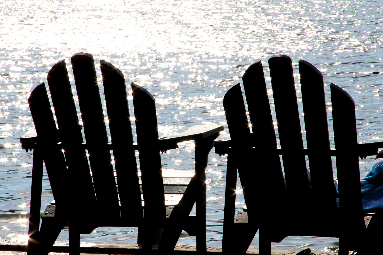
In August, my daughter and I drove from Boston to the Adirondack Loj (correct spelling), a few miles south of Lake Placid, New York. The lodge is efficiently run by the Adirondack Mountain Club and served as our base for two days of geological exploration within the High Peaks region. The lodge is replete with home-cooked meals and bagged lunches for hikers. It is immaculately clean with private and family bunk-rooms, and a communal great room for relaxing beside a stone hearth. There’s even swimming and canoeing in crystal clear Heart Lake. Built in 1927, this idyllic “gem-in-the-woods” has it all: mountain hospitality, Wi-Fi access, education classes in geology, botany and mountain lore, and easy access to the high peaks. Go there (shameless plug)! 
For their website click here.


My daughter (and climbing partner) enjoys the night air outside the lodge.

And yes, that IS a moose head above the hearth!


GLACIAL HEART LAKE
The lodge is situated on the edge of most pristine Heart Lake in the shadow of Mount Jo at 2,340 feet. It’s diminutive by Adirondack standards, but after a short hike above the glacial talus that litters the region, anorthosite bedrock quickly crops out. Go a little further, and the gabbroic anorthosite becomes gneissic as its constituent labradorite feldspar crystals begin to align. Still further, the trail crosses a fine-grained, black camptonite dike. All that geology within a mile of the lodge!


Taken from the summit of Mount Jo above Heart Lake with Mount Colden (left), the MacIntyre Range including the Peaks of Wright and Algonquin (center), and precipitous Wallface (right of center) are separated by the NE-SW fault valleys of Avalanche and Indian Pass, respectively. From a wonderful National Geographic article entitled “Adirondack Park-Forever Wild” at www.ngm.national geographic.com and photographer Michael Melford at www.michaelmelford.com)

The geological verdict on the lake is still out. Some believe it's a kettle lake that formed when ice calved from the front
of a receding glacier. In this scenario the lake would have become established in the glacial outwash when the ice melted. An alternative origin depicts its formation in a glacially-scoured basin replenished by melting glaciers and eventually mountain streams. That would lend credence to the thought that Heart Lake and the adjacent drybeds with unmistakable beaches were once one large glacial lake. The outlet of Heart Lake flows north into the lake basin of South Meadow. We’re looking south at the foothills of the MacIntyre range just before sunset, tomorrow’s destination.


Tranquility will have a new meaning!


ADIRONDACK MOUNTAIN HIGH
After a restful night in the lodge (2,174 feet), we began our sunrise-ascent to Wright Peak (4,580 feet) which was a warm up for Algonquin Peak (5,114 feet) to follow. Both mountains are within the MacIntyre Range, named after the owner of the Tahawus open pit, iron mining operation in the 1800’s and titanium dioxide in the early 1900’s.


The MacIntyre Range stands apart from the surrounding peaks and extends for eight miles running NE and SW along the trend of the faults that confine it. Its steep SW slope forms Indian Pass, while the NE side defines spectacular Avalanche Pass. Our two-day plan was to climb the range from Wright to Algonquin on the first day and investigate the system of lakes within the fault-valley to the east of the range on the second day.


The Adirondacks have a distinctive look and feel right down to the moss-covered, gnarled tree-roots that seem to imprison boulders of glacial talus.


The rough and rocky trail starts out in unconsolidated glacial talus and till, and transitions to anorthosite bedrock. The verdant slopes and valleys of the Adirondacks contain a deciduous mix of aspen, ash, cherry, beech, maple and birch at lower levels and hardy evergreens at higher elevations that includes pine, spruce, hemlock and cedar.


A TRAIL OF ANORTHOSITE
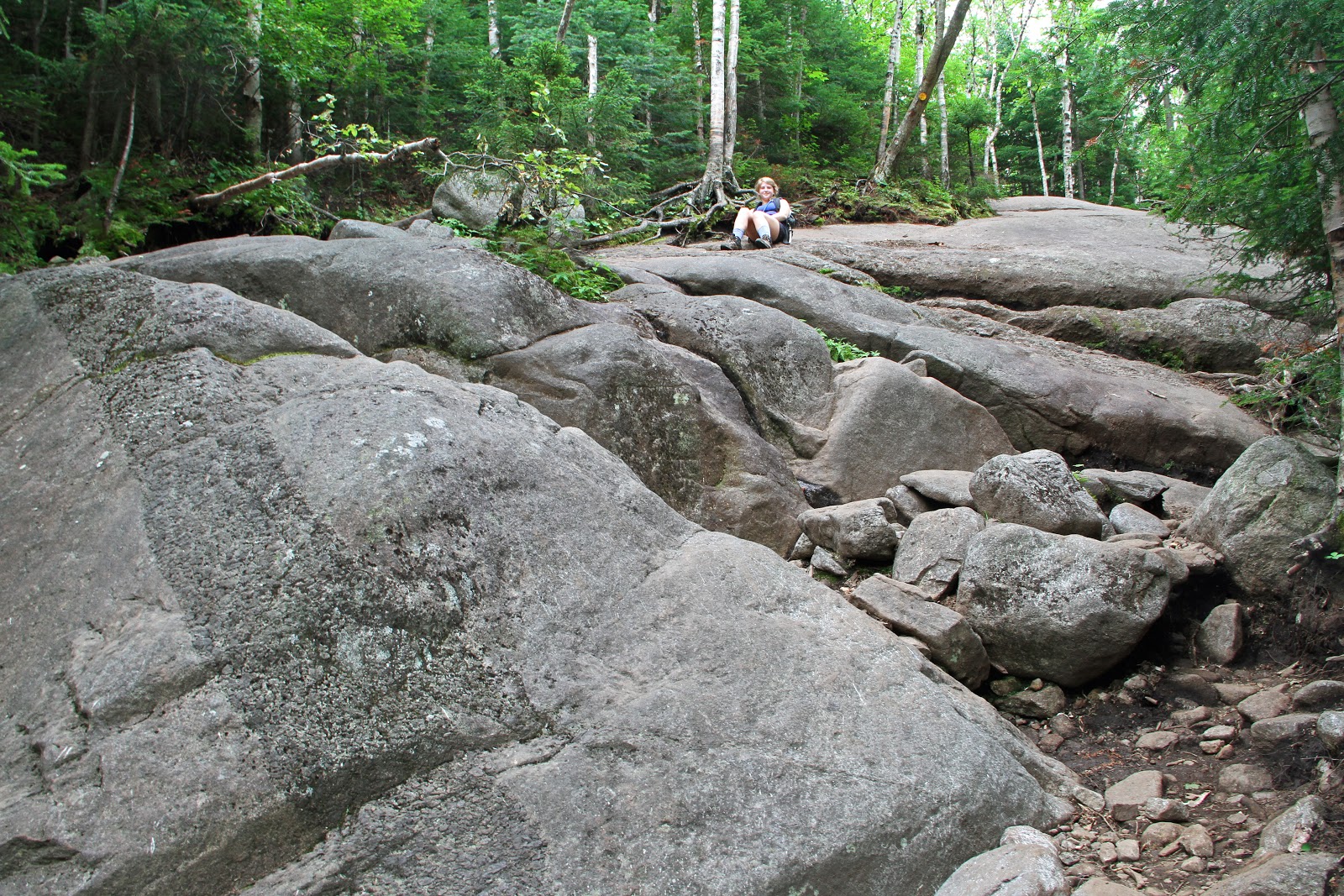
It wasn’t until about 2,340 feet that we encountered our first outcrop of anorthosite bedrock as the going steepened. From then on, the trail was entirely on exposures of metanorthosite and anorthositic gneiss requiring lots of scrambling and more planning for each step. We’re looking uptrail at one such steep exposure. The pitch is very deceiving at about 40-45º. My daughter is actually sitting upright. What a place to traverse in a downpour! The bedrock has been stripped of 30 km (give or take) of Grenville overburden by erosion, exhumation and uplift.


Notice the intrusion of a wide dike through the anorthosite with a small apophysis (offshoot) from the main channel mid-way up to the right. I suspect this dike to be of pyroxenite in composition. It lacks the chilled margin of fine crystalline growth indicative of most regional dikes which would indicate rapid cooling; therefore, the magma contacted the anorthosite while it was still hot. However, notice the cracks perpendicular to the path of dike-emplacement. The dike had already cooled enough to contract.


There are many dikes in the Adirondacks of various tectonic causations and time frames. Examples include: Late Proterozoic dikes of alkaline basalts (meta-diabasic) that intruded Grenvillian crust during orogenesis; late- to post-orogenic dikes associated with extensional collapse of the Grenville orogen; dikes associated with the rifting of Rodinia and the opening of the Iapetus Ocean in the latest Proterozoic and Early Cambrian; Mesozoic tholeiitic dikes associated with the rifting of Pangaea and the opening of the Atlantic Ocean; and dikes associated with passage over the Great Meteor hotspot (more so eastern Adirondacks). Dikes are of significance in studying such processes as continental breakup, and the composition of the lithosphere and asthenosphere.


Many of the waterfalls in the Adirondacks are associated with dikes that succumb more readily to erosion than the surrounding resistant anorthositic country rock. Such is the case with this waterfall of MacIntyre Brook associated with several diabase dikes that crosscut the bedrock. At an elevation of 3,255 feet, it only had a trickle of water. One can imagine the raging fury during a summer thunderstorm.


Along the trail, we encountered frequent veins, likely quartz, cross-cutting the bedrock where tension-cracks in the rock admitted the injection of erosion-resistant, mineral-bearing solutions.


ANORTHOSITES OF THE HIGH PEAKS
“Proterozoic massif-type anorthosites” (Ashwal, 1993) were emplaced along the southeastern aspect of the Canadian Shield within the Grenville Province during the waning stages of the Grenville Orogeny. The Adirondack Mountains of northern New York State represent a southern extension of the Grenville Province (visit my post Part II for details here). Separated by the Carthage-Colton Shear Zone, they are topographically divided into Central Highlands and Western Lowlands. Our climb in the High Peaks region of the Highlands was entirely within the Marcy massif (orange) and surrounded by associated granitoids of the AMCG suite (stripes), a tongue-twisting, felsic and intermediate complex of anorthosite, mangerite, charnockite and granite.


Anorthosite and AMCG series distribution in the Central Highlands of the Adirondacks
(Modified from Chiarenzelli and Valentino, 2008)

THE “ANORTHOSITE PROBLEM”
Anorthosite is the most difficult igneous rock to explain. Its unique geochemical nature and puzzling tectonogenesis have intrigued geologists for almost a hundred years. Enigmatic are its: near mono-mineralic composition and large crystals of over 90% plagioclase feldspar (fractional crystallization in Bowen’s Reaction Series is generally 40-50%); its gabbroic parental magma (the precursor of any igneous rock); its enigmatic association with bimodal granitoid-suites (the AMCG suite); its low (less than 10%) mafic to intermediate (diorite and gabbro) rock composition; its restrictive occurrence as plutonic rocks; its presence with layered mafic intrusions; its emplacement largely confined to the Middle Proterozoic; and its unique tectonic setting (“anorogenic”).


Many of these petrological problems have been resolved, but their genesis has remained elusive. Clearly, they formed by igneous processes, but they can not have formed from a magma of their own bulk composition. The problem with anorthosite is its geochemical composition and begins with the generation of magma, the necessary precursor of any igneous rock. Magma that is generated by small amounts of partial melting of the mantle is generally of basaltic composition, which has the opposite composition found in anorthosite, lower plagioclase and no ultramafic rocks.


BOWEN’S REACTION SERIES
The series (delineated by a petrologist in the early 1900’s) indicates the temperature at which minerals melt or crystallize in magma. It also explains why some minerals are always found together and why others are almost never associated. Magma generated by partial melting of the mantle is generally of basaltic composition. On the series under normal conditions, the composition of basaltic magma requires it to crystallize between 50 to 70% plagioclase with the bulk of the remaining magma crystallizing as mafic minerals such as pyroxene. Thus, basaltic magmas are typically plagioclase- AND pyroxene-rich. Basaltic magmas of anorthosite, however, are defined by a much higher plagioclase content and much lower mafic content. In petrology, this is known as the “anorthosite problem.” 


Gabbroic anorthosites are plagioclase-rich and mafic-poor in content unlike conventional intermediate basaltic igneous rocks.
Note that granite, somewhat similar in appearance to anorthosite, is derived lower in Bowen’s Series and chemically unrelated.
(From ck12.org)

For a more detailed explanation of the Bowen Reaction Series click here.


AN ANORTHOSITE (THEORETICAL) SOLUTION
Although controversial for many decades, a consensus has developed to provide an anorthosite solution. Simply stated, anorthosites are considered to be the product of basaltic magma and that the removal of mafic minerals has occurred at a deeper level. A key point is the ascending asthenosphere that provides thermal energy to melt gabbroic magma that has underplated the lower crust. And also uniquely Adirondack is the intense deformation during or after crystallization that occurred which generated th
e re-crystallized parent liquids of anorthosite.

The following is a chronological model of how anorthosite, plagioclase-rich and mafic-poor, may have formed along with its associated AMCG suite. Note that the process is “anorogenic” in that ponded magmas evolved in an extensional and regional event not directly derived from normal mantle melting rather than in an “orogenic” convergent tectonic event. Although the suite represents a small percentage of the Adirondacks, the AMCG's are crucial in understanding the petrogenesis of massif anorthosite. For clarification of events related to extension within the Grenville Orogeny, please visit my post Part II here.


A THEORETICAL MODEL
(A) After accretion of the Grenville Province in the late- to post-tectonic setting of the Grenville Orogeny, delamination of over-thickened lithosphere (from the Grenville contractional orogeny) and post-collisional extension (during orogen-collapse) promoted an influx of gabbroic magma from the asthenosphere yielded by decompression melting. Having left its mantle source, the picritic magma (olivine-rich and plagioclase-poor) underplated the crust, ponded there and differentiated into a magma chamber.
(B) Crystallization of olivine and pyroxene (aka Bowen) occurred with these dense mafic (ferro-magnesium) phases sinking back into the mantle.
(C) The remaining crystal mush became enriched in plagioclase, Al and Fe/Mg. This lower-density, buoyant basaltic melt (now a plagioclase-rich anorthosite) began to diapirically (hotspot plume-like) ascend into the crust.
(D) Anorthosite further ascended as plutons.
(E) The plutons coalesced to form massive anorthosite. The rising, hot asthenosphere (a key point) provides heat to partially melt the lower crust resulting in the formation of granitoids which, along with anorthosite magmas, formed the AMCG suites coevally (at the same time) but not co-magmatically (from separate magma chambers).


Model of Anorthosite and AMCG Suite Petrogenesis
 (Modified from Ashwal, 1993)
 
Why is this massif-type of anorthosite largely Proterozoic? At the early stage of Earth’s history, the emplacement of anorthosites was likely fueled by the Proterozoic crust, still sufficiently hot from the post-Archean age, yet sufficiently cool and rigid to support the intrusion of mafic magma and yet hot enough to allow the downward draining of dense magma residua.
 

METANORTHOSITE
The end result is our anorthosite, a phaneritic (coarse-grained), plutonic (magma chamber), intrusive (formed under the surface), mantle-derived (but not from mantle-melting), igneous rock that is enriched with plagioclase feldspar (usually labradorite, andesine or sometimes bytownite related to Bowen's Series) and depleted mafic derivatives (such as ilmenite, olivine, magnetite or pyroxene). The formation of anorthosite and associated granitoids are thought to have occurred late in the Shawinigan Orogeny and metamorphically imprinted during the Ottawan Orogeny (see Part II).
 
Plagioclase imparts a gray to bluish-black color to anorthosite due to Fe-Ti oxide inclusions. Anorthosite boulders and cobbles typically bed the brooks in the High Peaks region. Notice its distinctive blue-gray, granite-like, speckled-appearance and its characteristic eroded cobble-form.


After anorthosite crystallized, tectonic collisions toward the end of the multi-phasic Grenville event metamorphosed the rocks. This close-up of Marcy-type anorthositic gabbro shows metamorphic reaction-rims with coronas of garnet (C) surrounding mafic pyroxene megacrysts (B) within the plagioclase feldspar's interlocking-matrix (A). After initial metamorphism, an influx of fluids, garnet and hornblende growth, and textural modifications occurred. Garnets are indicative of the high temperature and pressure of granulite-facies metamorphism that occurred during the Ottawan Orogenic phase of the Grenville Orogeny. Garnets, whose formation is not completely understood, are useful in interpreting the genesis of many igneous and metamorphic rocks and in particular the temperature-time histories of the rocks in which they grew and in defining metamorphic facies of rocks.

By the way, garnet has been designated as the official New York State gemstone. It's used in coated abrasives, glass and metal grinding and polishing, and even to remove the red hulls of peanuts. The Barton mine in the Adirondacks sells up to 12,000 tons annually harvested from an amphibolite. Chances are if you're using red sandpaper, it's from the Barton mine.


Referring to the Bowen Reaction Series above, the plagioclase family of feldspars displays numerous mineral phases as it cools and migrates from calcium- to sodium-rich. One of the minerals, labradorite, is a principal constituent in anorthosite and is responsible for its blue-gray color, actually attributable to black ilmenite within its crystalline framework. Another interesting feature is labradorite’s blue-green iridescence (also called Schiller effect, labradorescence, opalescence and chatoyancy) especially under water. In fact, Opalescent River, that flows into the lake of Flowed Lands (see post Part IV coming next) contains a preponderance of iridescent anorthosite. The bluish optical phenomenon is related to light diffraction and reflection within submicroscopic layering or exsolution lamellae of the labradorite.

And lastly, the ‘zebra-stripes’ or ‘record-groove’ effect that plagioclase, particularly labradorite, exhibits is related to twinning during crystal growth. Symmetrical ingrowth of crystals enables plagioclase’s identification in the field. 


Photomicrograph of plagioclase crystal under cross-polarized light
showing distinct banding effect called twinning
(From Wikipedia.com)
 

ASCENDING WRIGHT PEAK
The spectacular view from Wright’s treeless summit captivated my daughter’s attention with Pitchoff, Cascade and Porter Mountains off to the northeast. Cloaked in low, ominous, swirling, gray clouds, the temps plummeted 30 degrees with wind gusting 25-35 mph. Instantly cooling down, out came the fleece and windbreakers on this otherwise hot August day. The threatening skies had us wondering about the conditions on adjacent Algonquin and if there’d be a view at all. We would be duly surprised!


On Wright, two sets of prominent vertical joints in the anorthosite intersect at right angles. Jointing is actually widespread throughout the massif and is a manifestation of forces of compression that resulted in the NE-SW faults. In some cases jointing has slight offsets indicative of faulting. Faults are responsible for the formation of the NE-SW valleys, as well as the subordinate NW-SE valleys. We seldom see faults on the surface but are aware of their presence by the landforms they create: belts of high mountains separated by narrow, swamp or lake-filled valleys. Deformational folds exist in the anorthosite as well, but because of its nearly mono-mineralic composition, they are difficult to identify.


Notice the prominent vertical joints in the anorthosite that decorate the entire summit. Two sets of them intersect at right angles. Vertical jointing is common throughout the Adirondack massif and is a manifestation of the forces of compression that resulted in the NE-SW faults. In some cases the jointing has slight offsets indicative of faulting. Folds exist in the anorthosite as well, but because of its nearly mono-mineralic composition, they are difficult to identify.

On January 16, 1962, a jet-powered strategic bomber, 30 miles off course in bad weather, clipped the top of Wright during a training mission killing four men on board. Parts of the plane still litter the crash site. Coincidentally, earlier this summer I climbed Mount Humphreys, the tallest peak in Arizona. It too was struck by a bomber on September 15, 1944 killing 8 airmen. A bronze plaque on Wright memorializes the airmen who lost their lives in service to their country. 


THE ARCTIC-ALPINE ZONE
The Adirondack timberline is about 4,000 feet, where the sub-alpine forest transitions into treeless alpine tundra. Timberline is not simply a matter of elevation. After all, timberline in the Rockies is nearly 12,000 feet. Even elevation and latitude together do not tell the entire story. In fact, timberline can be substantially lower on a cooler north-facing slope versus a sun-exposed southern slope. Timberline is determined by a combination of conditions that include low temperatures, frequent frosts, high winds, thick snow pack, inadequate precipitation and poor soils, all of which diminish seed production and viability.  


The Arctic-Alpine Plant Zone is the rarest habitat in New York State on 11 of the highest peaks of only 85 acres in the entire state! Its plants are identical to those found in tundra arctic regions at high latitudes, being equivocal to extreme elevation. Alpine low mean annual temperatures, frost-free periods (only two months a year), exposure to wind and ultraviolet radiation, lack of sufficient and nutritious soils, and wind speeds are comparable to that of the arctic. The Alpine Zone in the High Peaks Region is restricted to the meadows of 14 summits and are relics of the Ice Age, common throughout the region as the last glaciers made their retreat about 12,000 years ago. The plant communities were forced upslope by warming trends and the expansion of the forests in order to sustain their optimal growing conditions. The vegetation faces extinction similar to the threats facing arctic plants as the climate slowly warms.


The tundra vegetation is very fragile and slow-growing confined to isolated patches on thin remnants of soil that tenuously cling to the anorthosite. This Deer’s Hair Sedge is a densely tufted grass-like perennial that grows in large, windswept patches. The vegetated region seen here is on the leeward side of the summit from the wind. Can you tell the direction of the prevailing winds from the twisted balsam fir? Small stones were brought to the summit (over four tons!) by hikers and placed as barriers to protect the plants from inadvertent human trampling. For the last twenty years, many of the higher peaks have Summit Stewards that camp down below and spend their days educating the public about everything Adirondack especially the rare and fragile alpine ecosystems.


ALGONQUIN PEAK
Compared to the windy, cold and overcast summit of Wright, Algonquin, 536 feet higher, was semi-tropical in the upper 70’s with bright sun and a gentle breeze. It’s a lesson in Adirondack weather on the summits. Even in summer conditions can change in a flash. Being prepared is essential to survival.


Our view to the east takes in massive Mount Colden (4,714 feet), scarred with landslides that look like huge vertical stripes. A veneer of thin soil, often less than a meter thick, tentatively mantles the slopes of many of the high peaks. Held in place by tangles of trees, shrubs, grassy roots and the coarse texture of anorthosite, soils on steep slopes can easily be destabilized by heavy, saturating rains.

Such was the case with Mount Colden during Hurricane Floyd in 1999 that delivered 10% of the annual regional precipitation in one day. In fact, Floyd’s was the single largest precipitation event recorded in the previous 71 years. The slide completely blocked Avalanche Pass with rock debris and a tangled mass of vegetation. More recently, Hurricane Irene in 2011 created the highly noticeable clean white slide. In all, I counted over 15 separate slides on Colden’s western face! Snow avalanches are a major threat to skiers and winter hikers as well in the pass. Mount Marcy is in the background to the left. At the base of Colden and out of view is a magnificent faulted-valley that contains a string of glacially-derived spillover lakes. We’ll visit those lakes tomorrow.


My daughter took this panoramic video with her iPhone. It begins and ends facing to the west.


Grass-like Deer’s Hair Sedge, the threatened rich-blue, close-mouthed Bottle Gentian and the deciduous, round-leafed alpine bilberry are prominent members of the alpine tundra community on Algonquin’s summit.


The elevation gain on our steadily-upward trek from the lodge to Algonquin’s summit including the side excursion to Wright was almost 3,000 feet! The elevation of the Adirondack “Forty-Six” High Peaks averages between 4,000 and 5,344 feet. Compared to other mountain ranges the summits might seem diminutive, but with an average ascent of 2,500 to 4,500 feet, the climbs are significant not to mention the geology. Leaving Algonquin, we returned along the same trail of our ascent to the lodge at Heart Lake. The total excursion for the day was almost 12 miles. Tomorrow, we investigate the geology of the lakes in the fault-bounded valley (post Part IV).


Thursday, November 22, 2012

The Adirondack Mountains of New York State: Part I – What's so unique about their geology?


EVERY PICTURE TELLS A GEOLOGICAL STORY
This mountaineous vista is reminiscent of a real western scene with a big sky filled with billowy white clouds, wide open spaces, over forty summits and grassy fields blanketed with flowers. The Adirondack Mountains in northern New York State record one-third of the geological history of the Earth from Middle Proterozoic Grenville orogenesis through Pleistocene glaciation. The geological scenario that is depicted here is repeated throughout the region, that of an ancient, peneplaned, mountainous terrane that has been faulted, regionally uplifted and glacially-sculpted.  


THE HIGH PEAKS OF THE ADIRONDACKS
Barely ten miles from the historic ski and Olympic town of Lake Placid, we’re looking south at the High Peaks region of the Adirondacks. We’re standing just off the road to the Adirondack Loj (their spelling) only a few miles away, the base for our upcoming geological climbs. On the left is the landslide-scarred, glacially-cirqued edifice of Mount Colden. On center stage is the eight-mile run of the MacIntyre Range that includes the mountains of Wright, Algonquin, Iroquois and Marshall. Colden and the MacIntyres are separated by Avalanche Pass, a NE-SW fault that contains a glacier-sculpted valley filled with a chain of pristine lakes.

To the right, the geologically-equivalent cleft of Indian Pass defines the precipitous, 800 foot cliff of aptly-named Wallface. The flat grassy field in the foreground is a portion of the highest glacial meltwater lakebed in the Adirondacks called North Meadow at 2,200 feet above sea level. The depth of the valley-fill has been estimated at 300 feet with unmistakable beaches on its shoulders.


REMNANT WATERFORMS OF THE ICE AGE
Just around the bend facing east, North Meadow Brook flows west to join the West Branch of the Ausable River, a meandering post-glacial stream that has established drainage through the sand plain seen above. The High Peaks region is off to the right beyond the stand of evergreens. Repeated waxing and waning of Pleistocene continental glaciers scoured the landscape, but eventually warming trends and deglaciation are thought to have stranded enumerable alpine or valley glaciers to finish the job of cirque-formation on the higher summits. A final glacial advance is recorded during the Wisconsinan Stage from 35,000 to 10,000 ka, the last pulse of the Laurentide ice sheet. Vast quantities of meltwater spilling from the glaciers became impounded by ice, resistant bedrock and glacial debris giving rise to numerous lakes such as the modern drybed at North Meadow.


RIVERS FLOW TO THE SEA, EVENTUALLY
The waters of the West Branch will, in due course, empty into the Atlantic Ocean via glacial Lake Champlain to the east and then the St. Lawrence River. Also called the Seaway due to its heavy shipping traffic, it is the widest river in the world and connects the five Great Lakes upriver with the Atlantic Ocean. The entire drainage system was established by the close of the Wisconsinan glacial episode. On the west side of the Adirondack divide, waters flow to the Atlantic via Lake Ontario and then the St. Lawrence, while on the south side of the divide, to the Mohawk and Hudson Rivers and then to the Atlantic. Our geological excursion into the High Peaks (in post Part III) crosses Avalanche Pass that directs waters either north to the Seaway or south to the Hudson

River patterns are determined by slope and structure, and once established, tend to persist. The fluvial architecture in the Adirondack Mountains provides clues to its unique geomorphology and the chronology of the events of its formation. Underlying structure, tectonism and glaciation have all played a role in establishing the spatial arrangement of channels in the landscape.


OBSERVATIONS OF AN UNTRAINED EYE
In my early, pre-geology years, I frequently visited the Adirondacks and the various ranges of New England. Even to my untrained eye their rocks seemed to differ: the bluish, granite-like anorthosites of the Adirondacks, the gnarled schists of the Greens of Vermont and the Berkshires of Massachusetts, and the infamous, mica-laden granites of the Granite State, New Hampshire. The shapes of the ranges varied noticeably as well. Some were treeless, exposed, lofty and angular, and others verdant, stout and rounded. In whatever manner they were "manufactured" I suspected that must have differed as well. That was the extent of my geological knowledge.


(From wikipedia.com)


AND OF A TRAINED EYE
The Adirondacks are nothing like other major mountain systems in North America. Unlike the Rockies and Appalachians that are long, continuous mountain chains, the Adirondacks form a 160 mile-wide and one mile-high, slightly-elliptical, dome consisting of seemingly random peaks. And while the trend of the Rockies and Appalachians roughly parallels their respective continental margins (although the Rockies are set inland considerably), the Adirondacks possess no such apparent coastal association.

Furthermore, the range doesn't bear the telltale geological signatures of converging plates such as a subduction zone, an orogenic belt or surface volcanism. And, its mountains uniquely expose a crystalline Precambrian metamorphic basement. What’s more, the range is located within an enigmatic intraplate setting, well inboard of the passive plate margin of North America's east coast (which was active when the Appalachians were formed). Are the Adirondacks not part of the Appalachians? What forces of nature conspired to create such a singular landform appearing so isolated from the other ranges of the Northeast and suggesting a completely independent tectonic genesis?


(From earthobservatory.nasa.gov)


NEW MOUNTAINS FROM OLD ROCKS
Back in the 60's in ninth-grade Earth Science, I was taught that the Adirondacks were "ancient mountains," actually "some of the oldest on Earth” and were “part of the Appalachians.” Since then, detrital zircon geochronologic dating of its rocks has confirmed that they are indeed old, from the Middle Proterozoic. But more recent apatite fission-track thermochronology indicates its mountains were uplifted during the Late Cretaceous and considered young. A geological conundrum!

My school lesson was accurate but only in part. The Adirondacks ARE indeed ancient; however, they are NOT old mountains but NEW (geologically speaking). They’re actually some of the youngest on Earth, and according to some accounts, they’re still rising! They are, therefore, "new mountains from old rocks." *

Lastly, they are NOT part of the Appalachians, a common misconception, having formed during separate geological eras and under totally unrelated tectonic circumstances. In fact, they are the only mountains in the eastern United States that are not geographically Appalachian.

* The Geology of New York: A Simplified Account by the NYS Geological Survey 


OLD ROCK VESTIGES OF AN ANCIENT SUPERCONTINENT
The unusual mountain-beauty of the jagged Great Range of the High Peaks region is portrayed in its entirety in this three-photo panorama. A continuous 10.65 mile-trail extends from lowly Hedgehog, Rooster Comb and the Wolfjaws on the left, across the cols and tops of a half-dozen peaks to the angular summit of Mount Marcy on the right, the highest peak in the state. The valley in the foreground is called Johns Brook and is filled with glacially-generated rock debris including massive glacial erratics. Bedrock is exposed in stream beds, avalanched-flanks and mountain-summits. Johns Brook Valley is a fantastic gateway for the exploration of this unspoiled wilderness.  

The billion year “old rocks” of these peaks are metamorphosed volcanic strata called anorthosites, and their gabbroic and gneissic iterations. Anorthosite is a large-grained, intrusive igneous rock possessing a predominance of the mineral plagioclase feldspar (90-100%) and a minimal mafic component variably with pyroxene, ilmenite, magnetite and olivine. The precise origins of the Adirondack’s Proterozoic anorthosites have been a subject of debate for decades and referred to in older literature as the “anorthosite problem.” Curiously, anorthosite was a component of rock samples brought back from the moon.

 
The emplacement of the High Peak's meta-anorthosites did not occur on our contemporary North American continent, a late Mesozoic and Cenozoic landmass. Neither did it form on Pangaea, the late Paleozoic and early Mesozoic supercontinent that existed before it. Instead, it originated in Rodinia, the supercontinent of the Middle and Late Proterozoic. The anorthosites that comprise the High Peaks were generated deep within the Earth's mantle in tectonic collisions of the Middle Proterozoic called the Grenville Orogeny, over a billion years ago, and are thus vestiges of an ancient supercontinent. We’ll return to the region's anorthosites on our next post.


THE ENIGMATIC ADIRONDACK DOME
Seen from space, the Adirondack Mountains have a curious domal configuration that encourages its rivers and streams to radiate outward like the spokes of a wheel. Guided by the prevailing slope, its rivers flow to all quarters of the compass, but many of their courses have been modified. As uplift of the region progressed, outward radiating-rivers carved deeper into resistant bedrock with a prevailing NE-SW trend which then dictated their courses into the beginnings of a trellis pattern. Some stream patterns seem to ignore fractures in the bedrock. This suggests that the resistant bedrock in their path was uncovered only recently.


(Modified from stevekluge.com)

Notice the prevailing orientation of Adirondack’s waterforms, over 3,000 lakes and ponds, and 30,000 miles of rivers and streams. Their centrifugal drainage patterns bear witness to the domal uplift and the NE-SW prevailing fault trends. Even the geometry of the roads that emanate from the mountains reflects the region’s geological evolution. 


The blue line delineates the six million-acre Adirondack Park established in 1892.
The red dot depicts our location in the High Peaks region in post Part III.
(From adirondack.net)


FINDING FAULT
During the Pleistocene, the shattered rocks of the NE-SW fault zones were readily excavated by continental glaciers many of which contain a chain of interconnecting lakes. A perfect example is stellar Avalanche Lake seen below which we’ll visit in post Part II. We’re looking north from the beaver dam and flooded-wetland at its south outlet. It’s the highest of three spillover lakes connected by mountain-brooks that lie in the glaciated-fault zone between the extreme verticality of Avalanche Mountain on the left and Mount Colden on the right. Notice the debris flow that has built an apron out into the lake. Its associated rock slide is famous throughout the Adirondacks. Learn why in my post Part III.


A solitary park ranger plies pristine Avalanche Lake


The waters of Avalanche Lake spillover south to Lake Colden, then to the lake of Flowed Lands, and eventually merge with rivers that comprise the headwaters of the great Hudson River. The divide at Avalanche Pass at the opposite end of the lake sends its waters to the north toward the St. Lawrence River.


A SCARRED PAST
A great many of the high peaks in the region bear the scars of rock slides. Over the millennia, a score of immense slides have gradually exposed barren rock on Mount Colden’s slopes, and in so doing, raised the height of the lake by many feet. The thin, post-glacial cover of soil is weakly adherent to the slick anorthosite of the steep slopes barely stabilized by vegetation. The origin of many slides coincides with hurricanes and nor’easters that made their way to the High Peaks region. Rotating counter-clockwise, they send their soil-drenching bands throughout New England and New York from the northeast. Water-saturated soils are too much for the slopes to retain.

This is Mount Colden seen from atop Wright Peak looking east. With lowly Avalanche Mountain in between, just beyond its blanketed summit an 800-foot, shear cliff plummets straight down to Lake Colden (seen above) that is nestled snuggly within the fault scarp. You can easily tell the old slides on Colden from the new by the color of the anorthosite. The large, gray slide in the center was created during the hurricane of August 20, 1869. In 1942, a September hurricane catastrophically raised the height of the lake by ten feet. The gleaming white scar in the center is from hurricane Irene in 2011. Beyond Colden is Mount Marcy, the tallest peak in the state. All the summits in this photo are part of the Marcy massif of the High Peaks region whose bedrock was formed during the Grenville Orogeny. And as we will see in post Part II, possess a highly complex tectonic genesis.


COMING FULL CIRCLE
The geological singularity of the Adirondack Mountains makes them distinctively unique and accounts for their incredible beauty. Their story is of an ancient supercontinent long gone, the formation of an immense mountain belt ravaged by collapse and erosion, enigmatic uplift into an elliptical dome and scores of Ice Age ice sheets that bulldozed the region. What are the details of the Adirondack’s geological evolution? Please visit my forthcoming post Part II, and in my post Part III, we’ll climb the unique geology of the High Peaks region and explore the lakes within the fault scarp.


Thursday, August 4, 2011

Backpacking in the Great Range of the Adirondacks: From Johns Brook Lodge to the Summit of Mt. Marcy


"Because it's there."
George Mallory, 1923
English mountaineer

This July I had the pleasure of backpacking in the Adirondack Mountains of New York State with my daughter. It was actually our first, extended excursion together without the rest of the family. We went to the Great Range, an 11-mile chain of a dozen or more contiguous mountains in the High Peaks region with names such as the Wolf Jaws, Armstrong, Saddleback, Gothics, Haystack, Big Slide, and of course Mt. Marcy, the highest peak in the state at 5,344 feet. Summer haze can obscure visibility from the summits due to heat and humidity, but our climbing conditions were picture perfect. We had warm and dry weather with deep blue skies and big white clouds.

This four-photo panorama of the Great Range extends from the southeast to the west. It was taken from the summit of Big Slide Mountain (4,240 feet) which we climbed the following day. Johns Brook Valley lies in the foreground of the range with Johns Brook Lodge basically in the center. From the far left the peaks include Giant, the Rooster Comb, Lower Wolf Jaw, Upper Wolf Jaw, Armstrong, Gothics (with the big slide), Saddleback (two summits), Basin, Haystack, Marcy (the pointed peak right of center), Gray (tucked behind Marcy), Colden (pointed peak), Phelps (small), Algonquin (also a pointed peak) and Wright.
Click for a larger view.

I've backpacked the Great Range four times over the years, having first done it back in high school with a very close friend, a good 45 years ago. Equipment in those days was heavy and cumbersome, and qualified as being called "no-tech." Backpacks were made out of heavy, green canvas that got even heavier when wet, and stayed that way. There was no such thing as "cotton kills." Wool and down worked fairly well back then before being replaced by fleece and other breathable-microfibers. And certainly, there was nothing like DEET, which works well against the Adirondack's notorious blackflies. I remember a big frying pan dangling from my backpack that banged against my legs! Things have definitely changed for the better.

Fortunately, to my great delight, everything looked just as I remembered: the scenic drive up the Adirondack Northway (I-87), the majestic stretch to Keene Valley on NY 73, the quaint, little town of Keene Valley, the better-get-there-early car-park in the Garden, the 3.5 mile hike into the valley of Johns Brook, and finally, the lodge of the same name, maintained by the Adirondack Mountain Club (a.k.a. ADK). The excitement hadn't changed either! I hoped my daughter would experience the same. 


This old man and his young daughter are looking "ready, willing and able" at the Garden car-park. 

Johns Brook Lodge, known to many as JBL (but with the "J" written backwards stemming from an old tradition), is an unforgettable oasis in the woods. It’s the perfect base from which to initiate hikes into "some of the best hiking in the northeast." It’s rustic (c. 1925) and isolated (over an hour from the car), but clean as a whistle and very well-maintained. A veritable haven of peace, quiet and tranquility. You'll feel the stress flow from your body as you approach it. There’s no electricity, just a solar-powered refrigerator and a propane-powered stove. Even the lights are propane-fueled. By the way, all the food is backpacked in three times a week by the dedicated JBL crew. The lodge has a great porch-deck with chairs for hanging out. And what a view of the tops of the High Peaks through the trees!


The lodge has high ceilings inside with big beams and a massive, stone hearth. There are long, wooden tables for dining family-style. Listen for the dinner bell! There's hearty, home cooking with great deserts. How about some hand-churned ice cream? There’s lots of socializing. “What did you climb today?” "What's the condition of the trail?" “What’s the forecast for tomorrow?” Guest-lectures are in the evening after dinner. Scrabble. UNO. Monopoly. Bunk beds for 28 guests. Quiet time after 10. Even earplugs for non-snorers! Hot coffee and oatmeal are served in the morning when the breakfast bell rings. Pancakes too, with real maple syrup. My daughter absolutely raved about the lodge and can’t wait to come back next summer. 


Johns Brook Lodge

View of one of the range's peaks from the deck of the lodge

The Adirondacks have a distinctive look and addicting appeal. Hiking them is very different from my experiences in New England, and certainly out West. All the repeated ups and downs. The high water-bars made of logs that test the merit of your tendons and ligaments. The gnarled, exposed tree roots that offer a step-up to the next level, as well as a chance to trip your gait. The huge steps of rounded, glaciated-stones. Ascend and work your heart and lungs; descend and blast your knees and quads! And of course, there’s the wet, black muck. Step in it and risk pulling the hiking boot right off your foot. By the end of your trip, you will have acquired the balance of the Flying Wallendas by walking on all the narrow bridges made of wooden planks and logs. 

High above, the leafy tree-canopy sways in the breeze. Down below, the ever-present fallen trees are rotting and decomposing, covered with fungus, mushrooms and moss. Butterflies are everywhere, and unfortunately, blackflies and mosquitoes are too (mainly in the low wooded sections). Great smells, sights and sounds. Sensory overload. It all comes back to you, almost fifty years later. Tremendous!

Typical appearance of gnarled roots, exposed on the woodland floor

The infamous, Adirondack, boot-sucking, black muck has devoured my right foot.
This massive erratic in Johns Brook Valley was carried and deposited by glacial ice. In North America, the Laurentide continental ice sheet covered the uppermost half of North America during the Pleistocene, beginning 1.6 million years ago. It was characterized by several glacial advances and retreats, the most recent surge of which was the Wisconsin, ending about 10,000 years ago. Continental and later alpine glacial ice covered Mt. Marcy and the other peaks of the Adirondacks, as evidenced by glacial polish, glacial striations, and erratics such as this. 

On our first full day of hiking, my daughter and I plunged right in. We climbed remote Mt. Marcy at 5,344 feet. Starting at an elevation of 2,316 feet from the lodge, the distance to the summit of Marcy (my daughter and I still disagree on the mileage), is a total of 11.5 miles round trip (her figure is 13). The exact number matters little. It’s not a difficult climb to Marcy’s summit, but taking into account the distance from the lodge, and the elevation gain and loss of over 6,000 feet, it was a loooong day. Trust me. Our round trip was nine hours. Drink lots of water!
 
Our hike to the base of Mt. Marcy began from Johns Brook Lodge;
our hike to the summit began about 3 hours later. 
Heading southwest along the Phelps Trail (yellow markers) that essentially follows the brook,
we then skirted past Slant Rock (red markers) to summit from Marcy's northeast slope.
Notice the contiguous peaks of the Great Range that parallel our trail to the east.
You can climb them all in a Grand Traverse.
On our trek through the valley to Marcy, we've transitioned from the Northern hardwood forest zone
(of maple, beech, birch and hemlock) at the car-park and lodge to the coniferous spruce-fir forest zone
(of spruce, fir and balsam) at about 2,500 feet. A bridge of logs traverses a low, wet section of the boreal forest covered with Sphagnum moss, sedge and liverworts. As we gain altitude, the environment changes as well. The growing season is shorter. The temperatures are colder, and the effective precipitation is higher.  Notice our entry into a section of thinning, mature growth with a new, evergreen understory.

Sphagnum moss and Leather-leaf are right at home on the wet, boggy forest floor.

Decomposition is vital to renewal.
This gill fungus is probably Pluteus admirabilis that fruits on well-rotted wood.

Someday this rotting stump will be "borne-again",
 when its organic, nutritional components provide the fuel for new growth.
Ganoderma applanatum forms large, bracketed fruitbodies with distinctive concentric grooves.
It is also known as Artist's Conk, since it can be used for etched designs when fresh. It turns dark brown
when bruised. It occurs on living trees as well as recently cut stumps and logs.
There is some scientific evidence that indicates this mushroom has some antibacterial properties.

This epiphytic (tree) lichen (possibly Evernia prunastri or "Oakmoss lichen") is thriving
an a decomposing limb. Lichens are actually complex organisms, the result of a relationship
between a fungus and alga. In an alpine ecosystem such as this, the lichen functions as a soil-former
by converting atmospheric nitrogen into a utilizable form for other plants. 

After a while, it became a joke between my daughter and me.
All the butterflies landed on me, while all the mosquitoes landed on her. 
I actually had one beautiful butterfly that I was trying to photograph,
land on my hand that was holding my camera! This is a White Admiral (Limenitis arthemis).
It has a prominent white band across its wings making it readily recognizable on forest trails.

The well-camouflaged American toad (Bufo americanus) is a common trailside-insectivore.
The bracket fungus is Trametes versicolor with its characteristic shelving and overlapping of its fruitbodies.
Also known as "TurkeyTail," it's commonly found on downed logs and rotting stumps.
There has been recent research done on this fungus for its medicinal value
as an adjunct treatment for colorectal cancer and leukemia.
What at first appeared to be the top of Marcy is actually the summit of Little Marcy at 4,765 feet.
Many of the Adirondack's mountains have false summits and dual peaks. Read those maps!

We're now in the Krummholz or "crooked wood" zone at about 4,500 feet.
The trees have become shorter and are almost impenetrable with thick stands of balsam, fir
and black spruce. The inhospitably harsh climate here dwarfs the trees. The growing season
is barely two months. Along with the thin soil, extreme temperatures, winter winds,
and reduced sunlight due to clouding and fog, the flora appears in a miniaturized form.
That's Marcy's treeless dome, almost shrouded in the clouds, looming in the distance. Trees there can't survive the harsh summit conditions of its alpine climate zone. In the foreground, a poorly-drained depression has developed into a small alpine bog. My experience with bogs thus far has only included rather large, lowland bogs. Typically, the bog's tundral flora includes Sphagnum moss, sedge, leatherleaf, cottongrass and even carnivorous plants. Notice also the dwarf spruce and fir trees.
Final push for the summit!
Please visit my three posts on woodland bogs starting at:

While buffeting over 50 mile in hour gusts of wind at Marcy's summit, my daughter proudly exalts in the fact that she's the most elevated person in the State of New York, both geographically and emotionally.
Marcy's treeless and glaciated summit of exfoliating metanorthosite is speckled with lichen and moss,
the indigenous tundra-vegetation. Fragile patches of alpine soil are protected from the unsuspected trampling of hikers by rows of rocks. Non-native sedge has been planted to stabilize the sites so that native mosses can gradually revegetate the area. Johns Brook Valley, from whence we cometh, is in the distance and far below. Many of the plants in the alpine zone are rare, threatened or endangered, but all are protected. 

My turn on top!
The plaque at the summit officiates our presence.
Back at the lodge nine hours later, the cold Johns Brook is a sure-cure for tired, aching, blistered feet.
The brook is choked with large cobbles of rounded metanorthosite, also in gneissic and gabbroic forms. In fact the entire Great Range is underlain with this ancient, Precambrian rock. A compositionally similar version of metanorthosite is actually found on the Moon. The mysteries of the tectonic genesis of the Adirondacks as well as its curious, more recent doming, which accounts for up to 3mm of rise per year, remains a subject of heated debate and research. Thus, the Adirondacks are considered to be "new mountains from old rocks." It is a common misconception that the Adirondacks are merely old, eroded mountains. Another misconception is that the Adirondacks are geologically related to the Appalachians. In actuality, they are the only mountains in the eastern U.S. that aren't geologically Appalachian. The Adirondacks are related to a terrane called the Grenville Province and a mountain-building event called the Grenville Orogeny that far predates the formation of the Catskills, theTaconics, and the Green and White Mountains of New York and New England. I plan to address these issues in a future post.

Taken near the summit of Big Slide Mountain, climbed the following day, we were afforded an impressive view of of Big Slides' sheer slope, the Johns Brook Valley, the Upper Great Range and Mt. Marcy (to the right). On many steep slopes such as Big Slide and Gothic (seen in the distance), slides are common where a thin, soil cover over the basement of metaplutonic anorthosite has slid off. The groundwork for such slides was probably laid during the last ice age at elevations up to 2,000 feet or so. Clay and silts were deposited in large deep lakes in advance of the glaciers. Their deposition facilitates the conveyance of groundwater that contributes to slope instability especially on steep inclines. Heavy snowpacks, melting snow and rainfall over the millenia infiltrates the subsurface. At higher elevations, the soils that cling to the slopes are thinner making them less stable, especially when steep. Interestingly, talus at the base of the slopes is minimal.  

Back at the lodge at night and reflecting on the day's trek to Marcy and back, my daughter proclaimed “I’m really proud of myself!” And I, of her! There's an organization amongst climbers called the Forty-Sixers which recognizes those who have ascended the 46 High Peaks in the Adirondack Mountains. My daughter says she's interested.

Summiting Marcy was the second best part of the trip. The best part was doing it with her. Call it “quality time.” And, that it was.

P.S. I highly recommend the pocketsize Adirondack Alpine Summits by Nancy Slack and Allison Bell, as an ecological field guide with wonderful photos and concise descriptions.