Every blogger knows the challenge. What shall I blog about next? What photos should I use? By the time the end of the year rolls around, there are always a few posts that never quite made it. And so, with this final post of the year, here they are from here and there. Please visit the same for 2012 here.
January
Flying High Above Boston’s West African Harbor Islands
 |
Looking frigid and uninviting in mid-winter, Boston’s Harbor Islands are best explored during the summer months. The harbor is sprinkled with 38 of them, most designated as National Recreation Areas. Many have fascinating histories such as Georges Island (apostrophes are not used) with Civil War-era Fort Warren used as a Confederate prison and its resident ghost, the Lady in Black. Little Brewster is home to Boston Light, the oldest continually used lighthouse in the U.S. from 1716. Worlds End has plantings and roads by legendary 19th century landscape architect Frederick Law Olmsted, the designer of Central Park in NYC and Boston's Emerald Necklace park system. There’s even an abandoned, off-limits Nike missile silo on Long Island.
As for the region’s geology, Boston Harbor is a glaciated structural basin that has been inundated and modified by post-glacial sea level rise in the last 15,000 years. It contains dozens of exposed and submerged Pleistocene-age drumlins and other glacial features modified by coastal processes. The bedrock crops out at numerous locations and consists of the Late Proterozoic Boston Bay Group, rocks of the Avalonia terrane that accreted to Laurentia during the Middle Paleozoic.
The group consists of fine-grained clastics of the Cambridge Formation (“Argillite”) and coarse-grained clastics of the Roxbury Conglomerate better known as “puddingstone”, the Commonwealth’s state rock. The terrane of Avalonia rifted from its peri-Gondwanan, Southern Hemisphere-berth off the northern edge of the West Africa craton (although some advocate a northern South America provinence). It then drifted some 6,000 miles during the Ordovician across the Iapetus sea to its present location in Boston Harbor, accreting (attaching) in the process to a large portion of the Appalachian orogen along Laurentia’s northeast coast.
|
February
On an Appalachian-Derived Beach at Fort Lauderdale
On an Appalachian-Derived Beach at Fort Lauderdale
 |
This Fort Lauderdale beach scene is far more welcoming meteorologically this time of year. It depicts a commonplace entity with the warming climate – beach erosion and restoration. Sediment (mostly sand) is typically lost through longshore drift (movement of material by waves that approach at an angle to the shore but recede directly away from it) and from changing ocean currents and storms. A wider beach reduces damage to coastal structures by dissipating energy across the surf zone. It also protects upland structures and infrastructure from storm surges, tsunamis (not on this passive marginal coast) and unusually high tides.
Of course, Floridians will need to deal with the issue that everyone must confront, rising sea levels from melting glacial ice. It won’t be the first time it has risen. Fluctuating glacial periods of the Pleistocene triggered vacillating high seas that periodically flooded coastal plains. Before that, during the Cretaceous, North America’s central continental and coastal lowlands were completely submerged by global high seas of the Tejas transgression.
By the way, Lauderdale’s beaches are composed of brownish, quartz sand not whitish, calcium carbonate, which is not what one would expect considering Florida’s carbonate-platform heritage. Silicon dioxide-rich sand was transported downbeach from the eroding Appalachians Georgia-way by longshore currents during the Cenozoic. Next time you stroll along the beach further south, check out a handful of sand. It gets whiter as its carbonate content increases with distance from its granitic source up north.
|
April
Living Cretaceous Fossils in Bloom in Boston’s Backbay
 |
The annual explosion of pink and white magnolias in bloom is one of Boston’s first rites of spring. The city's floriferous trees have more to offer than large flowers, showy colors and fragrant scents. There's a tale of evolution to be told here.
You see, beetles pollinate magnolias, not bees as one might expect. Bees were not around in the mid-Cretaceous (about 100 million years ago), when magnolias were evolving. That pollinator relationship has changed little over the millennia since the co-evolution (mutual evolutionary influence) of insects and angiosperms (flowering plants). Magnolia flowers don't produce nectar, the sugary secretion that encourages insect visitation (and hence pollination). They do produce large quantities of pollen that's high in protein, which beetles use for food, and in the process, cross-fertilize (transfer) pollen from the male anther of one flower to the female stigma of another. The high proportion of beetle-pollinated systems within the Magnolia family has perpetuated the long-standing theory that modern flowers were derived largely from beetle-pollinated proto-angiosperms. Indeed, many paleobotanists have devoted their attention to plants such as magnolias in their attempts to unravel the events of angiosperm evolution.
Magnolia's ancestral floral characteristics include: its large blossom with its tepal structure (magnolia's petals and usually green sepals in higher plants all look alike); its central, cone-like receptacle of spirally-arranged, male stamens at the base and similarly-arranged spiral, female carpels; its radial symmetry; its actinomorphism (floral parts similar in size and shape); and its leathery beetle-durable petals.
One of many botanical classification systems, Cronquist's interpretation assigns magnolias to the most archaic positions of all living angiosperms, the subclass Magnoliids, along with water lilies and buttercups. The concept that magnolias are amongst the most basal angiosperms has been refuted by higher-level phylogenetic analyses, yet they remain one of the most important lineages in the early radiation of angiosperms. Appearing long before the radiation of flowering plants, Charles Darwin called their abrupt appearance in the fossil record “an abominable mystery.” What's more, the magnolia qualifies as a "living" fossil, having changed little since it first appeared.
By the way, magnolias acquired their name from the 17th century French botanist and physician Pierre Magnol. Now back to enjoying spring in Boston!
|
June
Luxuriating in the Grenville-Age High Peaks of the Adirondacks
Luxuriating in the Grenville-Age High Peaks of the Adirondacks
 |
This High Dynamic Range photo of glacial Heart Lake was taken from the summit of lowly Mount Jo in the High Peaks region of the Adirondack Mountains in uppermost New York State. The tall peak to the right is Algonquin. Colden is the rock slide-scarred summit in the center, and to the left, Mount Marcy is the highest in the state, each separated by Precambrian faults re-activated during the Paleozoic.
We see almost two billion years of geological scenery in the making, beginning with the meta-anorthosite bedrock that emplaced during the Grenville orogeny. The protracted, multi-phasic tectonic event culminated with the formation of the Late Proterozoic supercontinent of Rodinia and a transglobal Grenville Mountain spine. Rodinia’s subsequent fragmentation in the latest Proterozoic formed two megacontinental siblings: smaller equatorial-positioned Laurentia and larger australly-located Gondwana. The two incrementally re-assembled throughout the Paleozoic into the supercontinent of Pangaea along with its Appalachian Mountain spine.
In the Late Cretaceous, the peneplaned Grenville’s, now internal to Laurentia, began to dome upward triggered by the region's proximity to the Great Meteor Hotspot that tracked southeastward from Canada beneath the drifting North American plate. The hotspot crossed the Mid-Atlantic Ridge, after tracking beneath the North American plate generating seamounts in its path, and is currently off the coast of Africa beneath the African plate.
Having been glacially sculptured during the ice ages of the Pleistocene, the Adirondack’s ascent of “new mountains from old rocks” (namely Grenville basement crust domed into a mountain range) possibly continues to this day. What’s more, we geologically recognize that the Adirondack’s (located cratonward) are distinctly non-Appalachian in origin (paralleling the coast)! |
July
A Summer’s Wade in the Late Cretaceous Marl of Big Brook
A Summer’s Wade in the Late Cretaceous Marl of Big Brook
 |
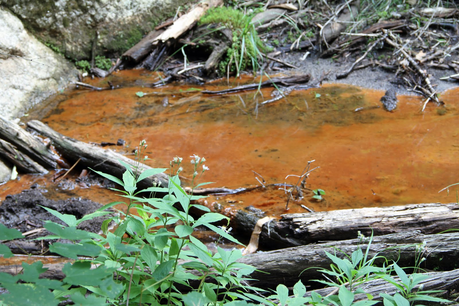
This lazy stream, a “piddly little dribble” in the words of the New York Paleontological Society's field guide, courses through one of the oldest and prolific collecting sites for marine fossils on the East Coast. Collectors, both amateur and professional, have been extricating both vertebrate and invertebrate faunal remains out of the clear-flowing waters of Big Brook in Monmouth County of coastal Central New Jersey for well over a hundred years.
The diverse, age-spanning list includes Cretaceous bullet-shaped belemnite guards (a squid-like mollusc), brachiopod, oyster and clam shells, steinkerns (shell casts), hadrosaur (washed down from the mainland), shark and mosasaur teeth, alligator scutes, Pleistocene sloth and mammoth remains, Holocene Lenape arrowheads and even Colonial nick-knacks such as smoking pipes and pottery.
As the brook wends its way to the sea through farmlands, forests and the gentrified estates of rural New Jersey, it flows through a Late Cretaceous continental shelf setting and dissects its way down through Pleistocene and Holocene alluvial surface-overburden along the way. Although the banks are off limits for active fossil exploration, the brook does most of the work for fossil hunters as the bounty virtually collapses in from the upland Navesink Formation and glauconitic Mount Laurel Formation of the streambed. All that’s needed to sift through the streambed is a wire-mesh screen, a garden trowel, a pair of waders and a little patience.
Simply park your car, stroll a short distance through the woods, step into the stream, and travel back in time 66 to 70 million years near the end of the Age of Dinosaurs!
|
August
Monster Mushrooms in Chestnut Hill, Massachusetts
 |
This astounding three-foot beauty appears like clockwork every August near the base of a massive oak in my Boston suburb of Chestnut Hill. The rather drab, cream-colored mushroom is intricately branched with overlapping caps, yet surprisingly emanates from a single stalk. Its mycelial network remains dormant beneath the soil until summer rains and heat cause the fungal “roots” to germinate into a gargantuan “plant” above the soil. It gives the impression of growing from the ground, but it actually has colonized the buried roots of the tree, making it parasitic.
Once considered to be plants, with which they share many traits, fungi actually belong to their own kingdom of classification. As for the mushroom (the fruitbody), it’s relationship to the parent fungus is as the apple (the fruit) to the tree. This Bondarzewia berkeleyi is a bracket fungus, so called because many within the family grow shelf-like from the sides of trees. Its reproductive spores are manufactured within tiny tubes on the underside of the fruitbody rather than within the more accustomed gills we're used to seeing. For this reason, species within this group are called polypores. If cut when fresh, the pores exude latex. It’s not considered edible because of its leathery and woody texture, not that you're tempted.
|
September
My Lofty Visit to an Alpine Bog in New Hampshire
My Lofty Visit to an Alpine Bog in New Hampshire
 |
Artificially located above the treeline due to ravaging fires in the early 19th century and below the climatic treeline of higher mountains in the region, this exquisite alpine bog hides on a corner of the summit of Mount Monadnock at the foot of the White Mountains of New Hampshire.
The tops of mountains, where the climate is cold, windy and rainfall is scant, are amongst the harshest biomes on our planet. Only a select few plants and animals can exist in these severe conditions. Depressions in the bedrock collect rain and retain what little soil exists on the summit, keeping it permanently saturated. The lifeforms encountered here are similar to those found in the arctic tundra further north. Well-adapted to the bog’s poorly-drained, nutrient-poor and acidic peat soil are Sphagnum mosses, which form a carpet on which the bog’s dwarf shrubs and herbs grow. Look for Deerhair bog sedge, sheep laurel and tufted cotton-grass interspersed with patches of Labrador tea, leatherleaf, cranberry and round-leafed sundew to name a few.
Mount Monadnock’s rocky core at higher elevations is composed of highly metamorphosed schists and quartzites of the Devonian-age Littleton Formation, which extends well north into the White Mountains of New Hampshire. The mountain represents an overturned syncline derived from compressional forces exerted during the Acadian orogeny, the second of three tectonic collisions that created the northern Appalachians and contributed to the crustal growth of Laurentia (proto-North America).
As our planet experiences progressively warmer climatic conditions, alpine flora and fauna will be challenged as they attempt to progress to a higher elevation to survive. They can only climb so high before being eradicated from their biome. If changing climatic conditions regionally prevail globally, the lifeforms will become extinct. This occurrence, species extinction, has been going on naturally since life appeared on our planet, but we understandably become concerned when its thought to be anthropogenic (man’s fault).
Henry David Thoreau spent some time on Monadnock in the mid-1800's, writing in his journal about the regional botany and geology. There's supposedly a bog up here named for him. This might be it!
|
October
High Atop Laccolithic Katahdin in the Remote North Woods of Maine
 |
Congratulations are in order! You’re approaching the flat Tableland of mile-high Mount Katahdin in the wilderness of northern Maine from its west flank. Notice the botanical succession you've witnessed with elevation: deciduous hardwoods in autumnal splendor that blanket the lowlands; evergreens foresting the mountain's slopes; and alpine tundral sedge in the foreground.
The bedrock of Katahdin is a Devonian-age laccolith that has achieved its lofty status through intrusive buoyancy, surface erosion and post-glacial isostatic rebound. Katahdin (Mainers and climbers in the know drop the “Mount” from the name) formed during the Acadian orogeny, the second of three tectonic collisional phases that built the Appalachian Mountain chain and contributed to the crustal growth of Laurentia, the Paleozoic continent of North America.
Once Pangaea fully assembled following the third orogeny, the Appalachians graced the supercontinent with a Himalayan-esque mountainous backbone. The pluton of Katahdin, along with the other regional peaks, emplaced within a sea of Late Silurian rock during the Acadian collision in what is thought to have been a retro-arc setting.
Getting here was no easy task, especially if you just trekked 2,180 miles along the Appalachian Trail from Springer Mountain in Georgia to this point at the trail’s terminus. But you're not quite finished. To reach the Tableland you still have to complete the “A.T.’s” final assault via the Hunt Trail’s Spur on a near-vertical,
quad-burning, heart-pounding, lichen-encrusted, truck-sized boulder-strewn ascent of pink Katahdin granite. Once on the Tableland's plateau, you must strive for Katahdin’s penultimate summit of Baxter Peak, one of five that rim its three cavernous glacial cirques on its east flank.
"Press on. You’re almost there. The view is spectacular!”
|
November
The Remnants of Historic Fort Bowie within the Apache Pass Fault Zone
The Remnants of Historic Fort Bowie within the Apache Pass Fault Zone
 |
Apache Pass is a natural opening and low point at the juncture of the Dos Cabezas and Chiricahua Mountains in southern Arizona. Since prehistoric times, it’s been of importance to humans as a major travel route connecting the San Simon and Sulphur Springs Valleys.
Part of the Basin and Range physiographic province of southeastern Arizona, the surrounding mountains rise abruptly like islands of rock in an arid desert from relatively flat, sediment-filled basins that formed during an extensional tectonic regime about 20 million years ago. Even older is the Apache Pass fault zone, initiated over a billion years ago as strike-slip and more recently reactivated as normal faults during Basin and Range extension. Precambrian rocks on the southwestern side of the fault (on this side of the fort) have been moved upward relative to the Paleozoic and Mesozoic strata on the northeastern side (the hills just beyond the fort). Thus, the fort rests on Permian Horquilla Limestone of the Naco Group, while, amongst other rocks, the hills are Late Jurassic to Cretaceous Glance Conglomerates of the Bisbee Group. Erosion of the fault zone's shattered rocks formed the saddle of Apache Pass.
The Apache people, who arrived in America with their Navajo cousins sometime after 1000 AD, hunted and camped in the area, and drank from Apache Spring that emanates within the fractured and faulted rocks within the fault zone. With the arrival of the Anglos in the mid-1800’s, Puerto del Dado, the Spanish name for the “Pass of Chance”, became the site of Fort Bowie (actually the second) by 1868 to insure the safe movement of the Butterfield Overland Mail, a stagecoach and mail service that connected Memphis and St. Louis with San Francisco. Prior to this, the arduous route was by ship across the Gulf of Mexico to the Isthmus of Panama, and on to California via the Pacific Ocean. For years, the Apache Wars led by Cochise and later Geronimo of the Chiricahua Apache waged upon the U.S. military. It all ended in 1886 with Geronimo's surrender and expatriation to Florida, leaving the foundations of the fort to decompose into the landscape. The region’s complex geologic history contributed to the strategic importance of the pass and delivered dependable water into the fracture zone. It's another reminder of the importance of geology and geographic setting in shaping the course of civilization and human history. |
December
A Six Hundred Million Year Old West African Riverbed in Newton, Massachusetts
 |
Oblivious to most passersby alongside Beacon Street, a major thoroughfare out of Boston, is a cross-section of an ancient streambed embedded within a cliff wall. The stream bed appears as a semi-circular channel outlined perfectly by fallen leaves. The transected bed and its banks consist of fine-grained, thinly-bedded, fissile (easily split along its planes) siltstone (mud rock) that displays a large infill of conglomerate rock over its entirety. The siltstone preserves the contours of an ancient landscape that was buried by subsequent deposition.
Upon close inspection, laminations within the streambed display whorls of sediment indicative of stream turbidity currents and slump features indicative of settling. The manmade wall at the top is composed of stacked conglomerate boulders.
The flat-lying rocks of the entire assemblage, being sedimentary, were deposited horizontally under the action of gravity. Subsequent to their deposition, compaction, cementation and lithification (conversion to solid rock), the assemblage and the rocks in the region were tilted by tectonic forces, which accounts for the angulation seen in the photo. These rocks belong to the Roxbury Conglomerate, a 2,000 foot thick formation of coarse arkosic sandstone with small to medium-size, rounded clasts (rounded fragments of stones). In 1830, the American poet Oliver Wendell Holmes likened the Roxbury to puddingstone, its common name, since it reminded him of raisins in English bread pudding.
The puddingstone's sandy matrix and rocky inclusions indicate they were deposited in a high-energy depositional and/or transport system such as a cascading mountain stream or a massive submarine flow. The Roxbury is exposed almost everywhere in the neighboring towns to the west and southwest of Boston. The channel's siltstone is a facies change, a clastless sediment within the Roxbury Formation. Along with the Cambridge Argillite (or Slate), the Roxbury Conglomerate comprises the sedimentary strata of the Boston Bay Group. As mentioned in the first vignette at the top of this post, the group was deposited on the microcontinent of Avalonia in an extensional regime, such as a faulted rift basin in Late Proterozoic-time between 595 and 540 million years ago.
Avalonia originated as an elongate volcanic island chain along the edge of the megacontinent of Gondwana, possibly of West Africa cratonic provenance in the southern hemisphere. Avalonia’s deeper basement is volcanic in origin, and, in the vicinity of the Boston Basin, they include the Brighton, Dedham, Mattapan, Lynn and Westwood granites, which underlie the rocks of the Boston Bay Group. During the Acadian orogeny, Avalonia welded to the continent of Laurentia about 370 million years ago. Can't get enough of the Roxbury Conglomerate? Check out my previous post here.
The "unnoticed" streambed is an example of my masthead statement at the top of my blog. "Geology is all around us, scarcely thought of as we go about our lives." Perhaps I should add, "but not by all of us!" |
Happy New Year from Franklin the Border Collie (and Jack)!
 |
| High Dynamic Range digital photograph |